


Description
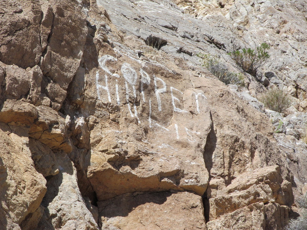
"LITTLE COPPER HILL"
20.66 Acre Lode Mining Claim in the Goodsprings Mining District of Clark County Nevada
NMC1122940

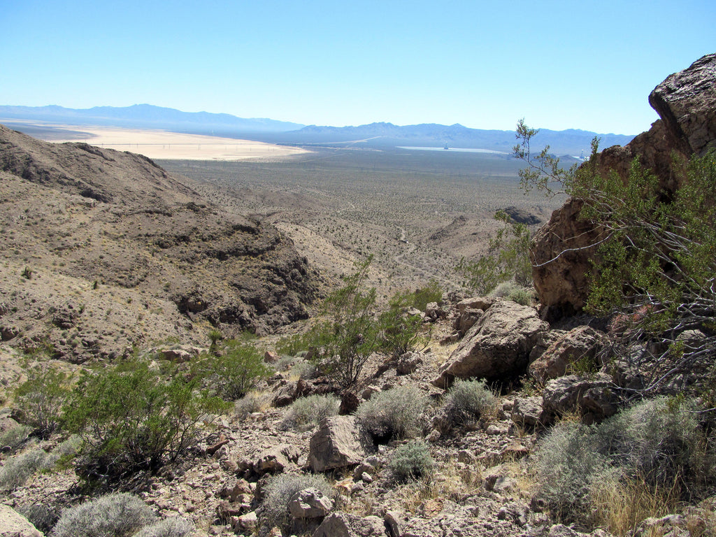
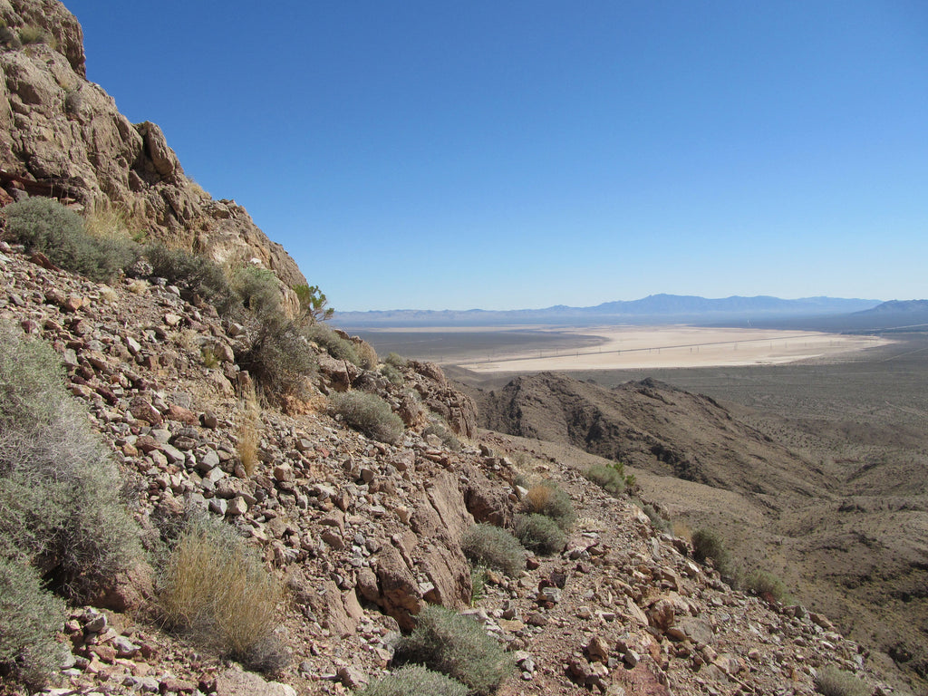
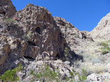
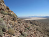
The Little Copper Hill Mines were originally founded in 1893 and worked for mostly copper with gold, silver, lead and zinc as byproducts. But, after WWII, it was reopened in 1952 and worked for native and free milling gold, as the extraction methods had improved significantly. This is a remote mine for sure – it will require 4-wheel drive I would say for the last mile just to get to about 1,500 feet below the base of the mines which up are a steep slope. Without a tracked vehicle, it will require a hike up the mountain on foot.

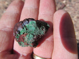
But, we got close to a dozen readings from a portable XRF (Olympus Delta Premium) ranging from 27 PPM to 86 PPM gold – which is almost 3 ounces per short ton – well worth the effort. Copper was also very highly concentrated, and in several areas of the main vein, we got a reading that indicated almost 4 oz. of Silver per ton as well.

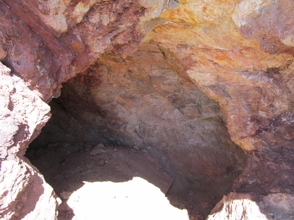
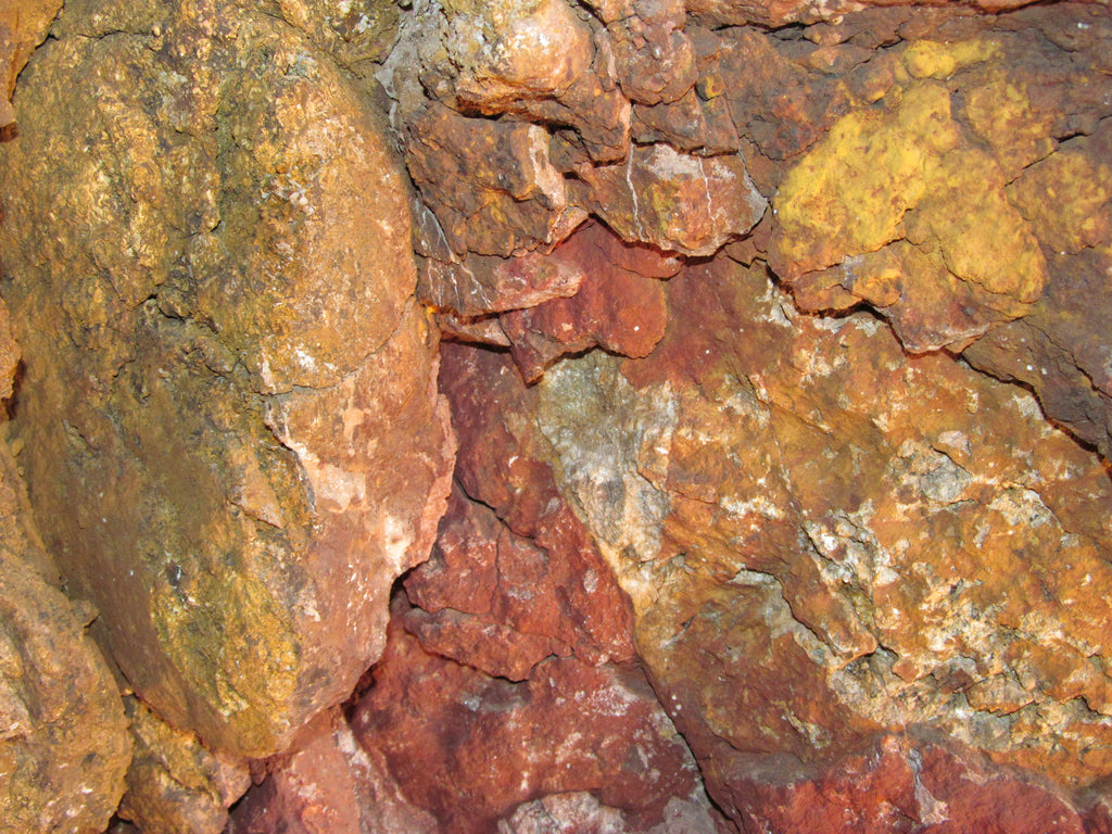
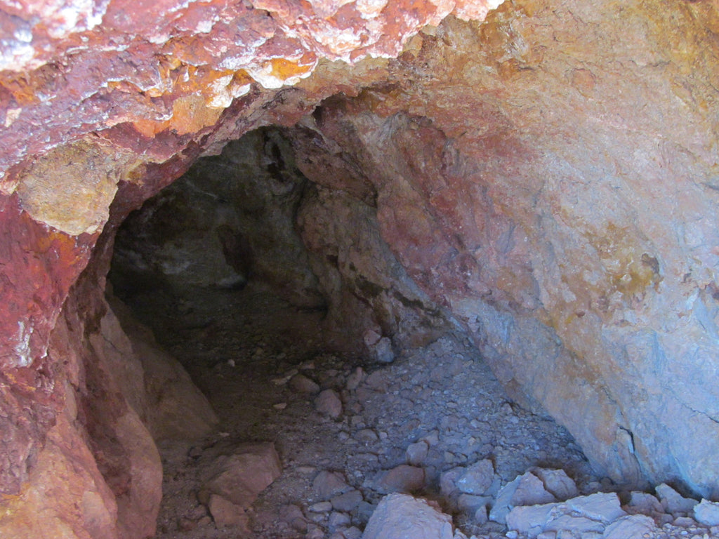
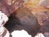
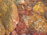
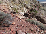
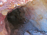
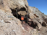
There’s two adits here and the historic records indicate a third which we were unable to locate as the terrain is pretty rugged. See the amazing colors in both the tailings and the mines for yourself in the below pictures. This is one to work for sure – and as far as a long term investment, they don’t come much better than this. Almost no available mines left in this district – this is the only one we could find, as everything else of value is claimed up tight!

Buyer will receive the following with their completed transaction:
- Quitclaim deed showing full ownership of the claim. This will be stamped, recorded and verified with the County and the BLM offices.
- Welcome packet with all of the rules and regulations as they relate to the State and BLM where the claim is located.
- Educational documents to annually renew your mining claim with the BLM.
- A CD of all of the documented images of the claim including maps of the site.
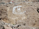
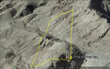
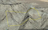
- Map of claim marked and GPS coordinates.
- Multiple maps showing claim location and surrounding areas for access.
TO VIEW MORE PICTURES: CLICK HERE
GOODSPRINGS MINING DISTRICT, CLARK COUNTY NEVADA
Abstract
The Goodsprings district lies in the Spring Mountains of southern Nevada. Although less famous than many of the other mining districts of the Great Basin it nevertheless ranks second only to Tonapah in total copper, lead and zinc production from Nevada. During World War I the district was one of the most productive in the West, but by the end of World War II only a few mines remained in operation. By the late 1950's all operations had ceased. In recent years, renewed activity has centered on some of the gold mines in the district.
Stratigraphy
The sedimentary rocks in the district range in age from Upper Cambrian to Recent. The Paleozoic section includes the Cambrian Bonanza King and Nopah Formations, the Devonian Sultan, Mississippian Monte Cristo Limestone, Pennsylvanian/Mississippian Bird Spring Formation and Permian Kaibab Limestone (Carr, 1987). The Mesozoic section is comprised only of the Triassic Moenkopi and Chinle Formations and an upper Mesozoic unit of uncertain age termed the Lavinia Wash Formation. The Paleozoic rocks are dominantly carbonates while the Mesozoic units are continental clastics. Tertiary rocks include gravels and minor volcanic tuffs.
Only two varieties of intrusive rocks are known in the district. The most abundant is granite porphyry which forms three large sill-like masses (Hewett, 1931). The sills generally lie near major thrust faults and are thought to have been emplaced along breccia zones at the base of the upper plate of the thrust fault. Locally, small dikes of basaltic composition and uncertain age have been encountered in some of the mine workings. Mid Tertiary felsic volcanics, a ubiquitous constituent of most Cordilleran mining districts, are rare in the Goodsprings District.

Structure
The region reveals an amazing record of folding, thrust faulting and normal faulting. Folding began in the early Jurassic, resulting in broad flexures in the more massive units and tight folds in the thinly bedded rocks. The thrust faults in the district are part of a belt of thrust faulted rocks, the Foreland Fold and Thrust Belt, that stretches from southern Canada to southern California. Deformation within this belt began in the Jurassic and continued until Cretaceous time.
Within the Goodsprings District thrust faulting appears to post-date much of the folding, but despite intensive study the actual age of thrusting continues to be the subject of contentious debate. Three major thrusts have been mapped; from west to east, the Green Monster, Keystone and Contact thrusts. Of these, the Keystone is the most persistent along strike having been mapped for a distance of over 50 kilometers. The stratigraphic relationships along the Keystone fault are similar to those for all the major thrusts in the area, Cambrian Bonanza King Formation has been thrust eastward over younger Paleozoic rocks.
Normal faulting has received much less study, despite its close association with many ore deposits in the district. Hewett (1931) suggested normal faulting began in the early Cretaceous and continued through the Tertiary. Albritton, et. al (1954) adopted the more recent theory that all normal faulting is related to Basin and Range extension and thus is no older than Miocene. Burchfiel and Davis (1988) also restrict normal faulting to the Tertiary, but concede some of the thrust faults may have been reactivated as low angle normal faults during early Tertiary.

Ore Mineralogy and Alteration
Ore deposits in the Goodsprings district can at best be characterized as enigmatic. They appear to fall into two distinct types which may or may not be related, gold-copper deposits and lead-zinc deposits. Gold-copper deposits are clearly related to sill-like masses of granite porphyry. All existing mines worked the contact between the intrusive and surrounding sedimentary rocks. Gold occurred in both the intrusive and the carbonate wall rocks. It appears any carbonate unit was a suitable host. The lead-zinc deposits are often distant from intrusives and occur as veins or replacements of brecciated rocks along fault zones, either thrust faults or normal faults. Unlike the gold deposits, the productive lead-zinc deposits are restricted to the Monte Cristo Formation.
Mineralogy of gold-copper deposits consists of native gold (often visible!), pyrite, limonite, cinnabar, malachite, azurite and chrysocolla. Lead-zinc deposits are comprised of hydrozincite, calamine, smithsonite, cerrusite, anglesite, galena and iron oxides. The rather unusual mineralogy of the district is due to the great depth of surface oxidation, exceeding 200 meters. Typical sulfides such as chalcopyrite, sphalerite and pyrite have been partially or completely altered to more stable hydrated carbonates and sulfates. Only the highly insoluble lead sulfide, galena has successfully resisted surface oxidation.
Primary alteration is difficult to characterize due to the supergene overprint, but again appears to differ for gold-copper deposits and lead-zinc deposits. Gold-copper ores have been extensively sericitized and kaolinized, altering the host pluton to a rock that can be mined through simple excavation with little or no blasting. The rock is so thoroughly altered it decrepitates on exposure to the atmosphere. On the other hand, lead-zinc deposits appear to be characterized by dolomitization and minor silicification.

ACCESS
This entire area is relatively easily accessible by dirt roads which are well marked and well maintained. A 2-wheel drive car can get to within a mile of this claim off of Route 15 via Stateline Road behind Whiskey Pete’s Hotel/Casino at Stateline, NV. But I the last mile is pretty rough and sandy, so I would recommend a good 4-wheel drive or even ATV’s to be able to access the entire claim that is not on the road.
The area is full of dirt roads, so a good map and a good GPS unit is a must, but we'll show you exactly where it is on the map as well as provide you with the precise latitude and longitude of each corner marker, so finding it will not be a problem for you.

I advise caution whenever driving or hiking on this claim – the entire valley is dotted with abandoned mines – most of them are easy to see from a distance, but some of them are impossible to see until you are right on top of them. I would estimate that only 20% of them are roped or fenced off – the rest are wide open and you should be extremely careful if entering them.

A couple of spare tires or an air compressor and patch kit or at least a couple of cans of tire sealant is strongly recommended for obvious reasons! Also, be sure to bring in whatever water you may need, as there are almost no water sources in the area 10 months out of the year.

LEGAL NOTES
We offer a lifetime guarantee should the BLM take back the land.
As the largest company in the mining industry selling legitimate and valuable historic claims, you can rest assured that you are not only covered with our 100% lifetime money-back guarantee, but you can also rest easy that there is no fine print on any of our claim listings telling you will have to deal with any games like being charged phony fees or having to pay inflated “processing” or “transfer” fees. The final price for this mine is ALL you will pay.
Our in-house legal counsel will complete all of the paperwork and documentation for recording and transferring FULL ownership of this mine into your name if you win the auction, AND we will ship you everything in one to two business days of receipt of your payment in full (usually just one day!). So you can plan to visit (and start working) your claim the next day without the lengthy delay you will experience with other companies selling claims –and you will not have to pay any extra costs, fees or other poor excuses for extra profit that normally just go into a seller’s pocket.
-PLUS-
We'll take care of all the paperwork and arrangements so you can enjoy your claim immediately after payment and we keep you informed through the entire process with confirmations when payment is received, when your paperwork has been shipped.

While we cannot physically ship land to you as it doesn't quite fit into the mail box ;)
We will ship all paperwork/maps upon payment clearing we ship same business day (if payment is received by 1PM P.S.T.) We always provide tracking information so you are always informed.
