


Description
GUNDAKER MINE
NMC1133442
Nevada Gold Claim 20.66 acre Lode Mine - Sand Springs Mineral County NV
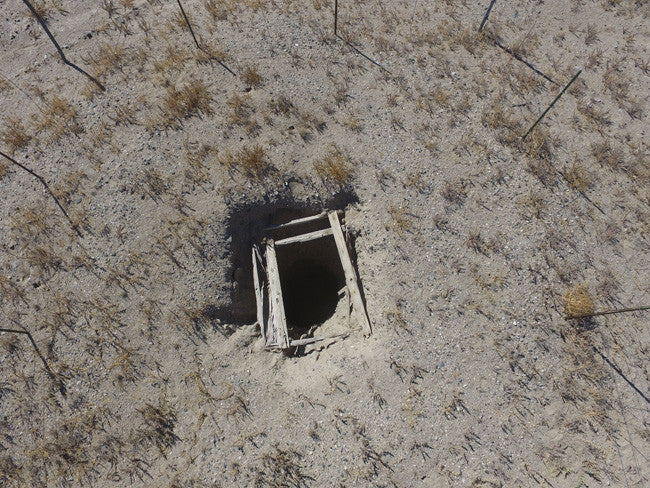
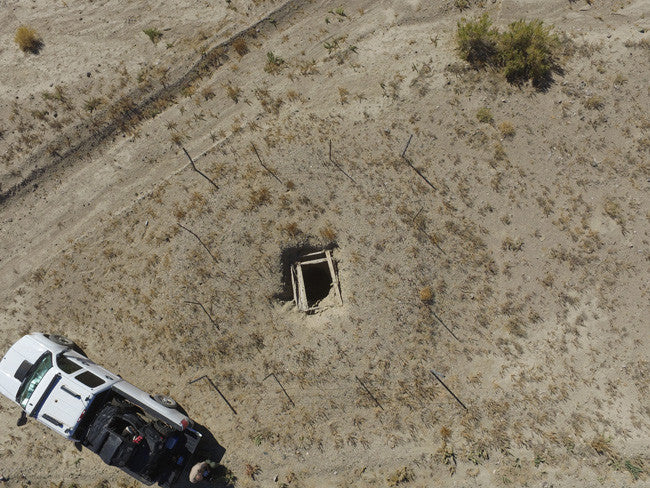
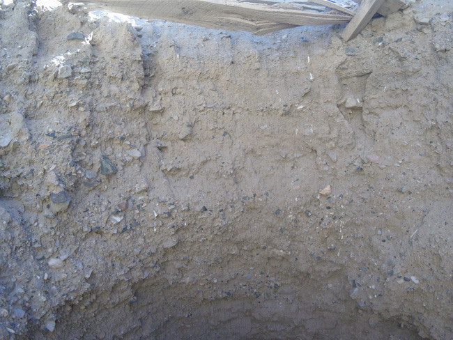
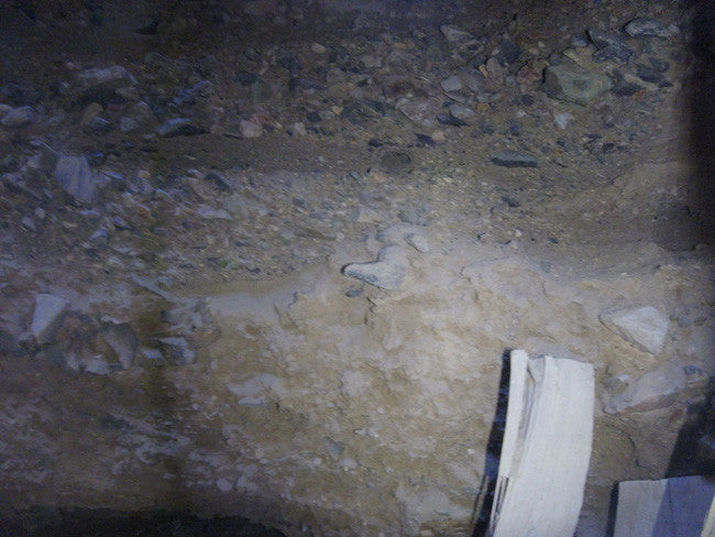
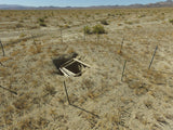
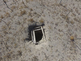
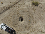
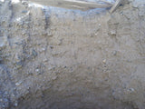
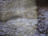
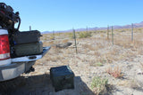
The Gundaker Mine is composed of a 58 ft. deep shaft (see pictures down the shaft further down the listing). Nice Gold and Silver readings, samples in the pictures taken from the site are also included. The claim is accessible via 2WD, with good roads which lead to a smooth ride in. The closest town is Fallon, NV which is about an hour away and conveniently has grocery and hardware stores, hotels, restaurants and RV campgrounds although there is enough space for camping and staging equipment on the claim.

QUICK FACTS ON THE MINE:
BLM Serial Number: NMC1133442
Elevation: 5,404 feet (1,647 meters)
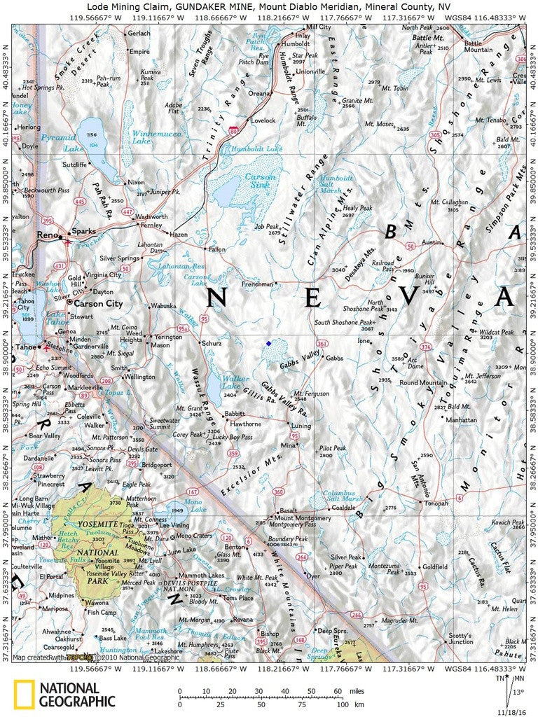
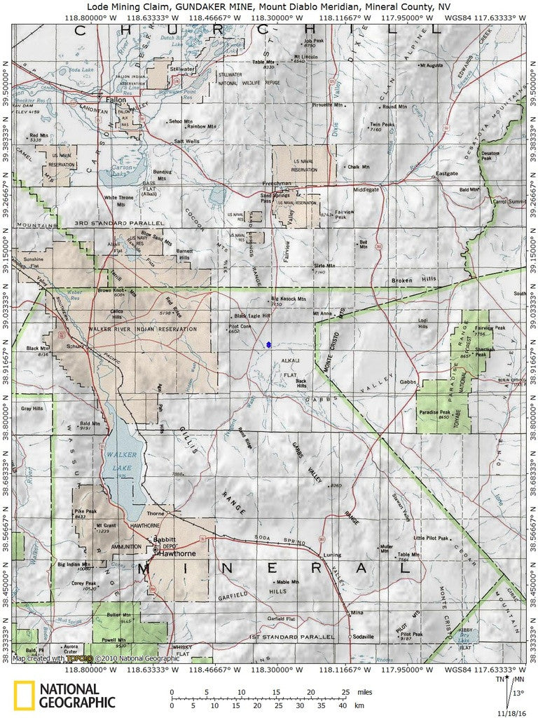
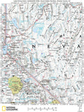
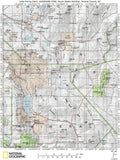
Access: (For maps / location scroll towards the bottom of the listing)
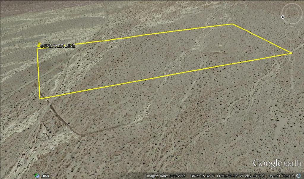
Acres: 20.66
Type: Lode
County: Mineral
Mining District: Sand Springs
Commodity:
Primary: Tungsten
Tertiary: Gold
Tertiary: Copper
Tertiary: Silver
Type: Lode
Physiography:
General Physiographic Area: Intermontane Plateaus
Physiographic Province: Basin and Range Province Physiographic Section: Great Basin

Although the Sand Springs district was prospected in 1905, its first gold production was not until 1919. To 1937 only $30,000 (about 1,450 ounces) in gold was produced, all of it from the Dan Tucker mine (Vanderburg, 1940, p. 40). From 1937 to 1951 the district yielded 20,875 ounces of gold as a byproduct of silver ores. From 1951 through 1959 no activity was reported. The ore bodies occur in an east-trending silicified zone that cuts country rock consisting of schist, limestone, and andesite. Free gold and minor silver chloride occur in a gangue of sugary quartz and crushed andesite (Vanderburg, 1940, p. 41).


Buyer will receive the following with their completed transaction:
- Quitclaim deed showing full ownership of the claim. This will be stamped, recorded and verified with the County and the BLM offices.
- Welcome packet with all of the rules and regulations as they relate to the State and BLM where the claim is located.
- Educational documents to annually renew your mining claim with the BLM.
- A CD of all of the documented images of the claim including maps of the site.
- Map of claim marked and GPS coordinates.
- Multiple maps showing claim location and surrounding areas for access.
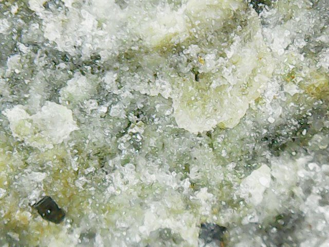
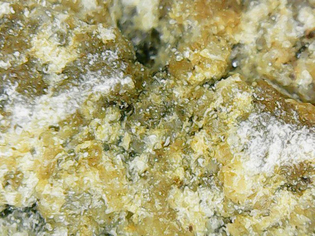
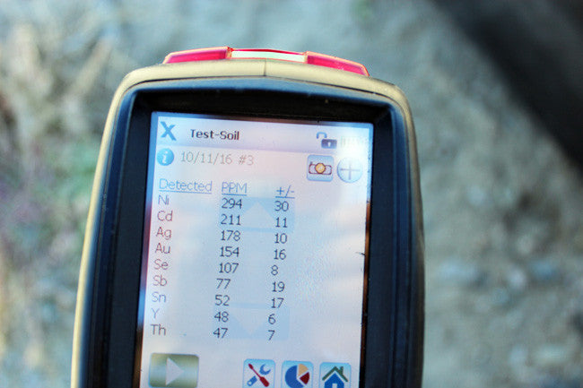
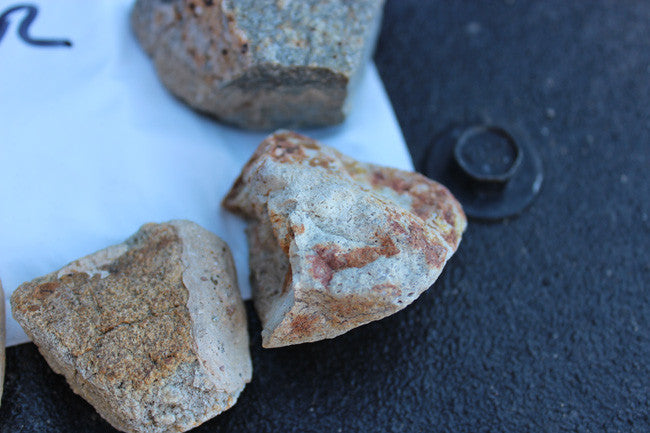
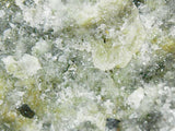
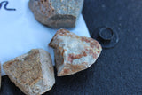
***Samples were pulled from our last visit. Below are the samples that you will receive along with everything else above.


Portable X-Ray Fluorescence field units (also known as XRF guns) are commonly used by large commercial mining operations, well-equipped/funded private prospectors and even the Environmental Protection Agency (EPA) as well as many other government agencies for the most accurate field sampling in the quickest amount of time. In no way do we advise that you base all of your commercial mining valuations on just one or two samples (regardless of how accurate the method that you use to sample is), but this extremely precise and versatile $40,000 device is equipped with powerful X-ray tubes, specialized filters, highly advanced detectors, and multi-beam optimization that efficiently analyzes the chemistry of the rock, soil, and sediment that hosts metals, for a quick and extremely accurate analysis of even trace levels of metals like silver, lead, gold, platinum, copper and many other elements.


Today’s highly sensitive XRF Handhelds (we use the best unit available on the market – an Olympus Delta Premium with a full mining package) work by emitting an x-ray beam with enough energy to displace the electrons in the inner shells of the atoms that differ from the energy it gives off leading to a loss of energy in that atom. The specific loss of energy identifies the elements that are present in the sample. While fire assay is still the most widely used way to gauge how much or a particular metal (like gold and silver) is present in a sample since it can test the entire sample, it is an expensive process and takes many weeks to get an answer. XRF technology is the fastest and most accepted method in existence today for sampling a few millimeters (or deeper depending on the type of host rock sampled) into the surface of even the hardest rock, and the accuracy is measured in 1 to 2 parts per million (PPM)


TO VIEW MORE PICTURES: CLICK HERE
Mineral County was carved out of Esmeralda County in 1911 shortly after the county seat of Esmeralda was moved to Goldfield in 1907. Its name came from the surrounding area, which is heavily mineralized.
Ghost Towns - All along Highway 95 and nearby connected roads (otherwise known as Nevada Silver Trails Territory) are Ghost Towns & Ghost Mining camps. From Aurora about 10 miles outside of Hawthorne to Candeleria at the far southern end of Mineral County do we have Ghost Towns for you to explore. There are also short day trips to Bodie, Mono & Mammoth Lakes. And while you’re at it don't forget all the Ghost Camps in between, especially in Mina if you’re an avid ATV/OHVer. What with over 1,000 perhaps two thousand miles of open dirt roads and trails to such places as Cabin under a Rock to the Ghost Carp Boat way behind Walker Lake to The Car Frame Windmill near the Ghost Mining camp of Poinsettia we got you covered in Dirt Road Fun.


This claim is located about 16 miles from the famous Summit King-Dan Tucker Mine as illustrated above.
Famous Summit King-Dan Tucker Mine
The property was developed from 1912 to present with sporadic production. The property lay idle after discovery in 1905 until 1912 when Leslie L. Leonard prospected it with good results, after which he and C.W. Kinney jointly sunk a 130-ft shaft and found the 8-ft vein carrying mill-grade ore all the way down with a pay shoot dipping westerly. In 1919 the Martin brothers took a lease and bond on the property, sunk several more shafts and shipped 150 tons of $125-$300/t ore and opened several parallel veins containing rich pockets of cerargyrite ore. In 1923, channel samples over 3000 ft. along the deposit by a N.Y. firm, averaged $15.80/ton in gold. In 1924 the mine was purchased by Senator N.H. Getchell who incorporated the property as the Dan Tucker Mining Co., who worked it and found 4 new 3-ft ore shoot. In 1927, the mine was said to be worked by lessees. In 1934, after several years idle the mine, under lease to Rosetta Mines Co. became active again. Some production was reported from the district in 1938 and 1940. The mine was owned and operated by Summit King mines, Ltd.in 1951. In 1985, Capri Resources Ltd. reported commencement of a major bulk sampling and 7-hole diamond drilling program on the Summit King property, fully funded by Tri-Basin Resources Ltd, who may earn up to a 50% interest in the property.
In 1939, reserves were reported as 15 Mt, assaying $3.50-4.50 per ton. Production from the mine in 1919 totaled 3 car loads of ore assaying $215-300 per ton; in 1927 1 Kt ore was produced; in 1940-41 and 1946-51 production totaled 20,895 oz. Au and 1,262,255 oz. Ag. There has probably been more unreported production from this property.
ABOUT THE MINING DISTRICT
Sand Springs Mining District in Nevada
Bedrock in the northern Sand Springs Range principally is a granite body about 3 to 5 miles wide in an east-west direction and 10 to 13 miles long in a north-south direction. The shape of the granite stock is not well known as the area has not been geologically mapped. The shape of the granite shown on figure 1 is based on a brief ground and aerial reconnaissance and should be considered as a sketch map of uncertain reliability. The granitic body is buried on the east and west sides by the alluvium in Fairview Valley and Fourtnile Flat, respectively, Presumably, large faults along the sides of the Range separate the Range from the bordering lowlands. The bordering valleys are deeply filled with alluvial debris from the nearby mts. A gravity survey along U.S. Highway 50 through the area indicates that the alluvium in Fairview Valley is 5,000 feet thick and on Fourmile Flat is 2, DOG feet thick (Thompson, 1959). The granite generally is coarse grained but variable in texture and composition. Details of these-variations are not known. Numerous dikes, faults, and fractures transect the granite body, but their extent, distribution, frequency, and continuity are not known. From cursory field examination, it is thought that homogeneous granite sufficiently extensive to accommodate the Shoal experiment can be found. There are numerous granite outcrops at the site and much of the area is covered by residual soil generally less than 10 feet thick.


The claim is accessible via 2WD, with good roads which lead to a smooth ride in. The closest town is Fallon, NV which is about an hour away and conveniently has grocery and hardware stores, hotels, restaurants and RV campgrounds although there is enough space for camping and staging equipment on the claim. Most of the roads are unnamed, but by putting in the coordinates and using your handheld GPS, you will be able to find the claim.


LEGAL NOTES
We offer a lifetime guarantee should the BLM take back the land.
As the largest company in the mining industry selling legitimate and valuable historic claims, you can rest assured that you are not only covered with our 100% lifetime money-back guarantee, but you can also rest easy that there is no fine print on any of our claim listings telling you will have to deal with any games like being charged phony fees or having to pay inflated “processing” or “transfer” fees. The final price for this mine is ALL you will pay.
Our in-house legal counsel will complete all of the paperwork and documentation for recording and transferring FULL ownership of this mine into your name if you win the auction, AND we will ship you everything in one to two business days of receipt of your payment in full (usually just one day!). So you can plan to visit (and start working) your claim the next day without the lengthy delay you will experience with other companies selling claims –and you will not have to pay any extra costs, fees or other poor excuses for extra profit that normally just go into a seller’s pocket.
-PLUS-
We'll take care of all the paperwork and arrangements so you can enjoy your claim immediately after payment and we keep you informed through the entire process with confirmations when payment is received, when your paperwork has been shipped.

While we cannot physically ship land to you as it doesn't quite fit into the mail box ;)
We will ship all paperwork/maps upon payment clearing we ship same business day (if payment is received by 1PM P.S.T.) We always provide tracking information so you are always informed.
