


Description
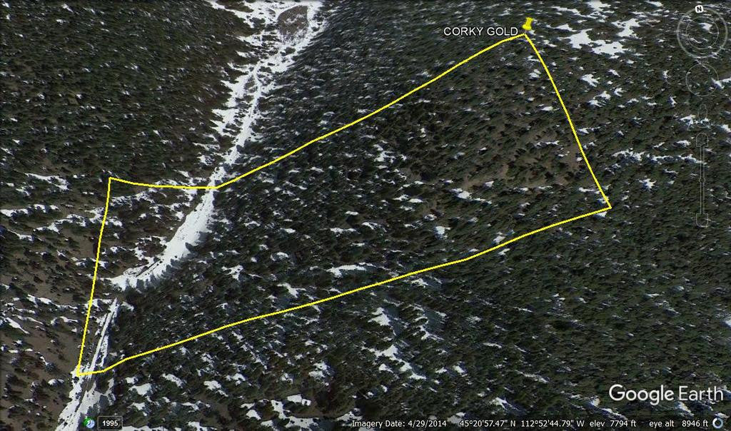
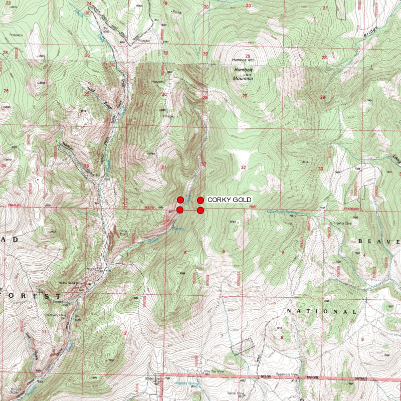
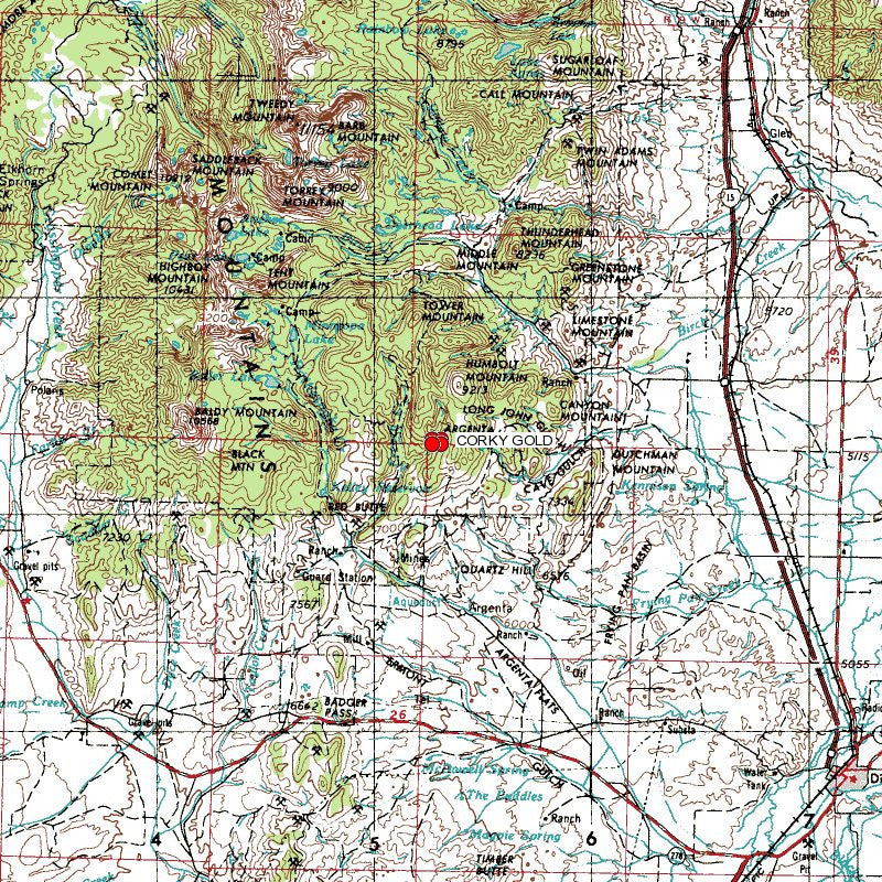
CORKY GOLD
MMC233897
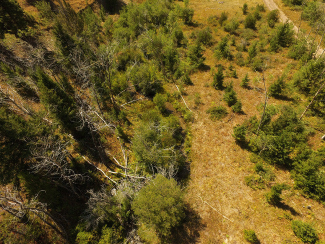
20 Acre Unpatented Placer Mining Claim on Federal Land Montana
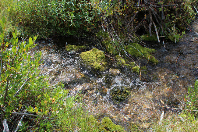
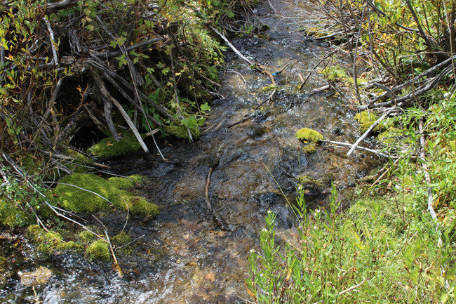
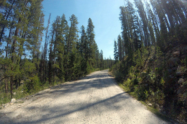
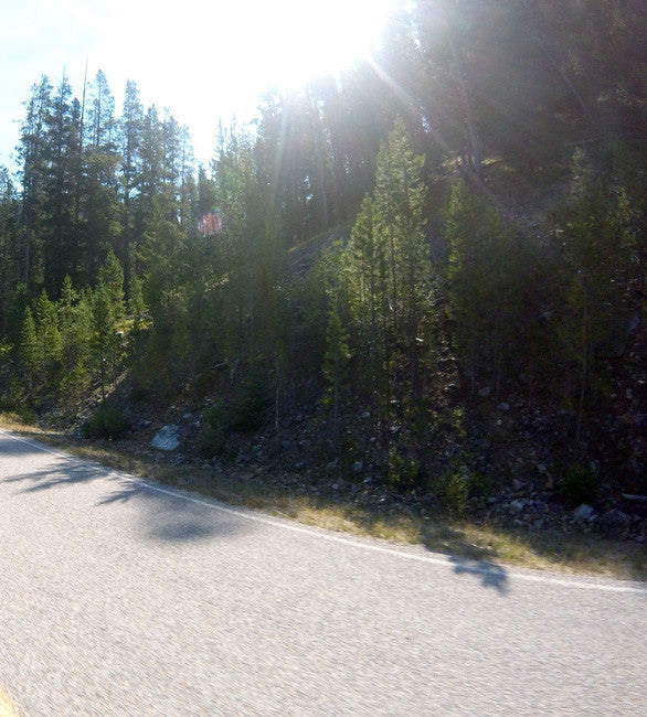
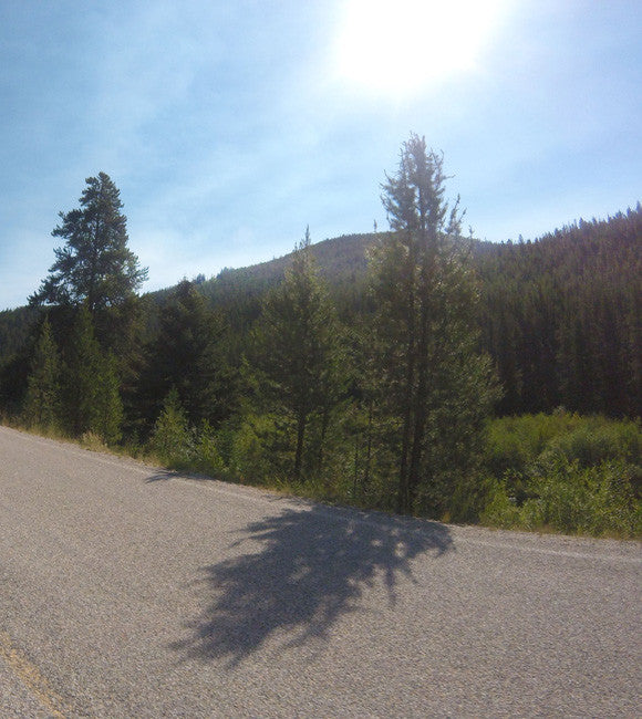
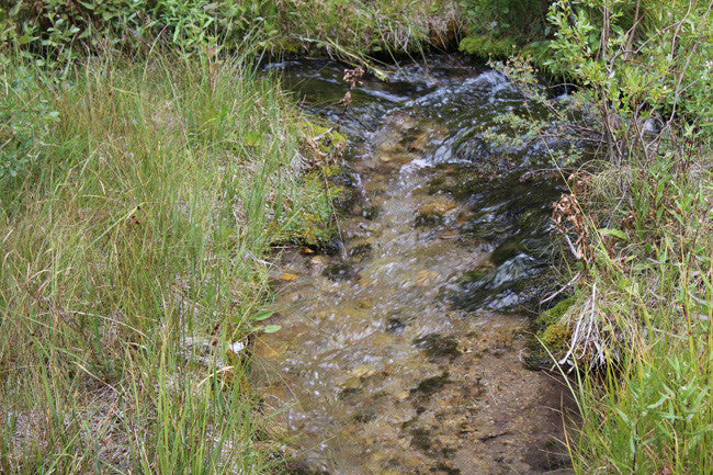
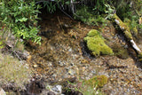
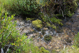
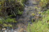
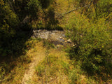
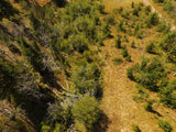
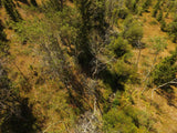
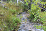
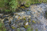
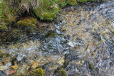
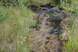
Trout Creek is well known for being a good gold area. The creek is quick running year round, and averages from about 3-11 ft. wide and a depth of about 6 inches – 2 ft. The road to the claim is 2WD accessible and runs about 10 – 60 ft. max away from the creek itself.
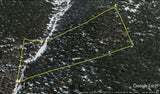
This placer gold Mine totals over 772 feet of creek. With this claim you will be getting the exclusive mineral rights to 20 acres on an excellent spot on the creek for you to work at your leisure.
Commodities (Major) - Gold Deposit
Elevation: 7812 Feet above MSL (2381 Meters)

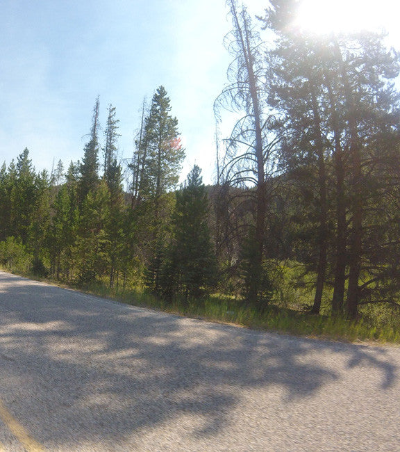
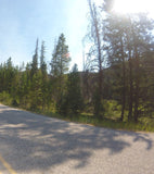
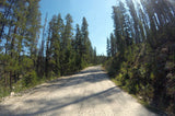
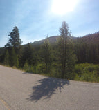
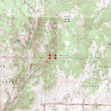
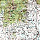
Access: (For maps / location scroll towards the bottom of the listing) Access to the claim is by French Creek Road. This is dirt road that can be handled with good 2WD drive clearance, but the best recommendation would be 4WD or ATV. It’s always best to check the road conditions before heading out to the claim, specifically during the winter season (http://mdt.mt.gov/travinfo/). The road runs right through the claim, for easy access to park, and grab tools/equipment. You will find a couple other dirt roads in and out of the claim, in the surrounding area that can be used as well.

Acres: 20
Type: Placer
Mining District: Argenta
County: Beaverhead
This is a summary of the ways in which Montana's 1985 stream access law affects the recreational use of the state's rivers and streams and incorporates the ways the law has been interpreted by the courts in Montana. The law states that rivers and streams capable of recreational use may be so used by the public regardless of streambed ownership. It also states that certain activities require landowner permission.
Because the law affects your rights and responsibilities as a landowner or recreationist, the information that follows may be of interest to you may want to look into the "Stream Access in Montana Brochure"
Recreational mining must adhere to closures and restrictions indicated in the Instream Mining Stream Classification list.
RECREATIONAL: For Fishing License purchase, fishing rules, and fishing regulations please visit Montana Fish & Wildlife. Please remember to check with the local Fish and Wildlife department to ensure the stream is open to the public.

Buyer will receive the following with their completed transaction:
- Quitclaim deed showing full ownership of the claim. This will be stamped, recorded and verified with the County and the BLM offices.
- Welcome packet with all of the rules and regulations as they relate to the State and BLM where the claim is located.
- Educational documents to annually renew your mining claim with the BLM.
- A CD of all of the documented images of the claim including maps of the site.
- Map of claim marked and GPS coordinates.
- Multiple maps showing claim location and surrounding areas for access.

Windfall Creek, Quartz Creek (AKA Trout Creek), and Cedar Creek are important gold creeks in this district. The gold is recovered from stream and bench gravels located along the three creeks and their tributaries. The gold originates from veins associated with igneous dykes crosscutting the northward extension of the Bitterroots. Chalcopyrite is the principal ore material, and also carries copper and silver in small amounts (Sahinen 1935).

Under the Montana Stream Access Law, the public may use rivers and streams for recreational purposes up to the ordinary high-water mark. Although the law gives recreationists the right to use rivers and streams for water-related recreation, it does not allow them to enter posted lands bordering those streams or to cross private lands to gain access to streams.
House Bill 190, passed during the 2009 Legislative Session, confirmed that the public has access to surface waters by public bridge or county road right-of-way. The Department, in cooperation with the affected landowner and county, is responsible for providing public passage around or through a fence preventing such access. A typical access feature would be a stile, gate, roller, walkover, or wooden rail fence. ( http://fwp.mt.gov/fishing/guide/access/streamAccess.html )
A recreational miner with a pick, shovel or gold pan does not need a special permit on BLM land in Montana. A person using a suction dredge in Montana should get a permit from the Water Protection Bureau, Department of Environmental Quality, 1520 East Sixth Ave. PO Box 200901, Helena, Montana 59620-0901, phone 406 444-3080. If the suction dredge intake is less than 4 inches in diameter, a general permit is required. If the dredge intake is larger than 4 inches, a more complicated permit is required for which there is a significant charge. The Montana Department of Natural Resources and Conservation and the US Army Corps of Engineers may also require permits for suction dredging.” http://nandugreen.typepad.com/chasing_the_wind/2009/08/recreational-gold-prospecting-on-public-land.html


ABOUT THE MINING DISTRICT
HISTORY: The placers were first claimed in 1869 by French Canadian Louis A. Barrette, and have seen continuous production since then. By 1935 the district had yielded at least $2,000,000 in gold and perhaps as much as $10,000,000. Annual output between 1869 and 1935 ranges from $1,000 to $50,000, with recovery primarily through sluicing and hydraulicking. A connected-bucket dredge was reported to have operated in 1912, and some shaft, drift and limited lode mining has been done. The gold was transported from Superior, a station on the Northern Pacific and the Chicago, Milwaukee and St. Paul Railroads (Rowe 1911; Sahinen 1935).
The gold recovered from the placers was considered to be exceptionally rich, ranging from $19.75 to $20.45 with a standard price of $20.67 per ounce. In 1875 it was reported that the various drifts were yielding as high as $300 to a set of timber, and that about $50,000 in gold was recovered each year from 1871 to 1873. The fineness was reported as ranging from .950 to .982 (Sahinen 1935; Lyden 1948).
The Argenta district, about 12 miles west of Dillon, has produced gold, silver, and lead, and smaller amounts of copper and zinc, mostly from lode deposits. After the discoveries of placer deposits in the Bannack district in 1862, some placer deposits were discovered near Argenta in the early 1860's, but apparently (Winchell, 1914a, p. 66) these were successfully mined on a small scale for only a short time in the 1870's. No figures are available as to the amount of placer gold produced. Lode deposits in the district were discovered in the spring of 1865 (Shenon, 1931, p. 57), and the early lode discoveries presumably consisted of rich argentiferous lead ore which carried only small amounts of gold. According to fragmentary early mining records, eight furnaces were built at Argenta in the first few years. The ore bodies were soon depleted, and by 1875 the district was almost deserted. The next 50 years was a period of dormancy, broken by brief periods of activity (Winchell, 1914a, p. 66). In 1926 the Ermont deposits were discovered and the bulk of the gold production of the district has come from them (W. B. Myers, written commun., 1947). The amount of gold produced prior to 1904 has not been ascertained but it probably was very small. From 1904 through 1957 the district produced about 65,350 ounces of gold.

The geology and ore deposits of the Argenta district were briefly described by Shenon (1931, p. 44-77) and by Winchell (1914a, p. 65-69).
The Argenta district is underlain by folded and complexly faulted sedimentary rocks of Precambrian and Paleozoic age that are intruded by a stock of quartz monzonite and by sills and dikes of ande-site and dacite of Late Cretaceous or Tertiary age.

The ore occurs chiefly in contact metamorphic deposits in limestone, in pipelike bodies in limestone, in tabular shoots along bedding planes in limestone, and in veins in both the sedimentary rocks and in the quartz monzonite. The deposit at the Ermont mine, the most productive in the district, is in andesite along the Ermont fault and in shale beneath an andesite sill. The ore is oxidized and contains gold and limonite which is pseudomorphic after pyrite (W. B. Myers, written commun., 1947).


LEGAL NOTES
We offer a lifetime guarantee should the BLM take back the land.
As the largest company in the mining industry selling legitimate and valuable historic claims, you can rest assured that you are not only covered with our 100% lifetime money-back guarantee, but you can also rest easy that there is no fine print on any of our claim listings telling you will have to deal with any games like being charged phony fees or having to pay inflated “processing” or “transfer” fees. The final price for this mine is ALL you will pay.
Our in-house legal counsel will complete all of the paperwork and documentation for recording and transferring FULL ownership of this mine into your name if you win the auction, AND we will ship you everything in one to two business days of receipt of your payment in full (usually just one day!). So you can plan to visit (and start working) your claim the next day without the lengthy delay you will experience with other companies selling claims –and you will not have to pay any extra costs, fees or other poor excuses for extra profit that normally just go into a seller’s pocket.
-PLUS-
We'll take care of all the paperwork and arrangements so you can enjoy your claim immediately after payment and we keep you informed through the entire process with confirmations when payment is received, when your paperwork has been shipped.

While we cannot physically ship land to you as it doesn't quite fit into the mail box ;)
We will ship all paperwork/maps upon payment clearing we ship same business day (if payment is received by 1PM P.S.T.) We always provide tracking information so you are always informed.
