


Description
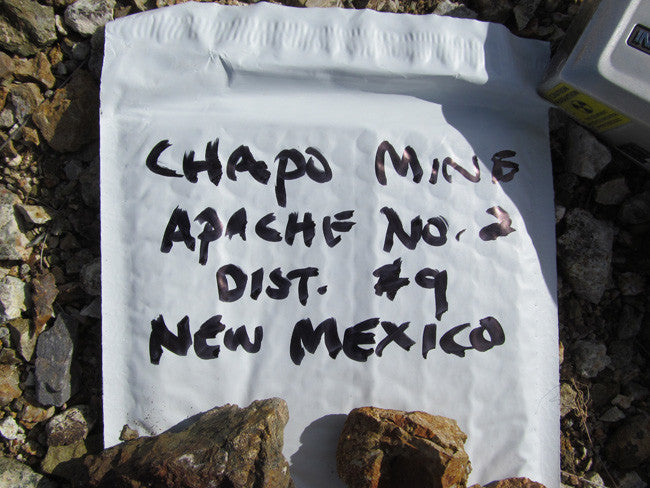
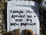
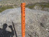
CHAPO MINE
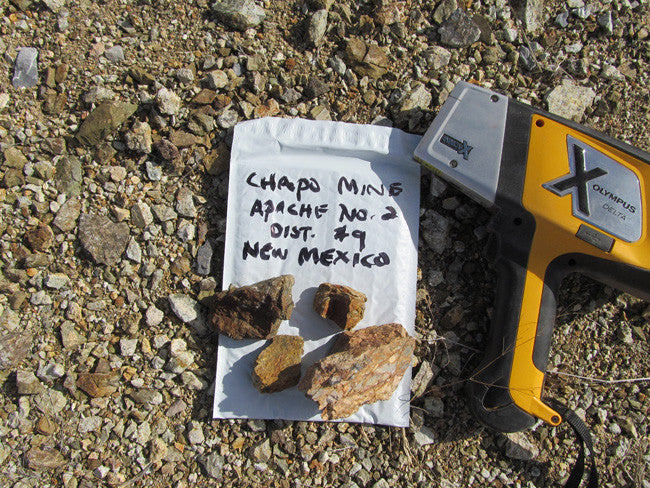
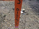
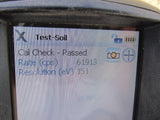
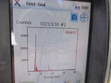
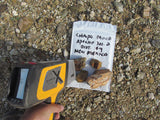
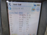
NMMC197828
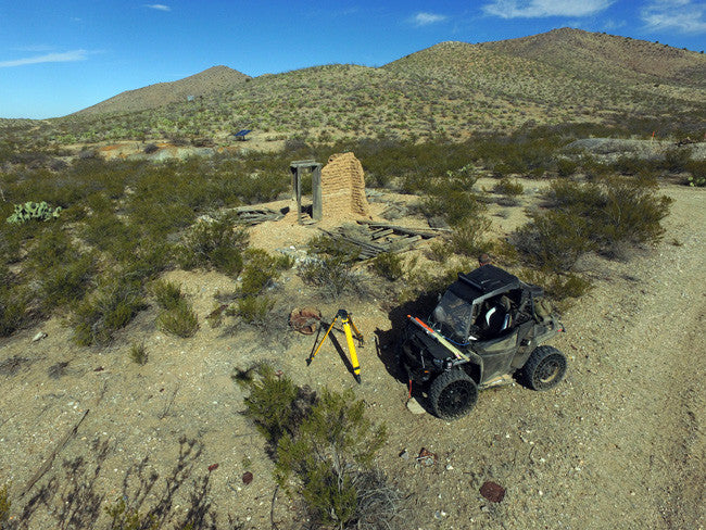
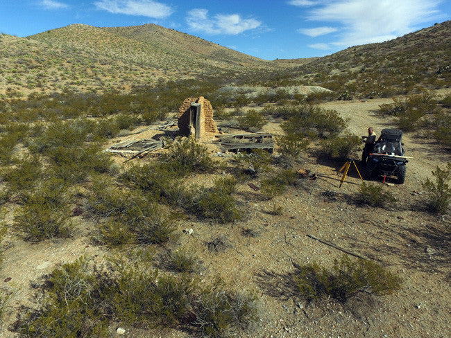
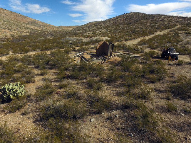
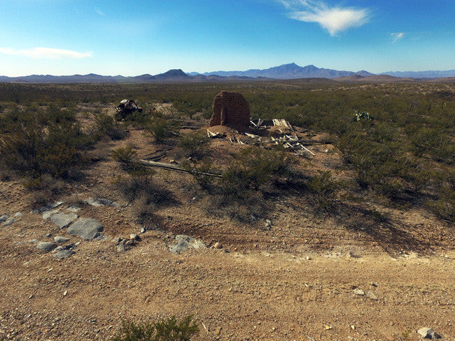
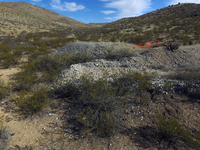
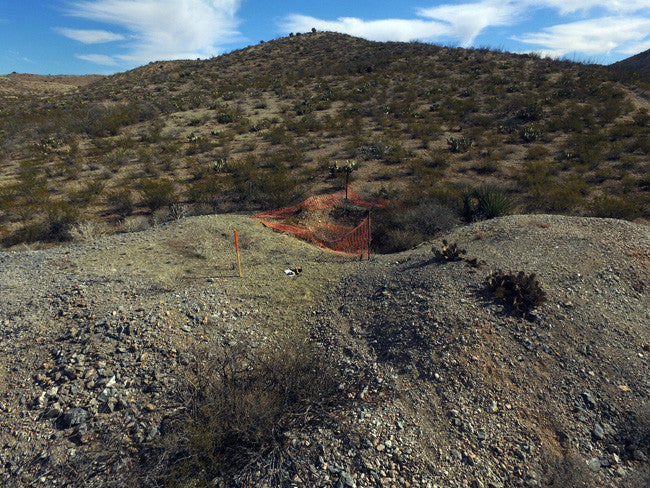
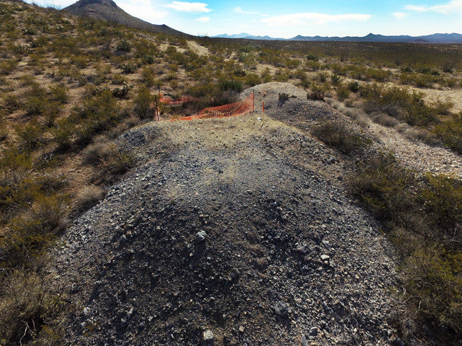
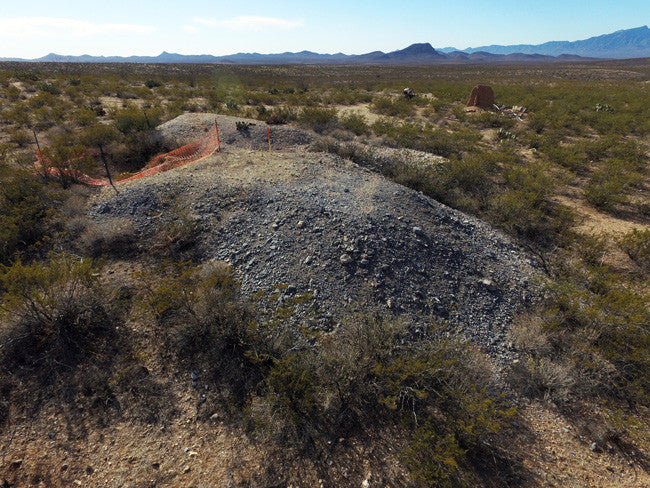
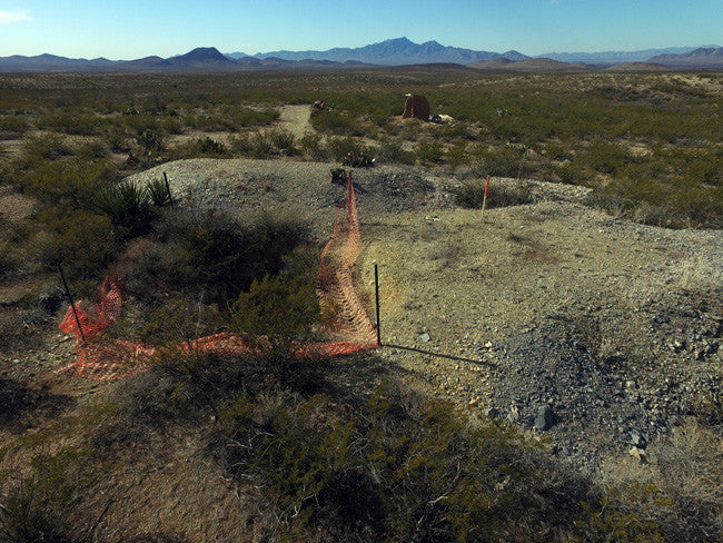
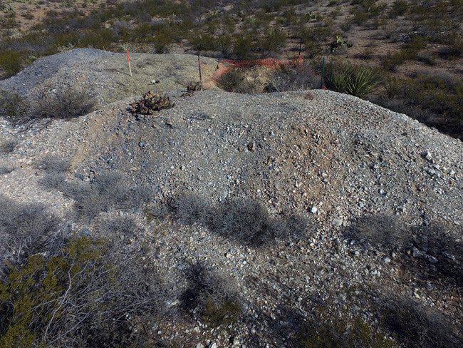
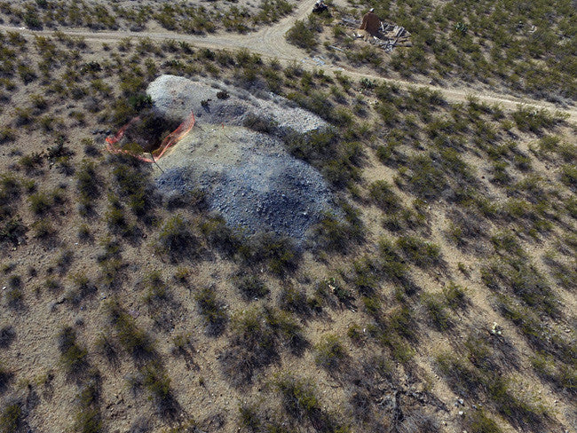
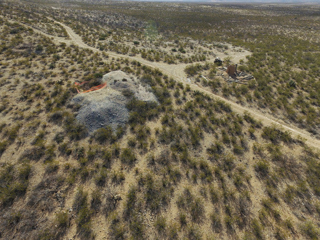
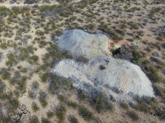
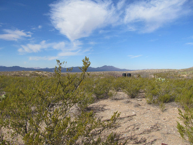
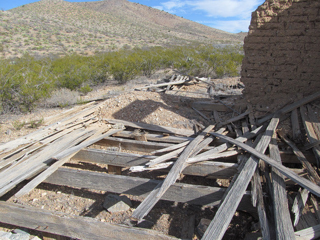
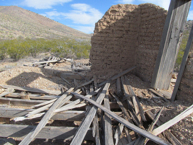
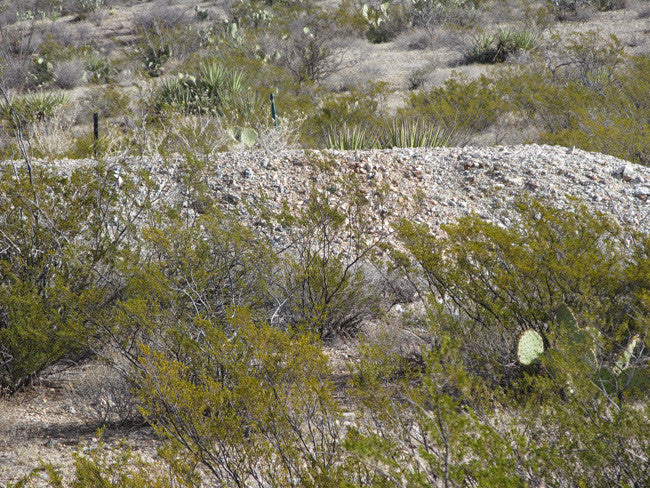
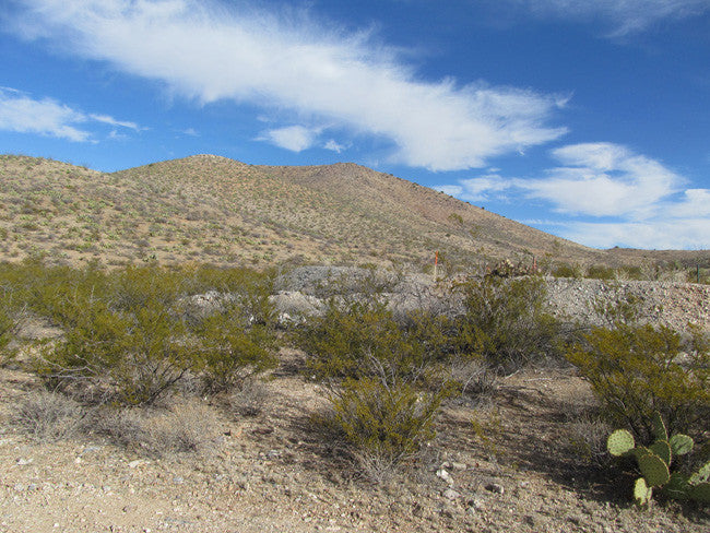
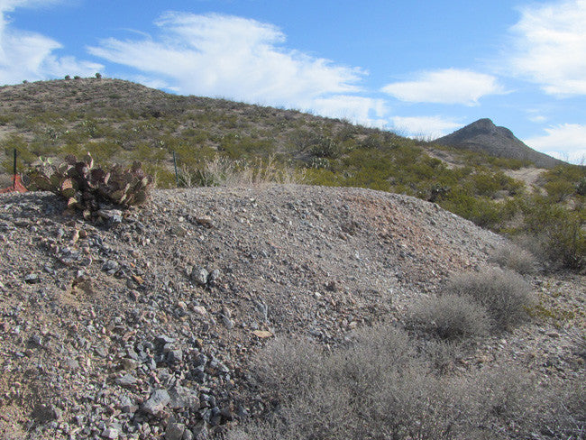
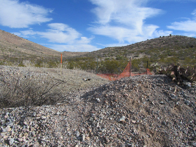
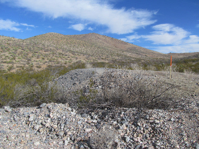
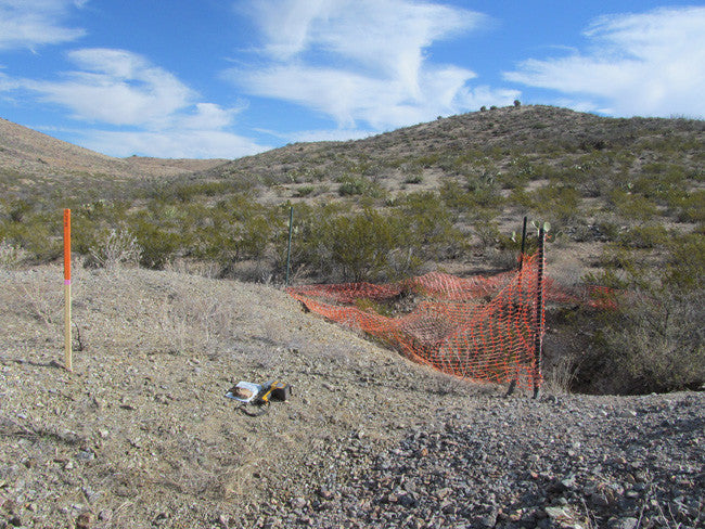
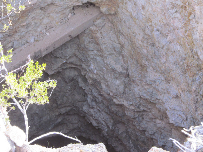
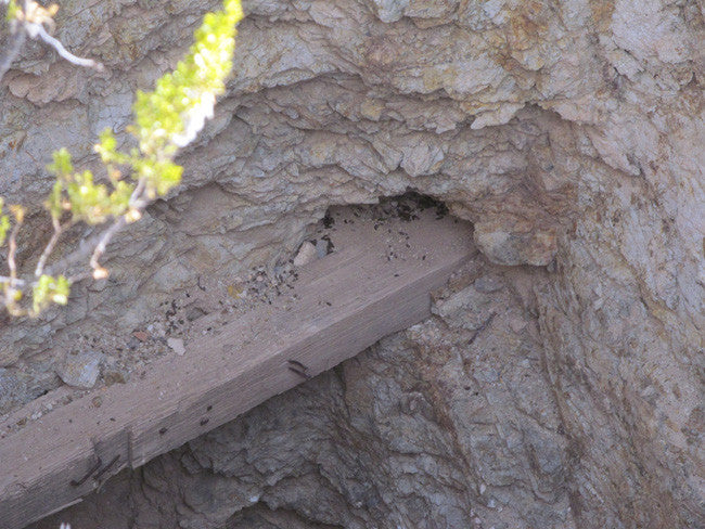
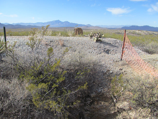
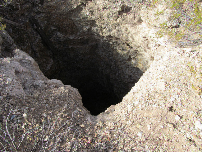
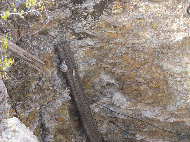
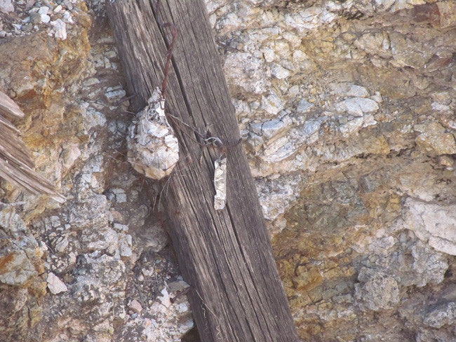
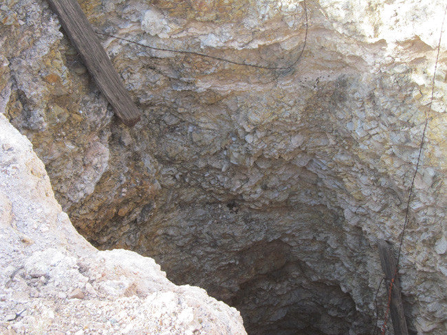
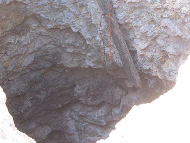
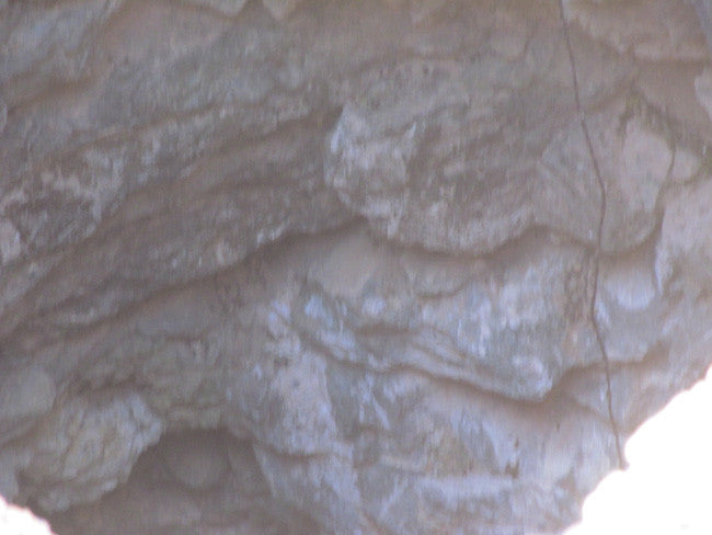
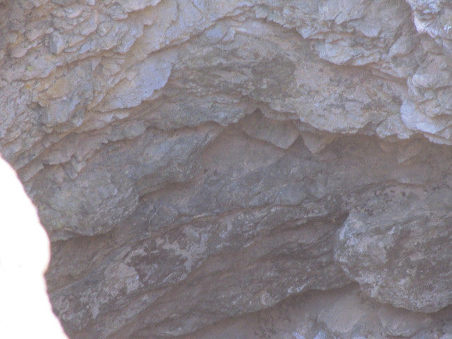
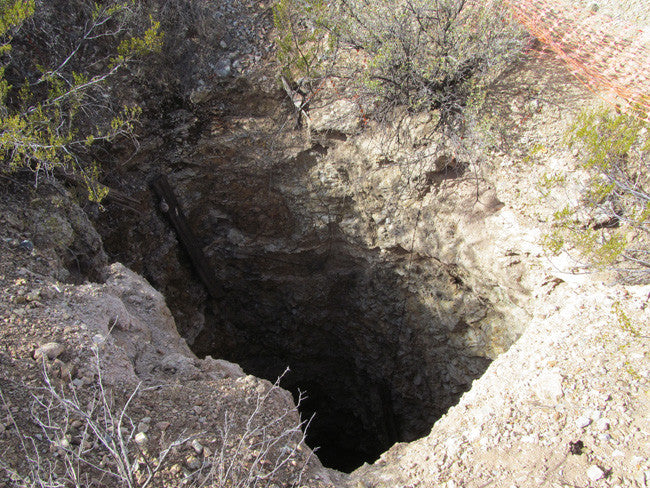
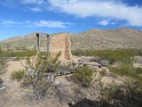
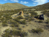
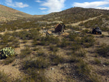
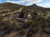
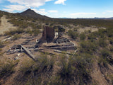
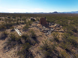
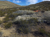
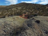
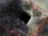
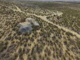
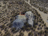
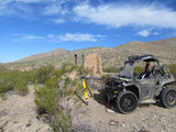
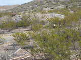
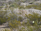
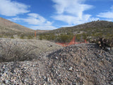
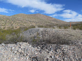
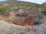
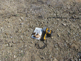
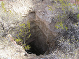
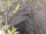
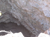
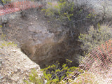
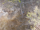
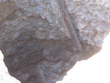
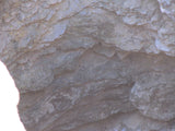
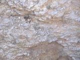
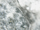
The historic Chapo Mine is one of the original few mines, that was here before the district was formed. This one actually contributed to forming the mining district. According to history books this mine is a shaft with a depth of 60 feet, and about 480 feet of horizontal workings. Our team took a laser reading of 58 feet, so there are probably a couple feet of loose gravel at the bottom, due to natural erosion, but it is still open. You will notice a lot of miner’s trash, old relics, and a ton of tailings!


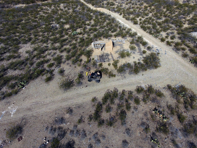
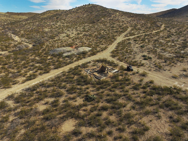
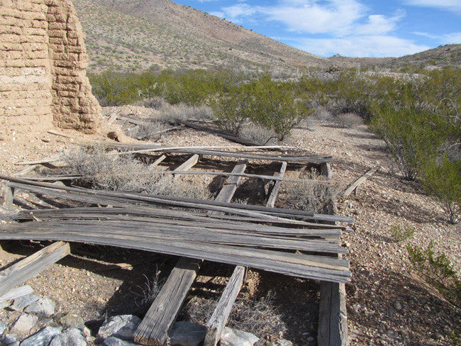
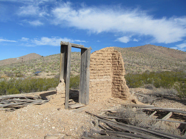
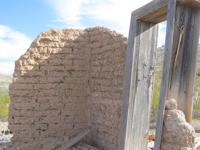
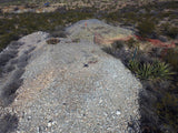
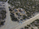
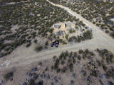
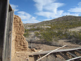
You can see ruins of the original settlers that lived here, with the old cabin that is located about 175 feet from the mine entrance. The cabin is down, but you can see the footprint is still there. It was an old adobe brick cabin, that was built on site and has a lot of timbering.


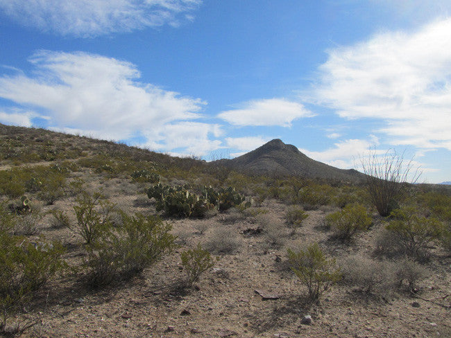
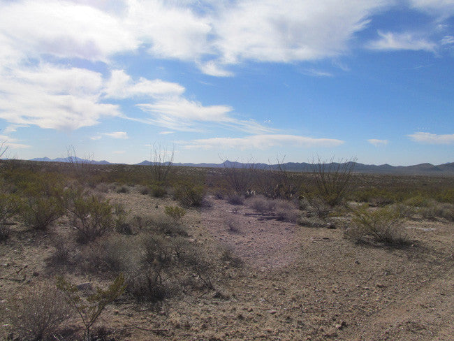
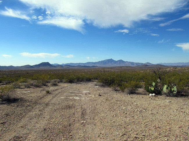
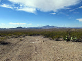
Hidalgo County draws rock hounds from all over with its moderate weather, beautiful scenery, reasonable accommodations, and vast miles of minerals pockets.
If rocks are your thing, Hidalgo County has hundreds of places you will love to explore!
Drive north from Lordsburg to find opals, fire agates, and chalcedony near the Summit Site. Search the remnants of mining claims of the Pyramid Mountains near Lordsburg for bornite, lead, linarite, azurite, and other minerals. Around Red rock, there is ricolite. Near the Coronado Forest (almost to the border of Mexico), search for geodes and Apache tears. Cross Granite Gap to find fields of quartz or explore Skeleton Canyon for agates and rhyolite.


GOLD MINING:
Prospecting in Hidalgo County began in 1870 but no serious mining could be attempted until the arrival of the Southern Pacific Railroad in 1880. From 1880 to 1893 the emphasis was on precious metals, especially silver. Base metals did not attract much attention until after the price of silver dropped disastrously in 1893. Proximity to smelters at El Paso, Texas and Douglas, Arizona, has favored development of mining in Hidalgo County, especially since much of the copper-silver gold ore from the Lordsburg district can be shipped directly to smelters as siliceous flux.
The gold-producing districts of New Mexico are distributed in a northeastward-trending mineral belt of variable width that extends diagonally across the State, from Hidalgo County in the southwest corner to Colfax County along the north-central border. From 1848 through 1965 New Mexico is credited with a gold production of about 2,267,000 ounces; however, several million dollars’ worth of placer gold was mined prior to 1848.


Hidalgo County has two ghost towns- Both are available for tours
Shakespeare- is 2.5 miles from Lordsburg and offers an authentic look into the mining era of the past. The first silver strike was in 1870 and the resulting town, then called Ralston, grew to over 3,000 residents. Thriving as an overland mail stage stop, a mining town, and the only point of merchandise sales in the area, it died with the arrival of the railroad (three miles away) which began Lordsburg and the closure of mines in the 1893 depression.
Steins- was established as a stop on the Butterfield Overland Stage route in the mid 1800's. When the Civil War began, Congress closed the stage line. The Army set up a communication station in Steins to signal news about Geronimo and other renegades. Later, the Southern Pacific Railroad built a work station in Steins, which sustained it until trains switched to diesel after WWII. The town then vacated.

Buyer will receive the following with their completed transaction:
•Quitclaim deed showing full ownership of the claim. This will be stamped, recorded and verified with the County and the BLM offices.
•Welcome packet with all of the rules and regulations as they relate to the State and BLM where the claim is located.
•Educational documents to annually renew your mining claim with the BLM.
•A CD of all of the documented images of the claim including maps of the site.
•Map of claim marked and GPS coordinates.
•Multiple maps showing claim location and surrounding areas for access.

GEOLOGY:
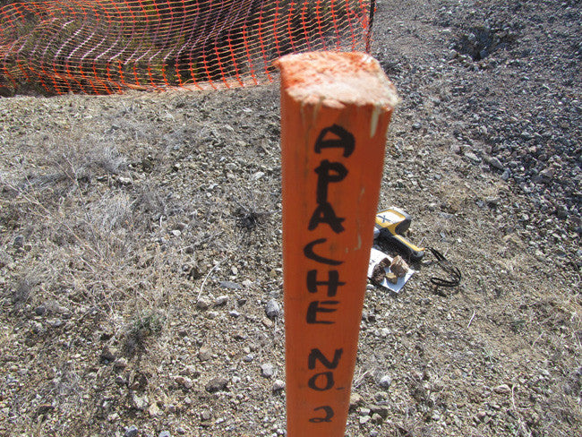
Three periods of mineralization can be recognized in Hidalgo County. Late Cretaceous to early Tertiary (Laramide), Middle Tertiary, and Late Tertiary to Quaternary. Of greatest commercial importance are high-temperature base-metal veins and contact metasomatic deposits formed during the first period in and around porphyritic intrusive bodies. Next in importance are low-temperature gold-, silver-, and lead-bearing veins formed during the second period. They are generally associated with volcanic rocks and their fine-grained intrusive equivalents. Some of the low-temperature psilomelane and fluorite veins of the third period grade into surficial hot-spring deposits. Hidalgo County has many features of unusual geologic interest, among then the Lordsburg district, the most important example of the copper-tourmaline class of ore deposits in the United States, several examples of hypo gene zoning, especially in the Lordsburg and San Simon districts, the association of contact metasomatic deposits with small bodies of felsite differentiated from larger porphyry bodies rather than with the porphyry bodies themselves, in the San Simon, Apache No. 2, and Fremont districts and the gradation of Plio-Pleistocene manganese and fluorite veins into travertine deposits in the Animas and Cap rock Mountain districts.
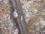
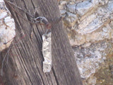
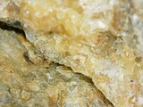
Cerrillos is not only an uncommon and unique form of native New Mexican turquoise, but has a history entwined with both ancient Native peoples of the Southwest and more recent American mining companies. Cerrillos turquoise was created and mined under unusual circumstances. It is the only turquoise that formed at the base of a volcano. Thus, a variety of colors developed from the minerals in the various volcanic host stones. In fact, seventy-five colors have been identified, from tan to khaki-green to rich, blue-green to bright and light colors. Cerrillos is a very hard stone and so takes a brilliant polish.


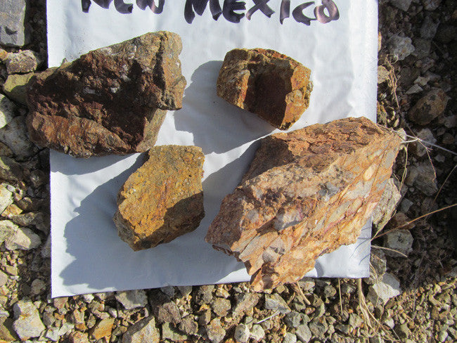
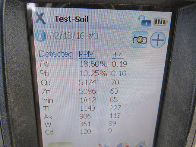
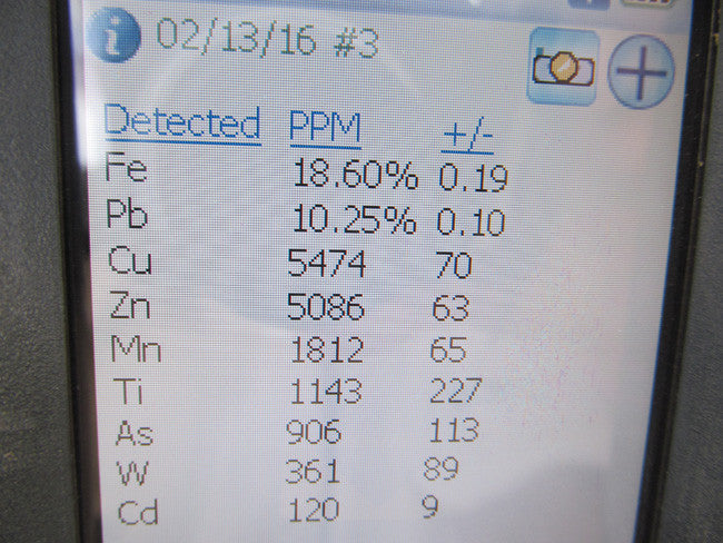
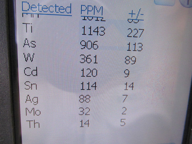
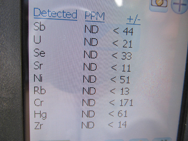
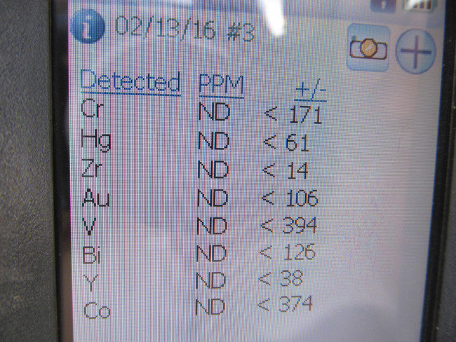
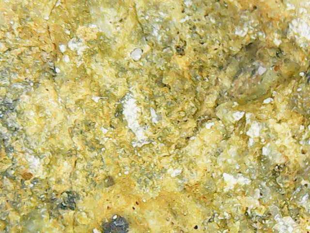
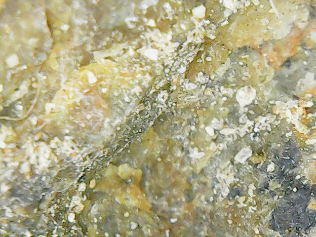
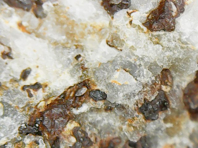
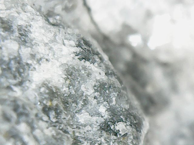
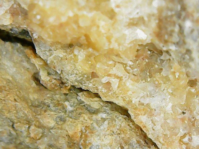
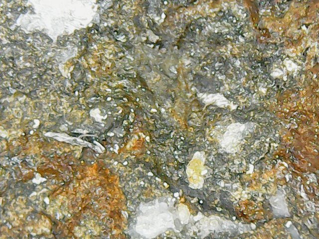
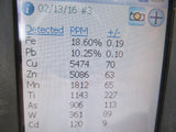
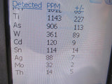
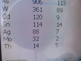
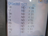
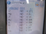
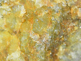
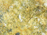
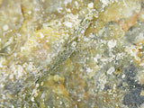
(Microscope pictures from the samples above - Samples come with the purchase!)


ABOUT THE MINING DISTRICT
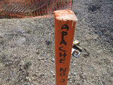
Apache Mining District in Hidalgo County, NM
A noteable claim in the district is the Apache mine, between 1880 and 1929 it shipped thousands of tons of low-grade malachite-calcite ore as calcareous flux to the El Paso and Douglas smelters. Total production probably exceeded $100,000. Since 1929, there has been sporadic exploration but only small-scale production. The deposit was formed by contact metasomatic replacement of limestone beds in the Cretaceous U-Bar Formation near a rhyolitic phase of the Apache Hills composite stock. In addition to about 2 percent copper and 3 ounces of silver per ton, the ore locally contains lead, zinc, bismuth, and tungsten (Strongin, 1957).
Mining in New Mexico began long before discoveries were made in any of the other Western States. The copper deposits at Santa Rita were known and mined late in the 18th century, and placer gold mining began as early as 1828 in the Ortiz Mountains south of Santa Fe. In 1839 placer deposits were discovered farther south along the foot of the San Pedro Mountains. The earliest lode mining, except the work at Santa Rita, dates back to 1833 when a gold-quartz vein was worked in the Ortiz Mountains New Mexico was incorporated as a Territory of the United States at the close of the Mexican War in 1846, but, because of its isolation, the general lack of knowledge of the region, and the hostility of the Apache Indians, it was not until about 1860 that prospectors and miners were attracted to the region. All mining in the Territory was suspended during the Confederate invasion in 1861-62, and later mining was frequently interrupted by Indian raids. New ore discoveries in the middle and late 1860's and in the 1870's stimulated mining in the Territory.

In the 1870's, many miners settled and worked in Hidalgo County, but it was isolated and made it difficult to transport ore out. With the completion of the Southern Pacific Railroad in 1880. precious metals could be shipped economically from the county, mainly silver. In 1893, silver prices dropped sharply and the exploration for other metals began. Most ores were shipped as flux to smelt.
After the "rush," other ores exceeded gold and silver. The Lordsburg district produced Between 1904 and over 4,000,000 tons of siliceous fluxing ore and milling grade ore, which yielded about 156,000,000 pounds of copper, 4,400,000 pounds of lead, 500,000 pounds of zinc, 157,000 ounces of gold and 6,700,000 ounces of silver between 1904 and 1961.
The Phelps Dodge Copper Smelter located in southern Hidalgo County and remained a high performing flash furnace smelter from the early 1970's until copper price dips caused its closure in 1999. As mining decreased, other industries moved in. Mercantile, travel amenities, pig farms, geothermal rose farming, and even a tilapia hatchery functioned successfully in the county. Of course, farming and ranching began before mining and continued after it ceased at large scale.

Places to Stay:
Sunny Flat Campground – 52.46 miles ;
Pinery Canyon Campground – 58.51 miles
Rustler Park – 58.86 miles
Sycamore Campground – 63.63 miles
Cities:
Lordsburg – 43.78 miles
Casa Grandes – 49.73 miles
Portal – 50.82 miles

GEMSTONES FOUND IN THE DISTRICT:
Vanadinite is highly sought after by mineral collectors due to its wide range of brilliant colors and high luster. Usually in well-developed, hexagonal crystals, it is a widely distributed and relatively common mineral in orebodies mined for lead, particularly in arid regions. Our team did come across some vanadinite on the claim.
Significant vanadinite occurrences in New Mexico are primarily in Grant and Sierra Counties in the southern part of the state. Vanadinite has, however, been reported from seven other counties, most of which are also in southern New Mexico. As of November 2008, 66 locations in New Mexico are reported to have vanadinite. Additional sites will undoubtedly come to light in the future.
CLIMATE
The weather in Hidalgo County is considered moderate, with about 360 days of sunshine a year. The warmest month is June and the coolest month is January. Average rainfall fluctuates around 10 inches a year, with most precipitation in July, the "monsoon month."
New Mexico’s pleasant climate has long been one of its greatest attractions, especially for those seeking a comfortable retirement or relief from respiratory and other ailments.
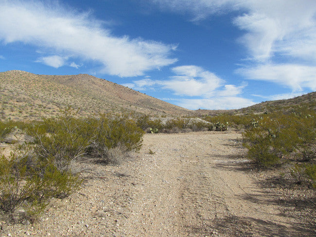
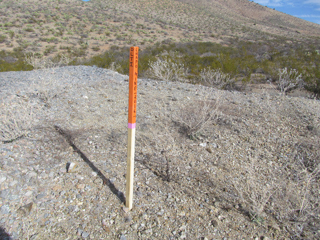
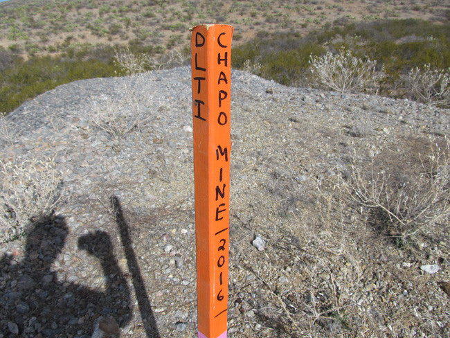
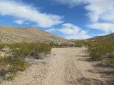
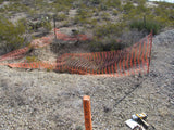
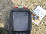
Access to the mine is very easy. It is 2WD all the way, and there is plenty of flat ground for you to stage equipment and vehicles. The road runs right next to the claim, and you can park 30 feet away from the mine. The area is full of dirt roads, so a good map and a good GPS unit is a must, but we'll show you exactly where both claims are on the map as well as provide you with the precise latitude and longitude of each corner marker, so finding them will not be a problem for you.


LEGAL NOTES
A mining claim gives the holder the right to mine on mineral-rich land that belongs to the federal government.
Mining claims are a tangible asset and show proof of all interests in minerals in the area. They can be bought, sold or used as collateral, just like any other piece of real estate. A mining claim can be sold, traded, leased, gifted, willed, used as collateral or transferred in part or in its entirety just like any other real property using a quitclaim deed which is a recordable conveyance.
We offer a lifetime guarantee should the BLM take back the land.
As the largest company in the mining industry selling legitimate and valuable historic claims, you can rest assured that you are not only covered with our 100% lifetime money-back guarantee, but you can also rest easy that there is no fine print on any of our claim listings telling you will have to deal with any games like being charged phony fees or having to pay inflated “processing” or “transfer” fees. The final price for this mine is ALL you will pay.
Our in-house legal counsel will complete all of the paperwork and documentation for recording and transferring FULL ownership AND we will ship you everything in one to two business days of receipt of your payment in full (usually just one day!). So you can plan to visit (and start working) your claim the next day without the lengthy delay you will experience with other companies selling claims –and you will not have to pay any extra costs, fees or other poor excuses for extra profit that normally just go into a seller’s pocket.
-PLUS-
We'll take care of all the paperwork and arrangements so you can enjoy your claim immediately after payment and we keep you informed through the entire process with confirmations when payment is received, when your paperwork has been shipped.
SHIPPING
While we cannot physically ship land to you as it doesn't quite fit into the mail box ;)
We will ship all paperwork/maps upon payment clearing we ship same business day (if payment is received by 1PM P.S.T.) We always provide tracking information so you are always informed.
