


Description
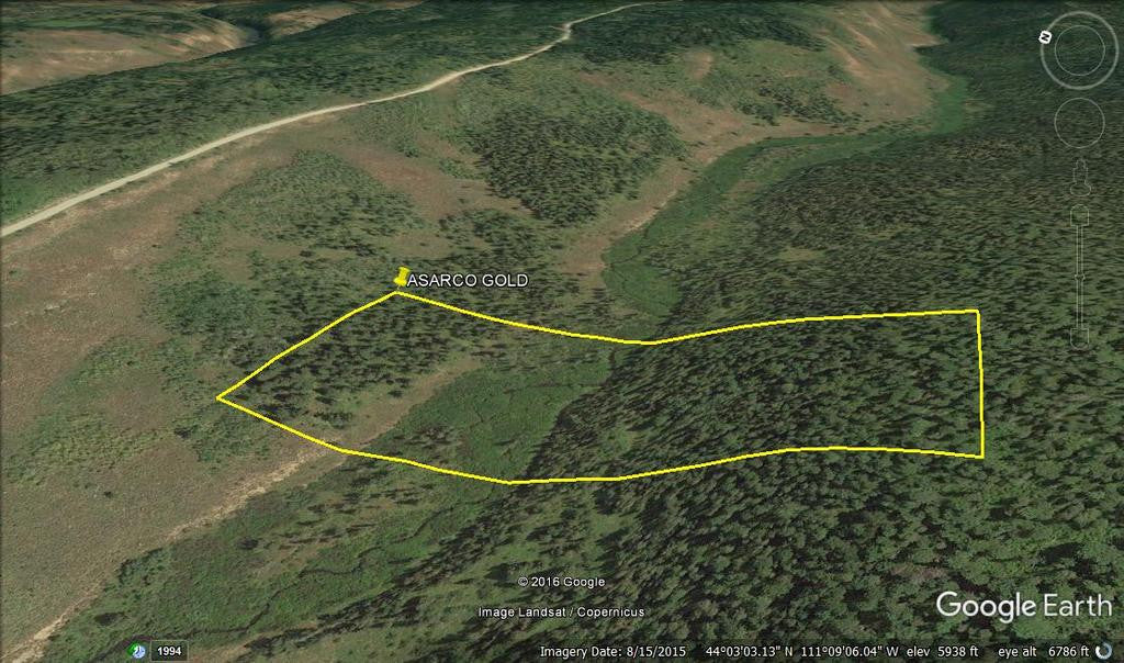
ASARCO GOLD
IMC217578

Unpatented Placer Mining Claim on Federal Land / Squirrel Creek, ID
QUICK FACTS ON THE MINE:
Commodities: Gold, Silver, Iron
County: Fremont, ID
Elevation: 6,064 to 5,236 feet.
Type of Claim: Placer
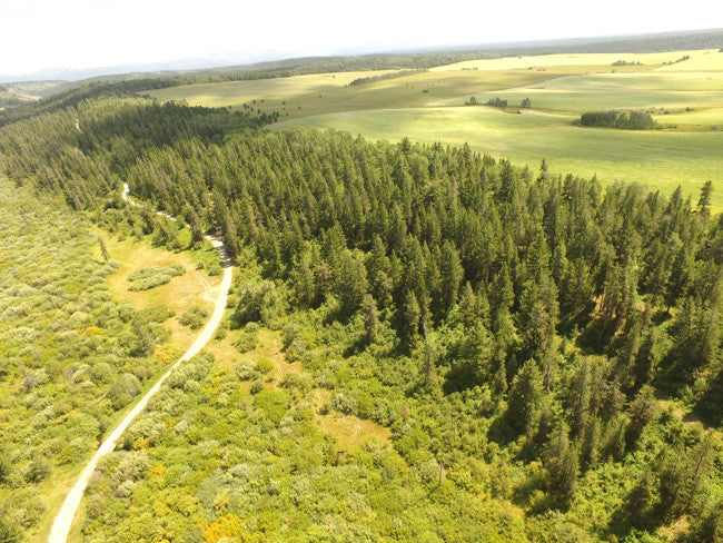
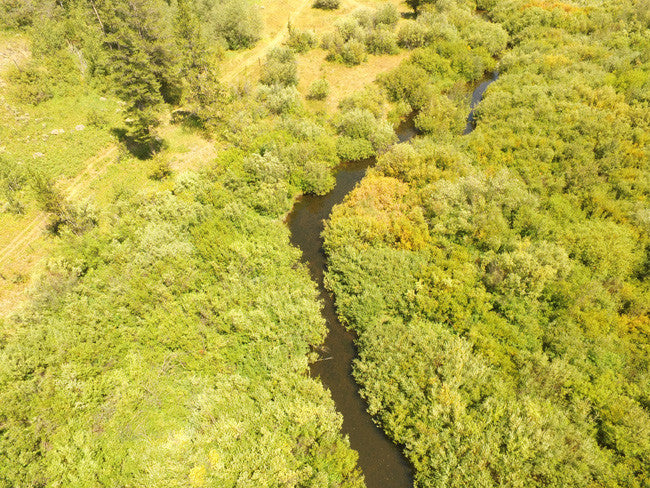
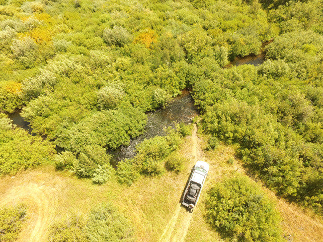
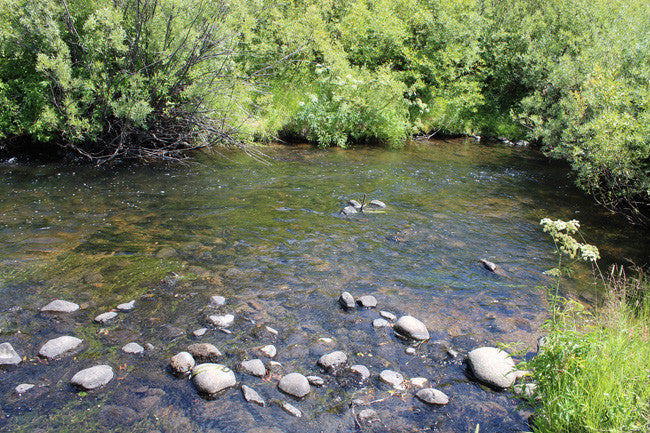
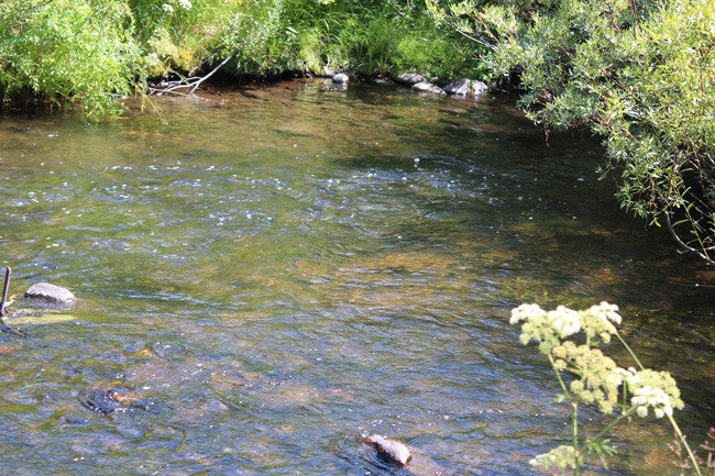
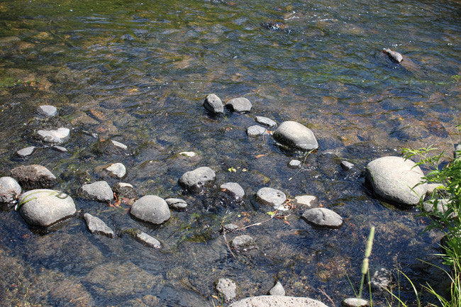
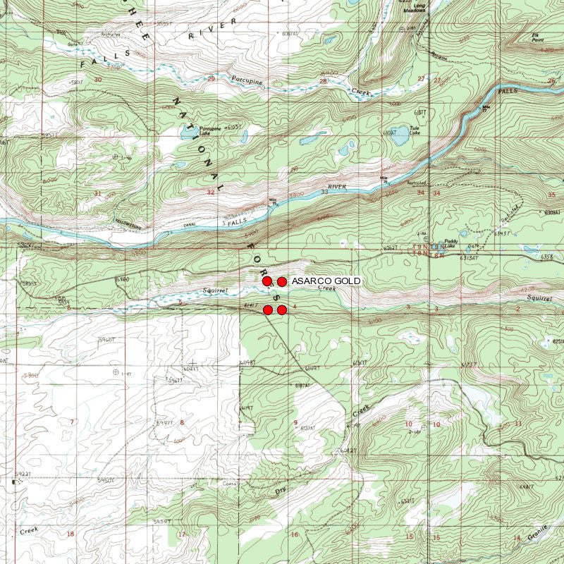
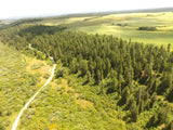
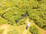
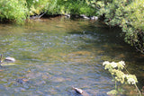
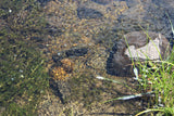
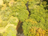
This gold claim and spans over 890 feet of prime working water on Squirrel Creek. Squirrel Creek is located in the Targee National Forest in Idaho. During the past year and half, this area has seen large amounts of rain which means there are overgrown bushes that might need some work to make the creek more easily reached. Squirrel Creek ranges between 4-12 ft. across, and about 8-3 ft. in depth. The creek has vibrant colors, and plenty of benches for gold trapping.
Gold can be mined in a variety of ways, including placer mining. This type of gold mining in Ashton ID involves using water or dredging to remove deposits of gold. Likely the most commonly thought of way to extract gold is by panning, though large-scale operations would not use this method. Panning for gold separates the gold from other materials such as gravel or soil. A pan is placed in water and shaken to sort gold, which settles at the bottom of the pan, from the other materials. Gold panning in Ashton Idaho is a popular tourist attraction in places with a history of gold mining, such as Alaska and California. Grab a pan and go see why gold mining in Ashton Idaho is making a huge comeback.


Buyer will receive the following with their completed transaction:
- Quitclaim deed showing full ownership of the claim. This will be stamped, recorded and verified with the County and the BLM offices.
- Welcome packet with all of the rules and regulations as they relate to the State and BLM where the claim is located.
- Educational documents to annually renew your mining claim with the BLM.
- A CD of all of the documented images of the claim including maps of the site.
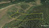
- Map of claim marked and GPS coordinates.
- Multiple maps showing claim location and surrounding areas for access.

-FAST FACTS-
ACCESS:
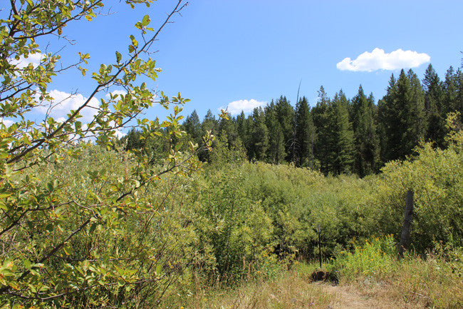
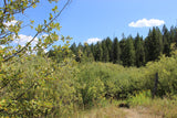
The creek is accessible via 2WD on the forest river roads 261 or 263. The road runs parallel to the creek, and gets as close as 250-1,000 ft. from the creek itself, which means that remaining space must be hiked with equipment that will be used to work on the creek. There is plenty of flat area available for setting up camp or equipment.

*FYI – Ashton-Flagg Ranch Road is closed during the winter, so make sure to double check the conditions before heading out.*
Squirrel is an unincorporated community in Fremont County, Idaho, United States. The area lies north of Idaho State Route 32 northeast of Drummond and southeast of Ashton.
Placer gold is common in Idaho. Also known as flour gold, the particles can be found in most streams and river beds in Idaho. Placer gold is created when load gold becomes dislodged from it's resting place and the nuggets are washed downstream by rain. The resulting friction smooths, flattens and reduces them into flakes that can be recovered with a flat pan. The most productive gold panning typically occurs after it rains.
Idaho was teeming with prospectors from the late 1800s to the early 1900s, all of them infected with gold fever. The discovery of gold brought the original settlers to Idaho and prompted the establishment of the Idaho territory in 1863. According to the United States Bureau of Mines, Idaho has more gold than any other state -- and much of it is still out there.


Squirrel Creek Elk Ranch & Inn is located within 20 miles of the rugged and remote south-western section of Yellowstone National Park. Located on the Flagg Ranch Road (1200 North) there is National Forest to the east complete with rivers and lakes for fishing, hunting, and sightseeing. The Bechler-Falls River basin is also full of waterfalls and is only accessible by the gravel Cave Falls Road through Ashton, Idaho. Squirrel Creek is perfect location for those looking to explore the awesome beauty of the southern Yellowstone Park area.

Idaho Department of Lands/Dredge and Placer Mining:
The IDL regulates surface mining in the State of Idaho. Surface mining is the extraction of minerals from the ground by removing the soil and rock over the mineral deposits. The Idaho Surface Mining Act, passed in 1971, requires reclamation of affected lands to return them to a productive condition.
The IDL administers the Idaho Dredge and Placer Mining Protection Act, passed in 1954. Dredge and placer mining is the extraction of minerals containing particles of gold or other valuable minerals, using suction dredges with a nozzle eight inches in diameter or more. A placer deposit can be in a natural watercourse or an ancient river channel high above a stream.

Recreational Mining
The IDL does not regulate recreational suction dredge mining. Recreational dredge mining applies when miners use power sluices, small recreational suction dredges with a nozzle five (5) inches in diameter or less, and equipment rated at a maximum of fifteen (15) horsepower or less. Recreational dredge mining is regulated by the Stream Channel Protection Act administered by the Idaho Department of Water Resources (IDWR). If a miner has a recreational dredging permit issued by IDWR they do not need any additional permits from the Idaho Department of Lands (IDL) to mine in a navigable stream. (https://www.idl.idaho.gov/mining/regulation/index.html)
ABOUT THE COUNTY
HISTORY: Fremont county was established in 1893, and was named for the explorer John C. Frémont.
Fremont County is part of the Rexburg, ID Micropolitan Statistical Area, which is also included in the Idaho Falls-Rexburg-Blackfoot, ID Combined Statistical Area.
Fremont County was established in 1893. It is named for John C. Frémont. The Fremont County Courthouse in St. Anthony is on the National Register of Historic Places.

GEOGRAPHY According to the U.S. Census Bureau, the county has a total area of 1,896 square miles (4,910 km2), of which 1,864 square miles (4,830 km2) is land and 32 square miles (83 km2) (1.7%) is water. The southern part of the county covers the northeast tip of the Snake River Basin, with the mountains of the continental divide forming its northern boundary. Montana lies to the north, and Wyoming to the east. A portion of Yellowstone National Park reaches into the county. ( Wikipedia )


LEGAL NOTES
A mining claim gives the holder the right to mine on mineral-rich land that belongs to the federal government.
We offer a lifetime guarantee should the BLM take back the land.
As the largest company in the mining industry selling legitimate and valuable historic claims, you can rest assured that you are not only covered with our 100% lifetime money-back guarantee, but you can also rest easy that there is no fine print on any of our claim listings telling you will have to deal with any games like being charged phony fees or having to pay inflated “processing” or “transfer” fees. The final price for this is ALL you will pay.
Our in-house legal counsel will complete all of the paperwork and documentation for recording and transferring FULL ownership of this mine into your name if you win the auction, AND we will ship you everything in one to two business days of receipt of your payment in full (usually just one day!). So you can plan to visit (and start working) your claim the next day without the lengthy delay you will experience with other companies selling claims –and you will not have to pay any extra costs, fees or other poor excuses for extra profit that normally just go into a seller’s pocket.
-PLUS-
We'll take care of all the paperwork and arrangements so you can enjoy your claim immediately after payment and we keep you informed through the entire process with confirmations when payment is received, when your paperwork has been shipped.

SHIPPING
While we cannot physically ship land to you as it doesn't quite fit into the mail box ;)
We will ship all paperwork/maps upon payment clearing we ship same business day (if payment is received by 1PM P.S.T.) We do ship same business day with USPS. We always provide tracking information so you are always informed.
