


Description
AMALGATE OPAL
WMC312365
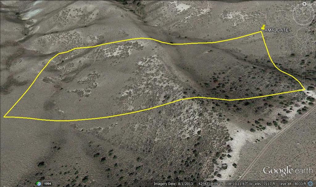
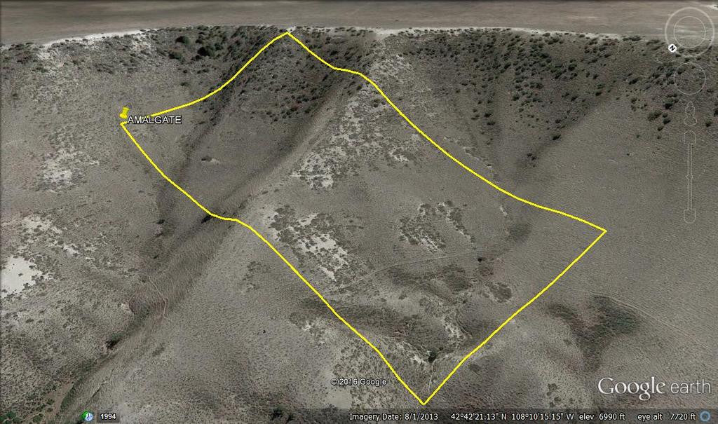
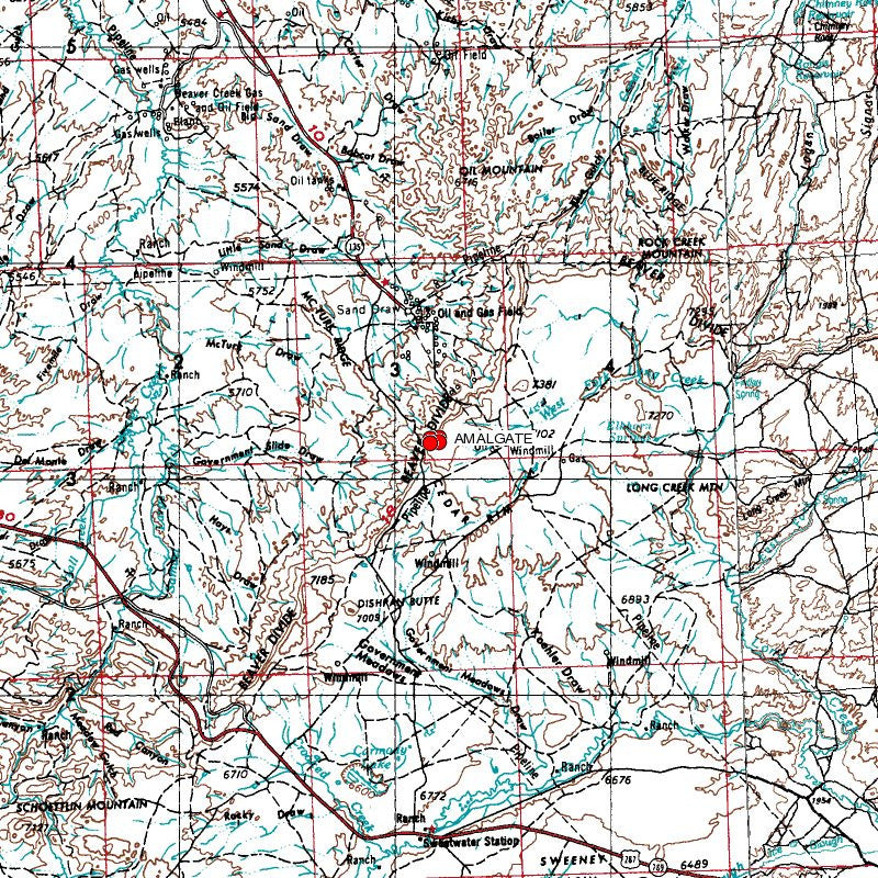
20 Acre Unpatented Placer Mining Claim on Federal Land Fremont County Wyoming
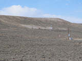
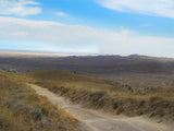
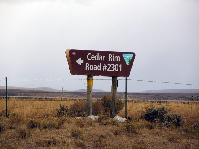
This 20 acre placer claim is located in the precious opal fields up in Cedar Mountain mining district. Opal is rare and when found occurred as secondary vein deposits mixed in common opal.
Opal (SiO2.nH2O) in general is a precious to semi-precious stone classified as an amorphous mineraloid with 6 to 10% water. A mineraloid is a mineral-like substance that does not yield an exact chemical formula; and like volcanic glass, shows no sign of crystallinity. Opal has a hardness of 5.5 to 6.5 & is fragile to relatively durable semi-precious gemstone. In general, the higher the water content, the less stable the opal.
Three general categories of opal include: (1) common, (2) fire, & (3) precious. Precious opal is the most valuable. Precious black opal is considered to be the most valuable of the precious opals by gemologists because of an internal color play enhanced against the dark matrix. Precious white opal is considered to be less valuable as the internal color play is less distinctive against the white opaline matrix. Even so, this preference is based on taste.
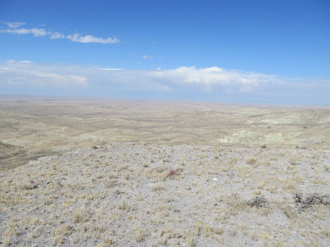
Fire opal, which may or may not have color play, can be translucent to transparent red, orange-red, orange and/or yellow. If transparent to translucent, fire opal may be faceted: Opaque to translucent fire opal is usually cut into cabochons. Translucent to opaque milky white common opal may contain streaks of blue, red, brown, or yellow, & is also cut into cabochons. Hyalite, a colorless to transparent opal found as globules that resemble drops of water, is most often cut into cabochons. All varieties have been observed at Cedar Rim either as massive material or in trace amounts. Cedar Rim is extensive, covering hundreds of acres of land, thus the potential for significant discoveries of high-quality precious opal is high, especially since little surface and no subsurface exploration has occurred.

The Cedar Rim deposit in Wyoming consists of vast amounts of white to light-blue opaque common opal, with lesser amounts of translucent to opaque yellow, yellow-orange to orange fire opal & some clear, transparent hayalite. In that all varieties of opal have been identified in the deposit & much of the field remains unexplored, the potential for discovery of valuable seams of opal must be considered. Large amounts of agate were also identified including the source beds of the popular Sweetwater dendritic agate. In places opal beds are a few feet to >50 feet thick. Since there has been no subsurface exploration, the true thickness remains unknown.
Cedar Rim occurs along Cedar Rim Draw near the NW margin of Beaver Rim. Beaver Rim is a topographic ridge that marks the northwestern edge of the Granite Mountains uplift. The nearest towns are Riverton (25 miles to the northwest), Lander further west, and Jeffrey City to the southeast.

History of Opal in the Area:
Prior to 1975, only jade and a few agates were known in Wyoming. But within a few decades, Wyoming became the gem capital of North America with the most diverse collection of documented gems of any state in the US. A collection that includes agate, jasper; common opal, fire opal, precious opal, onyx, gold nuggets, pyrope garnet, spessartine garnet, chrome diopside, enstatite, kyanite, iolite, ruby, sapphire, peridot, diamond, specularite, apatite, minyulite, amethyst, aquamarine, jade, almandine, chalcedony, silicified banded iron formation, jasperoid, labradorite, grunerite, amber, chrysocolla, heliodor, varisite, specularite & others.
Wyoming is filled with diamonds, gemstones, gold, platinum, coal, oil, gas, rare earths, platinum, palladium and copper. It has the ‘GEMSTONE STATE’.
Over the next few years, more than 40 diamond pipes and dikes were discovered – half in Wyoming and half in Colorado. Several properties were mined for diamonds including George Creek, Sloan, and Kelsey Lake. Over 130,000 diamonds were mined including gemstones larger than 28 carats. A 6.5 carat diamond was found in Wyoming and diamonds of 14 and 28 carats were mined from Colorado.
In 1981, Wyoming was unknown for gold even though all of the surrounding states had considerable gold. Gold had been discovered in Wyoming in 1842, but nothing much was ever done. Significant gold was found in the Seminoe Mountains in 1981 by a geologist from Laramie named Dan Hausel. The Rawlins Times reported a gold rush filled all of the motels in Rawlins, Saratoga, Sinclair and even Laramie with people wanting a piece of the pie. It was Timberline Minerals from Dubois who tied up the property. The company president, John Wells indicated they drilled the discovery site at Bradley Peak and picked up samples of quartz and iron formation with visible gold.

Buyer will receive the following with their completed transaction:
- Quitclaim deed showing full ownership of the claim. This will be stamped, recorded and verified with the County and the BLM offices.
- Welcome packet with all of the rules and regulations as they relate to the State and BLM where the claim is located.
- Educational documents to annually renew your mining claim with the BLM.
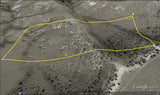
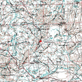
- A CD of all of the documented images of the claim including maps of the site.
- Map of claim marked and GPS coordinates.
- Multiple maps showing claim location and surrounding areas for access.

Come to Hike, Camp, Ride and Shoot - or come to pull some shiny rock$ out of the ground;-)
ABOUT THE MINING DISTRICT
Fremont County was created in 1884. It is the historical home of the Wind River Indian Reservation, home of the Shoshone and Arapaho tribes of Native Americans. It included Park, Big Horn, and Hot Springs counties until 1890 when they split. It was named for General John Charles Fremont, who was a surveyor and explorer searching for a route to the Pacific Ocean in 1842. His group of 20 men were guided by Kit Carson and Enos, a Shoshone Indian.
South Pass, a break in the continental divide, is also located in Fremont County. Indians had been using the pass for centuries before Robert Stuart and his group were the first whites to cross the pass October 12, 1812. The first horse drawn wagons to cross the pass were led by Captain Benjamin Bonneville in 1832. Gold was discovered here in 1842. The big boom came in 1867 when the Carissa mine (Named for Clarissa Whitney who is thought to be the first white child born in Wyoming), Miner Delight, and Burr mines were discovered, producing millions of dollars in gold. Over 5,000 people came to the area during this time to search for gold.
Fremont County produces more than half of the uranium in Wyoming, which is second in the United States in uranium production. Jade also found in Fremont County which is the Wyoming State gem stone.
Gold was discovered about 25 miles south of Lander in 1842, but mining did not begin seriously until at least the early part of 1870. There are many placers, but lode gold has been the most important. Some authorities credit the area with about 90,000 ounces of gold. It is an area where local inquiry could be very important in finding gold.

CLIMATE -
Fremont County, Wyoming, gets 9 inches of rain per year. The US average is 37. Snowfall is 42 inches. The average US city gets 25 inches of snow per year. The number of days with any measurable precipitation is 47.
On average, there are 235 sunny days per year in Fremont County, Wyoming. The July high is around 85 degrees. The January low is 10. Our comfort index, which is based on humidity during the hot months, is a 66 out of 100, where higher is more comfortable. The US average on the comfort index is 44.

TEMPERATURE –
Because of its elevation, Wyoming has a relatively cool climate. Above the 6,000 feet level the temperature rarely exceeds 100° F. The warmest parts of the State are the lower portions of portions of the Big Horn Basin, the lower elevations of the central and northeast portions, and along the east border. The highest recorded temperature was 114° F on July 12, 1900, at Basin in the Big Horn Basin.
The average maximum temperature at Basin in July is 92° F. For most of the State, mean maximum temperatures in July range between 85 and 95° F. With increasing elevation, average values drop rapidly. A few places in the mountains at about the 9,000 foot level have average maximums in July close to 70° F. Summer nights are almost invariably cool, even though daytime readings may be quite high at times. For most places away from the mountains, the mean minimum temperature in July ranges from 50 to 60 ° F. Of course, the mountains and high valleys are much cooler with average lows in the middle of the summer in the 30s and 40s with occasional drops below freezing.
In the wintertime it is characteristic to have rapid and frequent changes between mild and cold spells. Usually there are less than 10 cold waves during a winter, and frequently less than half that number for most of the State. The majority of cold waves move southward on the east side of the Divide. Sometimes only the northeast part of the State is affected by the cold air as it slides eastward over the plains. Many of the cold waves are not accompanied by enough snow to cause severe conditions. In January, the coldest month generally, man minimum temperatures range mostly from 5 to 10° F. In the western valleys mean values go down to about 5° below zero. The record low for the State is -66° F observed February 9, 1933, at Yellowstone Park. During warm spells in the winter, nighttime temperatures frequently remain above freezing. Chinooks, warm downslope winds, are common along the eastern slopes.

ACCESS
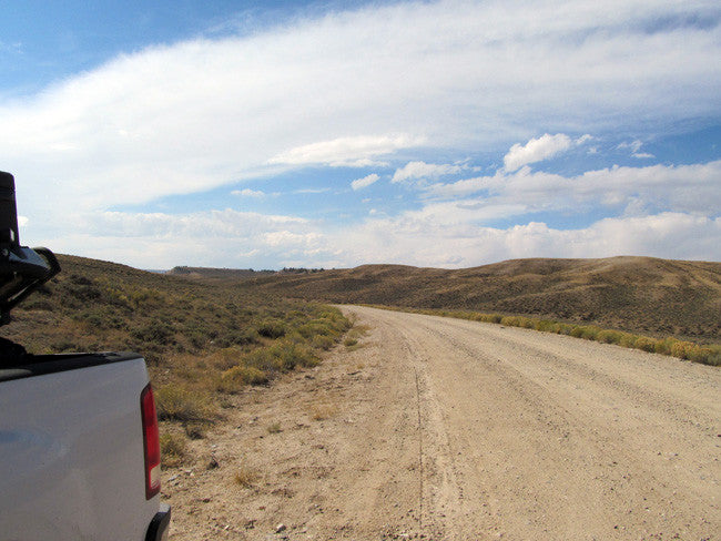
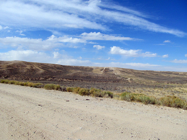
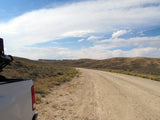
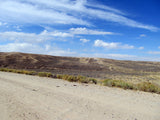
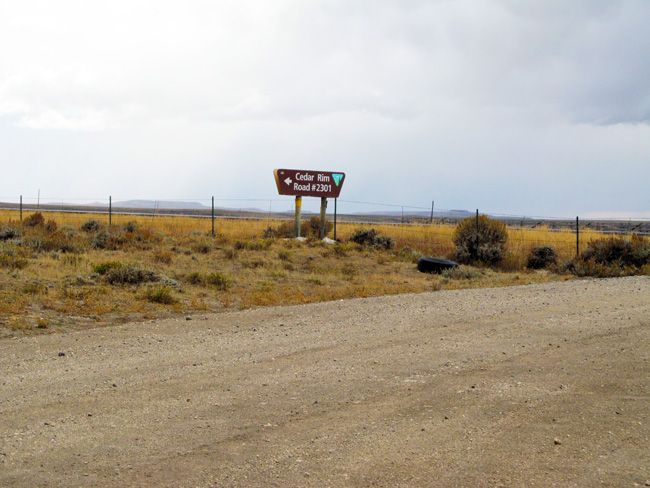
The main route coming out of Lander, and headed towards the claim is US-287 S. This road is a highway and is a pretty easy drive. It is mostly dry is most spots on the way to the claim. There can be strong winds at certain times of the year, so just make sure you check it out before getting on the road. Easy two wheel drive all the way to the claim.
The next main road that will take you all the way to the claim, is the Sand Draw Rd. (WY-135 N) Sand Draw Rd is paved, so it is another easy road to access the claim. Once you reach your destination you can either walk over to the claim, or ride an ATV over, from the road. There is no rough parts of the road to worry about, but in order to reach the claim from the road, there is a bit of rough terrain and hills.
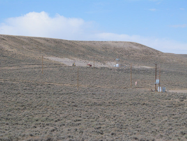
Walking distance from the paved road is only 0.76 miles; so either a four wheel drive vehicle or even an ATV. The mine is situated on the side of small hill, so if you want to park your vehicle next to it, there is a flat surface at the top of the mine, where you can keep your equipment and vehicles.

Bear Basin Adventures – 41.63 miles

OTHER THINGS OF INTEREST:
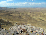
•Sightseeing - spectacular views of the surrounding Wyoming landscape are easy to find.
•Hunting - outstanding deer and elk hunting.
•Rock Hounding - jade and agate are found in surrounding areas.
•Wild horses - can be seen in and around the area year-round.
•Fishing - brook trout fishing in the east fork of Cottonwood Creek at Cottonwood Campground.
•Mountain Biking - ride the Green Mountain loop road with a side trip to Wild Horse Point. Begin at U.S. Highway 287 and ride the entire loop road-approximately 31 miles. A trip to Wild Horse Point is eight miles one-way from Cottonwood Campground.
•Fremont County Picnic Area - located on the west loop of Green Mountain Road.


LEGAL NOTES
We offer a lifetime guarantee should the BLM take back the land.
As the largest company in the mining industry selling legitimate and valuable historic claims, you can rest assured that you are not only covered with our 100% lifetime money-back guarantee, but you can also rest easy that there is no fine print on any of our claim listings telling you will have to deal with any games like being charged phony fees or having to pay inflated “processing” or “transfer” fees. The final price for this mine is ALL you will pay.
Our in-house legal counsel will complete all of the paperwork and documentation for recording and transferring FULL ownership of this mine into your name if you win the auction, AND we will ship you everything in one to two business days of receipt of your payment in full (usually just one day!). So you can plan to visit (and start working) your claim the next day without the lengthy delay you will experience with other companies selling claims –and you will not have to pay any extra costs, fees or other poor excuses for extra profit that normally just go into a seller’s pocket.
-PLUS-
We'll take care of all the paperwork and arrangements so you can enjoy your claim immediately after payment and we keep you informed through the entire process with confirmations when payment is received, when your paperwork has been shipped.

While we cannot physically ship land to you as it doesn't quite fit into the mail box ;)
We will ship all paperwork/maps upon payment clearing we ship same business day (if payment is received by 1PM P.S.T.) We always provide tracking information so you are always informed.
