


Description
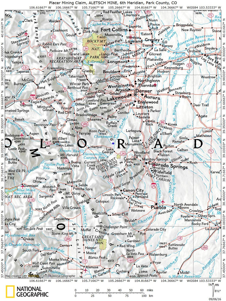
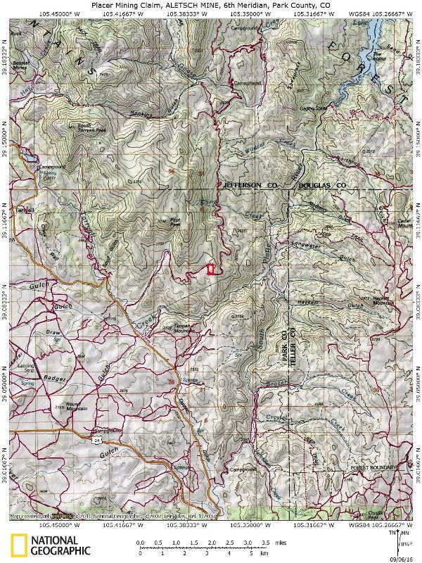
ALETSCH MINE
CMC288453

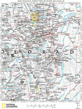
20 Acre Unpatented Placer Mining Claim on Federal Land in Park County, CO
This is a rare chance to own a claim in this particular area. Park County only has about 8 percent of State owned lands while privately owned land accounts for about 41 percent. With the purchase of this claim you will be getting the exclusive mineral rights to 20 acres on an excellent spot located in Park County nearby the famous Topaz Mountain Gem Mine.

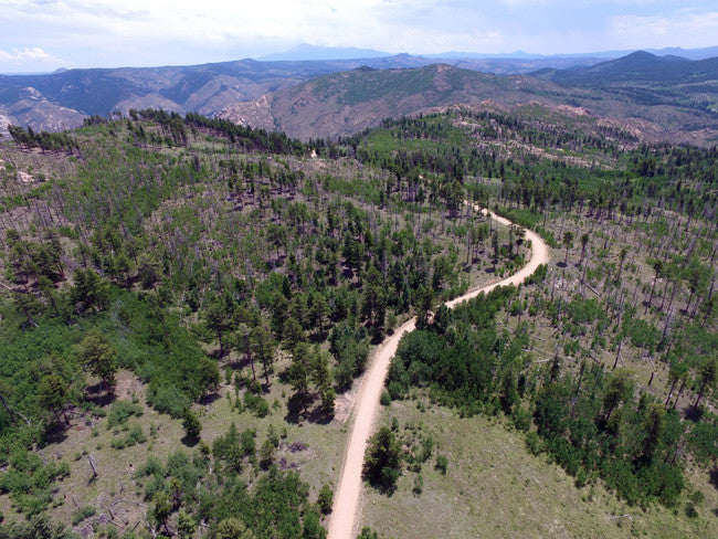
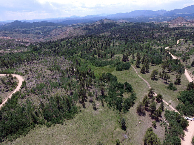
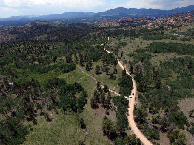
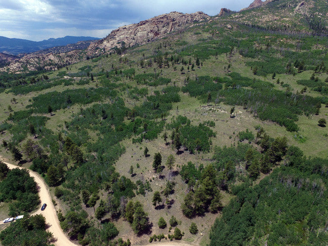
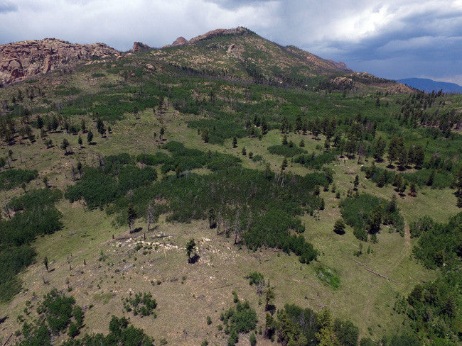
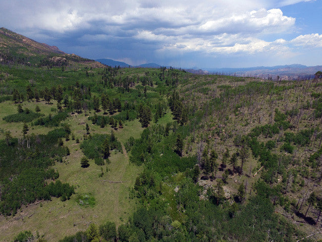
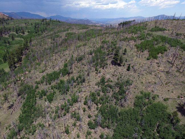
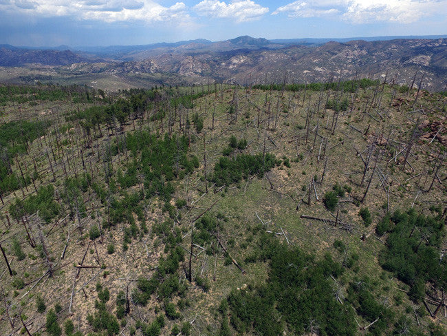
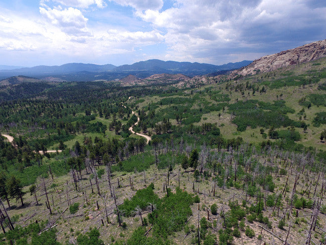
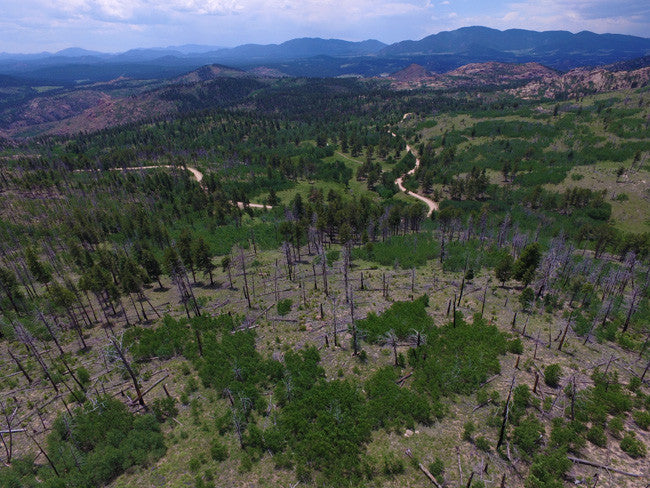
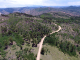
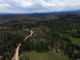
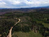
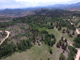
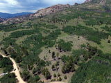
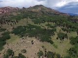
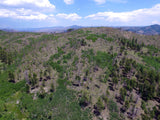
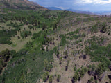
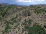
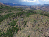
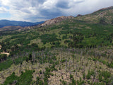
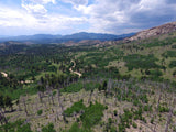
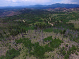
This claim is located in the Tarryall Mountains, a rugged, forested area that includes parts of Pike National Forest and the Lost Creek Wilderness.
Topaz occurs in the Tarryall Mts. in miarolitic cavities in pegmatites, in colluvial deposits, and in colluvial/alluvial deposits produced by glacial meltwater (Michalski, 1986). At the Topaz Mountain Gem mine, topaz occurs in 2 types of deposits. First, it forms well rounded "cutters" in small seams of deeper gravel that was deposited between large boulders. Second, it occurs in "pristine", sharply terminated crystals in poorly sorted granite colluvium. Both types probably originated in the rugged outcrops of 970- to 990-million-year-old potassium rich granite that occur to the east and northwest of the mine. These outcrops are a part of the Redskin stock, a late intrusive phase of the Pikes Peak batholith. Topaz occurrences are concentrated along the contact between the Pikes Peak Granite and the Redskin stock (Muntyan and Muntyan, 1985).
Topaz is a semiprecious gemstone that occurs as very hard, transparent crystals in a variety of colors. Topaz crystals, are naturally amber colored, but become colorless after exposure to sunlight. Topaz forms within cavities of the volcanic rock, rhyolite, from eruptions that occurred six to seven million years ago during the Tertiary Period. Topaz is embedded in the rhyolite rock, and also found loose on the slopes and arroyos.

Topaz occurs in a variety of colors. Colorado topaz is usually pale blue, while Utah topaz is a sherry brown or amber color.
Other minerals at this locality include rare, euhedral zircon crystals (Joe Dorris, personal communication, 2012), common smoky quartz (some with phenakite or needly schorl crystals attached), milky quartz, microcline, albite, goethite, ferrocolumbite (Dorris, 2006), and altered biotite.


We also found records of other minerals found in this area that include:
Albite
Columbite-(Fe)
Fluorite
Goethite
Hematite
Microcline
Muscovite
Phenakite
Quartz
Schorl
Topaz
Zircon
( http://www.mindat.org/loc-159278.html )


Buyer will receive the following with their completed transaction:
- Quitclaim deed showing full ownership of the claim. This will be stamped, recorded and verified with the County and the BLM offices.
- Welcome packet with all of the rules and regulations as they relate to the State and BLM where the claim is located.
- Educational documents to annually renew your mining claim with the BLM.
- A CD of all of the documented images of the claim including maps of the site.
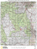
- Map of claim marked and GPS coordinates.
- Multiple maps showing claim location and surrounding areas for access.

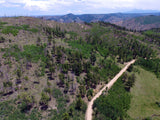
This area was heavily timbered until the Hayman fire of 2002. When it swept through, it burned much of the timber from the claims and the surrounding hillsides. Now, scarred and blackened snags cover the mountains. Recovery is underway, and much like the area around the Glacier Peak amazonite claims farther south, the wildflowers have returned in abundance. Aspens are also up to six feet tall. The grass is quite lush. Of course, it will be many years before all of the pines and firs return.

**Our claims are less than 1 mile from the famous Topaz Mountain Gem Mine**
Located at 39 degrees 6.345 minutes N, 105 degrees 23.591 minutes W, the Topaz Mountain Gem mine can be reached from Lake George, Park Co., Colorado by following Park Co. Rd. 77 north for about 7 miles from where it intersects US Rt. 24; then turning right (northeast) onto Forest Service Rd. 211 (Matakat, aka Matukat, Matucat, Rd.) and driving approximately 2.5 miles to the entrance gate (on the north side of Matakat Rd., just past the cattle guard). The locality occupies 2 Forest Service placer claims owned by Glacier Peak Mining, LLC, which is operated by Joseph L. Dorris (i.e. Prospectors Show) and his family.
COLLECTING IS STRICTLY PROHIBITED except when Mr. Dorris is present, and requires purchase of a bag of gem gravel. For detailed directions, conditions, and dates, go to:
http://pinnacle5minerals.com/GlacierPeakWeb/Visits/TopazVisits.html

Colorado has produced thousands of topaz specimens from numerous localities with some gem crystals approaching five pounds in weight (Eckel and others, 1997)! Local rock club members are familiar with the best known source of Colorado topaz---the pegmatites associated with the Pikes Peak Batholith (Precambrian in age, around 1.05 Ga). Several of the Colorado mineral societies have claims that may produce topaz and certainly some society members have individual claims. For many years a commercial topaz operation was open to the public near Spruce Grove Campground as the Topaz Mountain Gem Mine. The intrepid rockhounders could purchase “buckets” of material and hunt for the rough crystals. Today mines of the Glacier Peak Mining L.L.C. at Topaz Mountain “produce the finest U. S. topaz crystals and cutting rough …and perhaps the finest bi-color sherry and blue topaz ever found” (personal communication, Joseph L. Dorris).

Here are some tools that you should bring: rock hammer, or regular hammer, screwdriver, bags for your gems, hiking boots, hat, sunscreen, bug repellant and once again don't forget the water! Jeans are also a good idea because you will be spending most of your time on your knees, and the rocks are very ruff and jagged.

One of the more interesting aspects of the Pikes Peak topaz is that many of the crystals are found in stream sediments and weathered granite. Prospectors screen for the crystals rather than “pound rock”. These alluvial specimens are commonly frosted on the surface but have not been transported a great distance from their granitic source.
ABOUT THE MINING DISTRICT
The Pikes Peak granite formed in several stages. In the initial stage, about 1.02 billion years ago, a large mass of magma intruded into what is now the Front Range of Colorado. Although there may have been volcanoes overlying the intrusion, the majority of the magma never reached the surface, but formed and cooled at a depth of about 1 to 2 miles (1.6 to 3.3 km). Ultimately, the underground extent of the magma covered an area of 1,200 square miles (3,100 km2). Later on, over the next 40-million years, newer pulses of magma pushed into the existing granite, re-melting and pushing it aside to form, what are now called "intrusive centers." As the magma flowed into these intrusive centers, it tended to form a circular masses of rock with concentric rings of varying composition that look something like a bulls eye. The granite in the intrusive centers is different from the original granite, with higher concentrations of rare elements and more exotic minerals. Some of the best mineral collecting areas in Colorado can be found around the edges of these intrusive centers.
The Tarryall Mountains are located about 12 miles (19 km) north of Lake George. They represent an intrusive center called the Redskin Stock. Like the other localities in the region, smoky quartz and amazonite are the primary minerals, however, the amazonite is usually very pale and grading into ordinary pink or white microcline feldspar.

TRAVEL / ACTIVITIES
Four-wheel or all-wheel drive vehicles are recommended in all seasons on Park County roads, and an emergency kit of blankets, energy snacks, water, flashlights, and a shovel are essential in the winter, which can begin in late September and last until May.
Mining History, Production, Mines and Prospects
|
Between 1859 and 1989 (when the London Mine shut down after the last of several brief post World War II revivals), mines in Park County produced in excess of 9,404,623 ounces of silver, 1,366,374 ounces of gold, 12,668,632 pounds of zinc, 63,333,051 pounds of lead, and 3,334,886 pounds of copper worth over $470 million at 1999 metal prices (silver—$5.00/ounce, gold— $280.00/ounce, zinc—$0.50/pound, lead = $0.50/pound, copper—$0.75/pound). The USGS compiled data on over 235 mines and prospects in Park County within the Mineral Resource Data System (MRDS) database. Of this total, 101 occur in northwest Park County, 49 occur in the east-central Park County, and 24 are located in southeast Park County. The remaining 61 mines and prospects are scattered. It is estimated, from an examination of topographic maps and other literature sources, that there are at least 600 old workings in the County. Half are located in northwest Park County. In northwest Park County, Reiber (unpublished report, 1999) documented the presence of over 3,000 patented mining claims. |
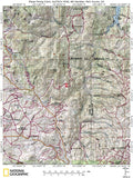
ACCESS / MAPS
To reach the claim you are able to use either 2WD or 4WD depending on the road conditions, and the time of year. The main paved road leading you to the area is called Tarryall Rd. Once you on that road you are looking for a dirt road named Matukat Rd. Continue on this road until you read the claim. This road goes right through the claim, giving you easy access to your vehicle and equipment. There is plenty of space on the claim to park a small camper or trailer.
U.S. Highways 285 and 24, Colorado Highway 9, many Park County roads, and numerous national forest access routes provide automobile access into and through the County. Some of the National Forest routes are suitable for off-highway vehicles (OHVs) only. Five water storage reservoirs (Antero, Elevenmile, Tarryall, Spinney and Montgomery) have become important wildlife and aquatic recreation areas, attracting 0.5 million people each year.


A mining claim gives the holder the right to mine on mineral-rich land that belongs to the federal government.
Mining claims are a tangible asset and show proof of all interests in minerals in the area. They can be bought, sold or used as collateral, just like any other piece of real estate. A mining claim can be sold, traded, leased, gifted, willed, used as collateral or transferred in part or in its entirety just like any other real property using a quitclaim deed which is a recordable conveyance.
We offer a lifetime guarantee should the BLM take back the land.
As the largest company in the mining industry selling legitimate and valuable historic claims, you can rest assured that you are not only covered with our 100% lifetime money-back guarantee, but you can also rest easy that there is no fine print on any of our claim listings telling you will have to deal with any games like being charged phony fees or having to pay inflated “processing” or “transfer” fees. The listing price for this mine is ALL you will pay.
SHIPPING
We'll take care of all the paperwork and arrangements so you can enjoy your claim immediately after payment and we keep you informed through the entire process with confirmations when payment is received, when your paperwork has been shipped out.

While we cannot physically ship land to you as it doesn't quite fit into the mail box ;)
We will ship all paperwork/maps upon payment clearing we ship same business day(if payment is received by 1PM P.S.T.) We always provide tracking information so you are always informed.
