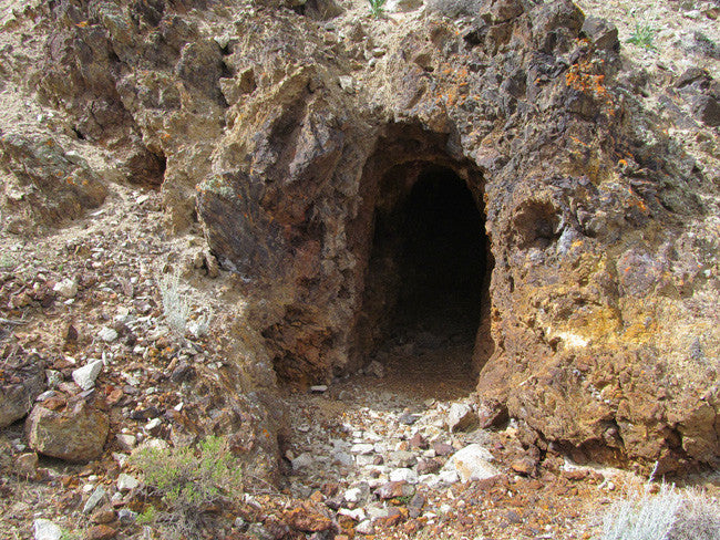


Description
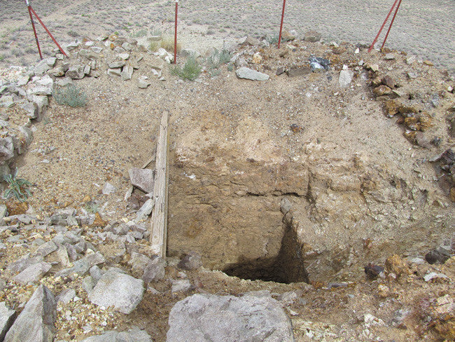
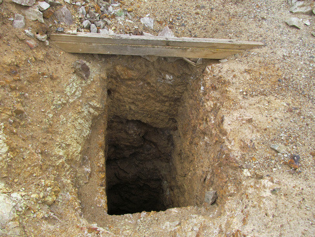
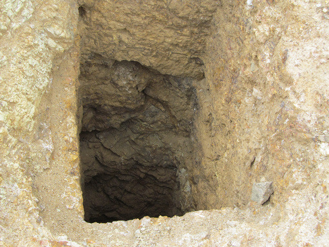
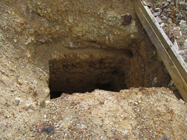
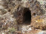
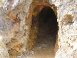
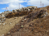
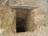
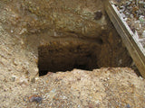
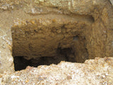
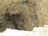
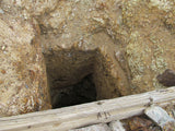
Historical records show that this mine was opened in the 20's to only a depth of 175 feet. It was then re-opened after WWII. It was documented that there was over 1800 feet of workings on two levels.
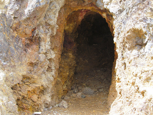
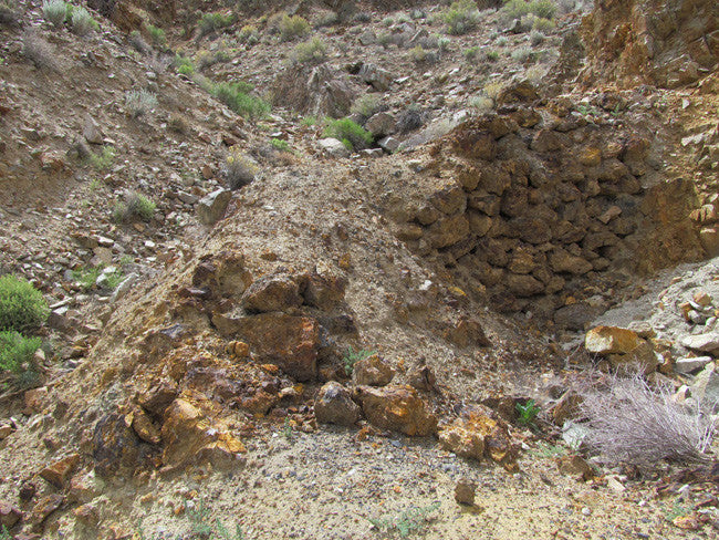
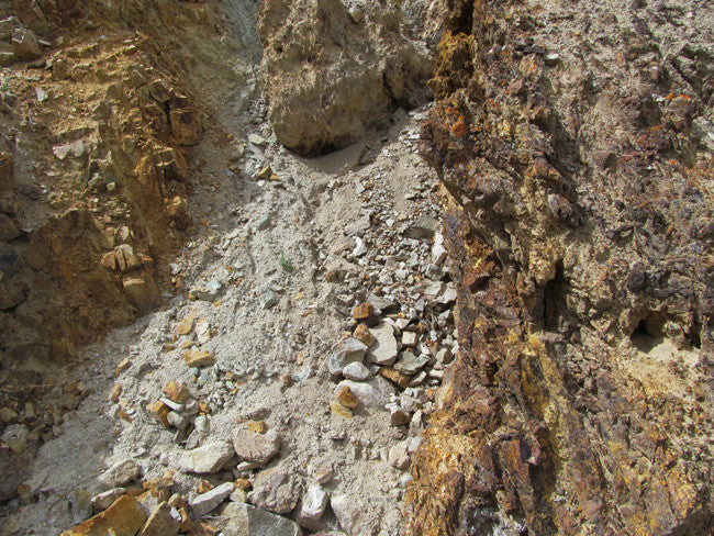
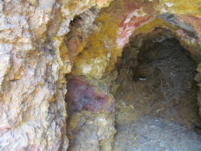
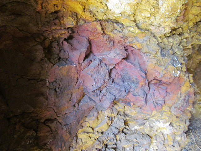
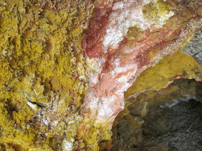
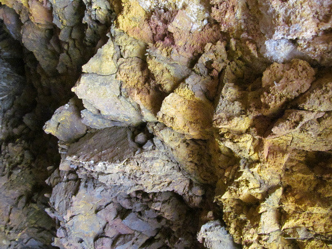
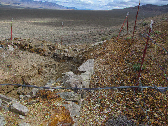
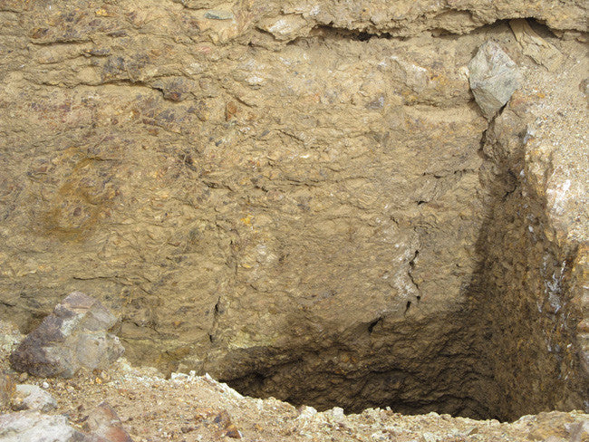
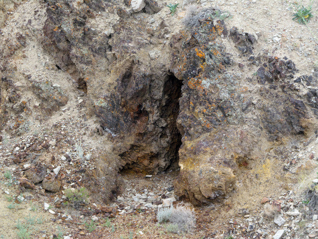
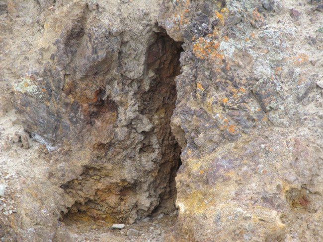
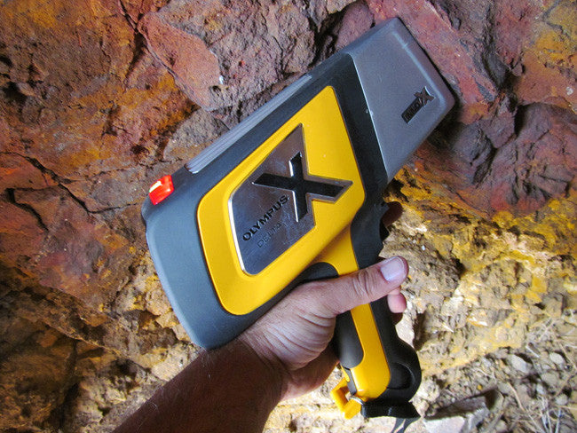
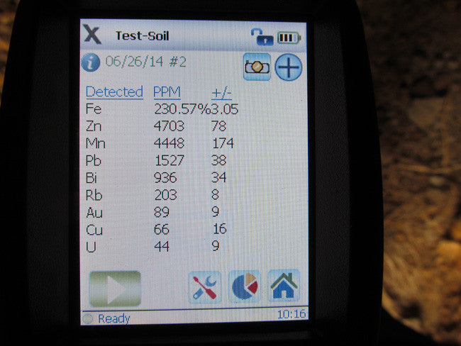
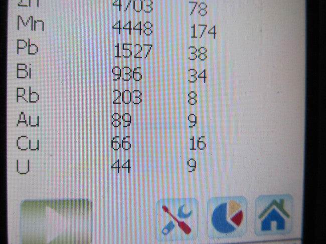
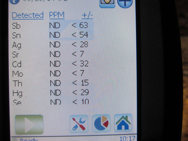
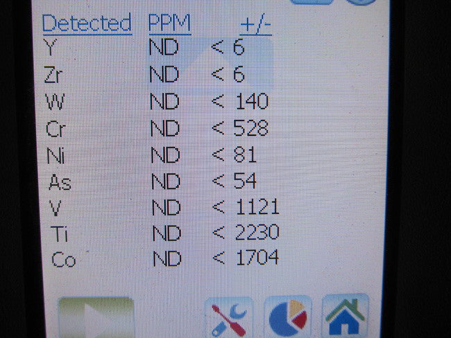
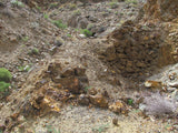
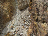
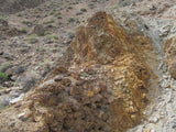
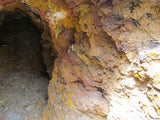
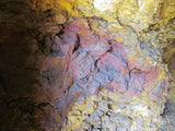
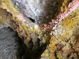
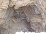
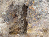
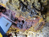
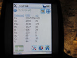
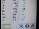
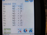
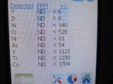
It has massive tailings that are very colorful and would be well worth re-working. The main shaft is currently at 307 feet deep. Under advice of legal counsel, I will not pass on the gold values here, as I do not want them to be misinterpreted as a guarantee of future values. But I will say that the gold and silver levels here are the best that I have seen in the entire district and they will support a profitable commercial operation.
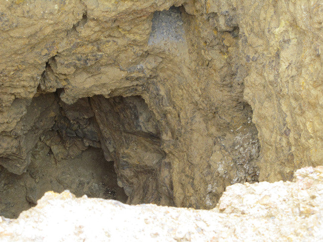
There is some incredible color in there, both gold and silver. This region is known for the free-mill gold.
ABOUT THE MINING DISTRICT
CHALK MOUNTAIN MINING DISTRICT, CHURCHILL COUNTY, NV
LOCATION
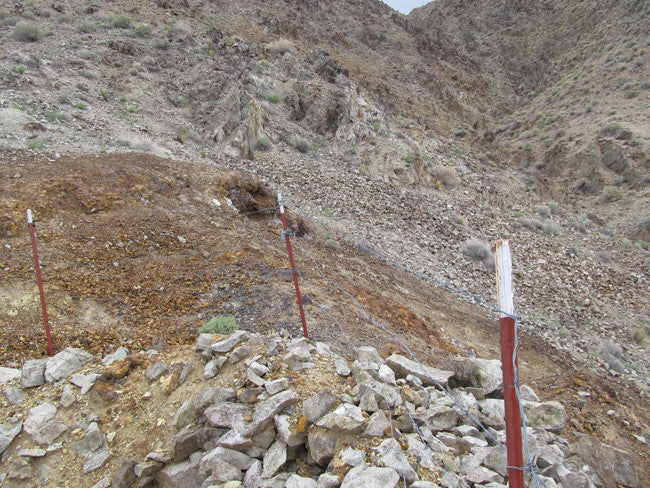
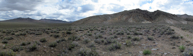
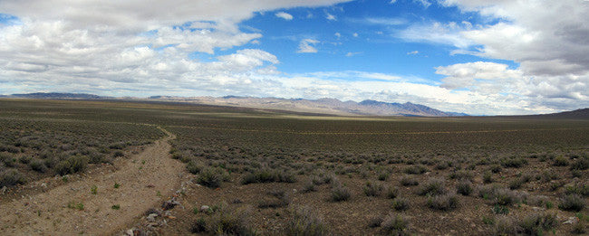
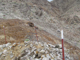
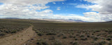
The Chalk Mountain district, Churchill County, encompasses Chalk Mountain, which is just north of U.S. Highway 50 at Drumm Summit, about 45 miles east of Fallon. The mountain, named for its conspicuous light color, is about 3 miles long by 2 miles wide and rises some 1,000 feet above the surrounding terrain. Chalk Mountain is on the east side of Dixie Valley, about midway between the old mining camps of Fairview and Wonder. Access is from the south via Highway 50 or from the west from the Dixie Valley road (State Route 121).
HISTORY
Miners from the early days of the Comstock were aware of the gold-lead-silver mineralization at Chalk Mountain, but ore was unable to be shipped economically until the district was fully developed (Schrader, 1947, p. 116). Prior to 1921, production was sporadic with occasional carload shipments running 4 ounces gold to the ton, 60 percent lead and 60 ounces silver to the ton. Major activity began in 1922 with the formation of the Chalk Mountain Lead-Silver Mining Co. to develop mines located about mid-way down the eastside of the mountain. By 1925, the company was reported to be shipping 12 tons daily of $100/ton ore (Schrader, 1947, p. 116). At least five other mining operations, mostly on the west side of the mountain, were active during the same 1920's period.
The most notable of these was the Nevada Chalk Mountain Mining co. which produced large quantities of ore for several years. The most productive years for the district were from 1923 to 1929, but the exact dollar amount produced is not known as part of the production was credited to the nearby Fairview district. The Chalk Mountain mine continued to operate sporadically until the 1950's (Willden and Speed, 1974, p. 64).
GEOLOGIC SETTING
Four major rock types crop out at Chalk Mountain; highly folded limestone and dolomite of possible Triassic age, volcanic and sedimentary rocks of Triassic or Jurassic age, massive quartz porphyry that intrudes the carbonate rocks, and a younger granodiorite (Willden and Speed, 1974, p. 64). The northern half of Chalk Mountain is made up of the quartz porphyry which is itself intruded by several smaller bodies of granodiorite. The quartz porphyry is bounded on the south by an irregular, approximately east-west striking contact with carbonate rocks that make up most of the southern half of the mountain. A large body of granodiorite intrudes the carbonate rocks and crops out along the southwestern flank of Chalk Mountain; the carbonate rocks are highly folded and narrow skarn zones occur along their contact with the granodiorite.
