


Description
CIARA GOLD
MMC233889
20 Acre Unpatented Placer Mining Claim on Federal Land Montana
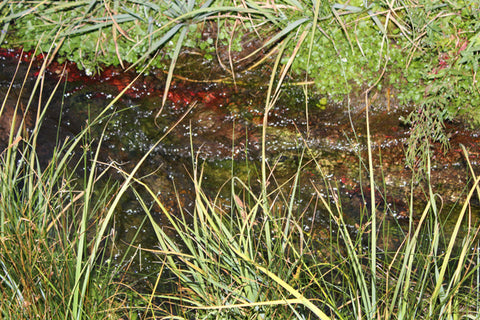
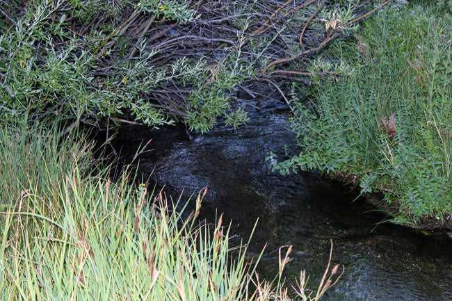
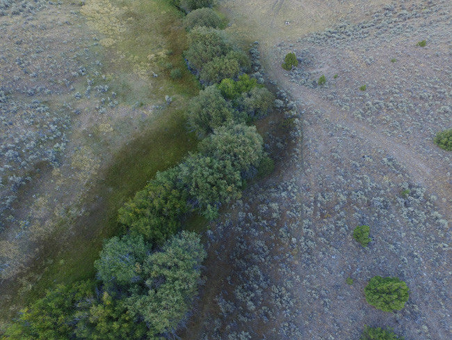
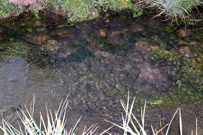
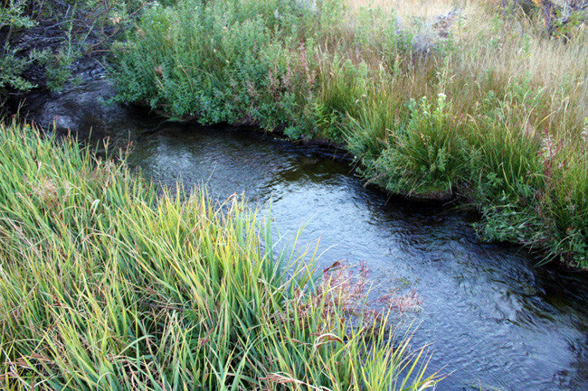
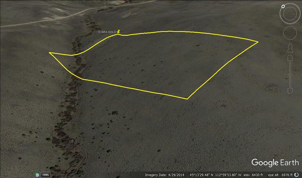
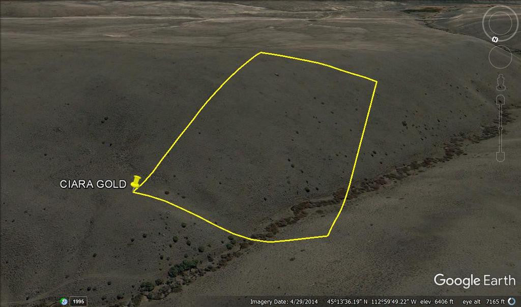
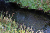
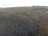
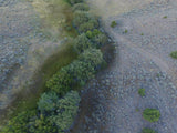
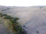
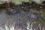
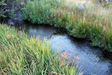
This placer gold mine totals over 748 feet of creek. With this claim you will be getting the exclusive mineral rights to 20 acres on an excellent spot on the creek for you to work at your leisure.
Commodities (Major) - Gold Deposit
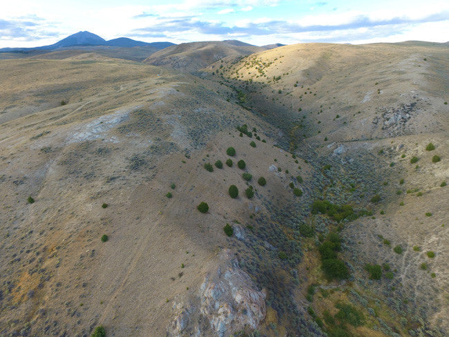
Elevation: 7812 Feet above MSL (2381 Meters)
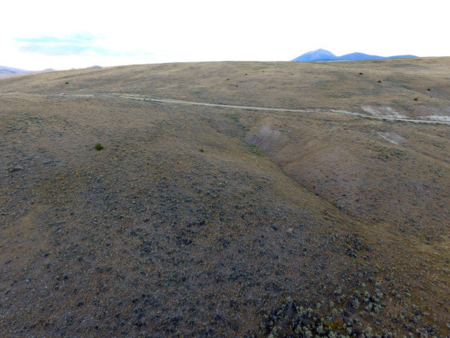
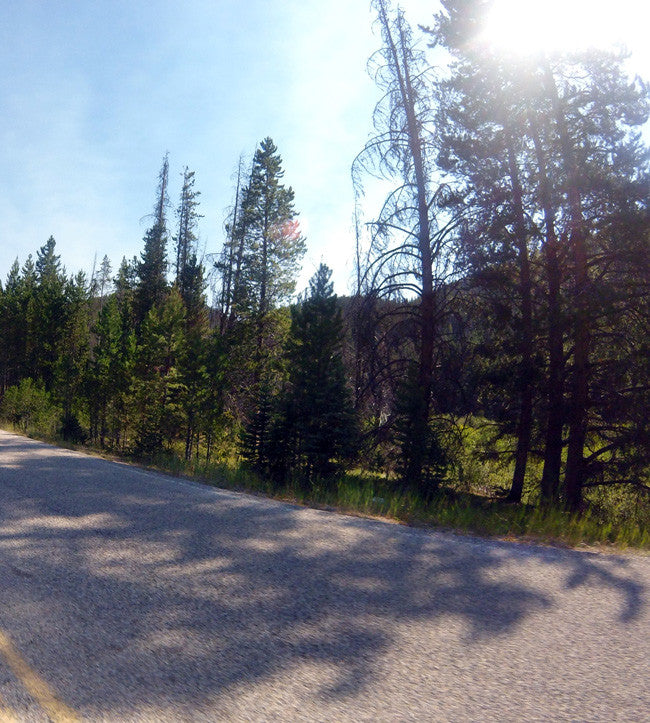
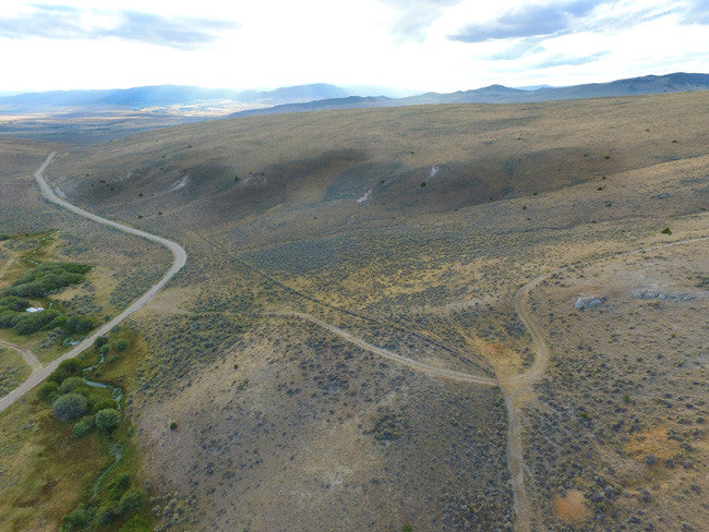
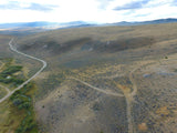
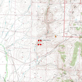
Access: (For maps / location scroll towards the bottom of the listing) You can access the claim by 2WD, just be cautious of weather, since that can determine certain road conditions in the area. Taylor Creek Rd, will lead you to the claim. There is an unnamed road that branches off, taking you directly to the creek, and where the claim is located. There is a slight hillside, from the road, down to the creek, so we advise caution when parking and walking down to the creek. It’s about 600-700 feet between the road and the creek. There is enough space for staging equipment, small camper or trailer, and parking.

Acres: 20
Type: Placer
Mining District: Bannack
County: Beaverhead
The Taylor Creek placer mines are located approximately 70 miles South-East of the Taylor Creek Lode Mine.
The Taylor Creek Mine is a lode and is a large open pit on a hillside in iron-stained, Precambrian Belt, banded argillites and quartzites. The area was considered active and had a valid mine permit with the Forest Service. The Taylor Creek Mine is upslope from the Larrigon Mine.
The Montana law states that rivers and streams capable of recreational use may be so used by the public regardless of streambed ownership. It also states that certain activities require landowner permission.
Because the law affects your rights and responsibilities as a landowner or recreationist, the information that follows may be of interest to you may want to look into the "Stream Access in Montana Brochure"
Recreational mining must adhere to closures and restrictions indicated in the Instream Mining Stream Classification list.
RECREATIONAL:
For Fishing License purchase, fishing rules, and fishing regulations please visit Montana Fish & Wildlife. Please remember to check with the local Fish and Wildlife department to ensure the stream is open to the public.


Buyer will receive the following with their completed transaction:
- Quitclaim deed showing full ownership of the claim. This will be stamped, recorded and verified with the County and the BLM offices.
- Welcome packet with all of the rules and regulations as they relate to the State and BLM where the claim is located.
- Educational documents to annually renew your mining claim with the BLM.
- A CD of all of the documented images of the claim including maps of the site.
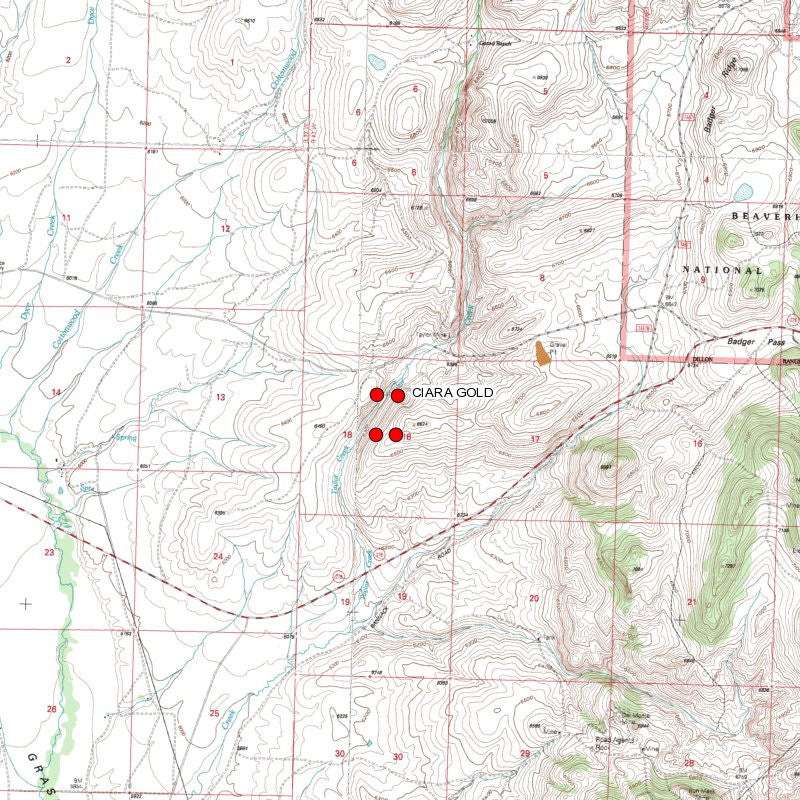
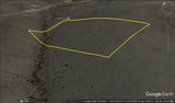
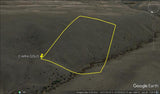
- Map of claim marked and GPS coordinates.
- Multiple maps showing claim location and surrounding areas for access.

Taylor creek resides in the Bannack mining district. It was the site of the first major gold discovery in the Montana Territory; it was the first territorial capital; it was the first county seat of Beaverhead County; it saw the first lode mining in Montana Territory and it was the location of the first successful dredging operation in the United States. Mining began in 1862 and continues sporadically on a minor scale today. The main periods of mining in the Bannack area were the early placer, hydraulic and lode activity (1862 to 1875) and the dredging of Grasshopper Creek (1895 to 1902).
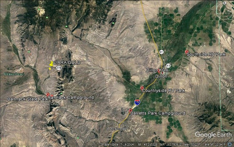
There is lodging and camping facilities approximately 14-20 miles away

This claim is located near the famous Bon Accord Placer mine as seen in the above map. The site area of the Bon Accord placers, about a half mile stretch of disturbed gravels, was first worked during the initial Bannack gold rush by placer miners who staked claims on the placer grounds along Grasshopper Creek from the town of Bannack down through the canyon to the mouth of Spring Gulch. The early miners, however, lacked the equipment and capital needed to work the 35-foot gravels down to bedrock and, following the initial rush, little further mining occurred in the area for the next two decades (Sassman 1941; Wolle 1963).

The first large-scale mining of the Bon Accord placers began in 1885 when the Bon Accord Mining Company was organized to work the placer gravels down to bedrock by hydraulic means. A patent for the Bon Accord Placer claim was granted to Thomas Lancey and others on September 4, 1888 (Mineral Survey #708; Pat. #14270). The Canyon Ditch, which tapped the waters of Grasshopper Creek, was built at a cost of $7000 to provide water to the diggings. The company also built 500 feet of flume and tunneled the ground 35 feet below the surface to bedrock during the winter months. A Leffel waterwheel was used to drive the pumps which were used to keep the tunnels dry but it remained difficult and dangerous work.


Under the Montana Stream Access Law, the public may use rivers and streams for recreational purposes up to the ordinary high-water mark. Although the law gives recreationists the right to use rivers and streams for water-related recreation, it does not allow them to enter posted lands bordering those streams or to cross private lands to gain access to streams.
House Bill 190, passed during the 2009 Legislative Session, confirmed that the public has access to surface waters by public bridge or county road right-of-way. The Department, in cooperation with the affected landowner and county, is responsible for providing public passage around or through a fence preventing such access. A typical access feature would be a stile, gate, roller, walkover, or wooden rail fence. ( http://fwp.mt.gov/fishing/guide/access/streamAccess.html )
A recreational miner with a pick, shovel or gold pan does not need a special permit on BLM land in Montana. A person using a suction dredge in Montana should get a permit from the Water Protection Bureau, Department of Environmental Quality, 1520 East Sixth Ave. PO Box 200901, Helena, Montana 59620-0901, phone 406 444-3080. If the suction dredge intake is less than 4 inches in diameter, a general permit is required. If the dredge intake is larger than 4 inches, a more complicated permit is required for which there is a significant charge. The Montana Department of Natural Resources and Conservation and the US Army Corps of Engineers may also require permits for suction dredging.” http://nandugreen.typepad.com/chasing_the_wind/2009/08/recreational-gold-prospecting-on-public-land.html

ABOUT THE MINING DISTRICT
|
Bannack's placer mining period was brief, violent, rich in gold and the source of an equally rich lode of historical legends. More than a ton of gold was taken from the Grasshopper diggings during the first season. Not only were the placer bars easily worked and incredibly rich, they produced some of the purest gold found anywhere in the world. On the average, Bannack gold assayed at 990 fine (99% pure) and in a few cases it went as high as 999 fine - essentially a chemically pure state (Cushman 1973). Bannack's place in the history of gold mining is secure as it is ranked as one of Montana's most colorful and productive historic gold mining camps. Although records as to total production figures are either non-existent or unreliable, it has been estimated that the Bannack mining district has produced approximately $12,000,000 in gold from 1862 until 1930 (with gold priced at $20.67 per ounce). The placer operations alone during the period from 1862 to 1876 produced an estimated $3,000,000 worth of extraordinarily pure gold (Shenon 1931; Sassman 1941). The geology of the Bannack district is described by Winchell (1914) as consisting of Paleozoic limestone intruded by a small stock of granodiorite. Immediately above this limestone layer are a few remnants of the Quadrant quartzite. The principal granodiorite intrusion is nearly circular and is on the south side of Grasshopper Creek south of the town of Bannack. A minor granodiorite intrusion is found on the north side of the creek just west of Bannack. Tertiary deposits, west of Bannack, extend over the surface for a number of miles both to the north and south. The ores found in the Bannack mining district are usually found in contact deposits but some minor ore bodies are in fissures. The ores have been valuable almost solely for their gold content, but they also contain some silver, lead and copper. The ore bodies are generally found along the contact between limestone and granodiorite, or in stringers or small fissures. Large amounts of garnet, with some epidote, are also found along the contact. From the late 1860's to the 1930's, Bannack continued as a mining town with a fluctuating population. By the 1950's gold workings had dwindled and most folks had moved on. At that point the State of Montana declared Bannack a State Park. Today, over sixty structures remain standing, most of which can be explored. People from all over visit this renowned ghost town to discover their heritage. The Montana Department of Fish, Wildlife, and Parks governs the townsite and surrounding area of Bannack.
|


LEGAL NOTES
We offer a lifetime guarantee should the BLM take back the land.
As the largest company in the mining industry selling legitimate and valuable historic claims, you can rest assured that you are not only covered with our 100% lifetime money-back guarantee, but you can also rest easy that there is no fine print on any of our claim listings telling you will have to deal with any games like being charged phony fees or having to pay inflated “processing” or “transfer” fees. The final price for this mine is ALL you will pay.
Our in-house legal counsel will complete all of the paperwork and documentation for recording and transferring FULL ownership of this mine into your name if you win the auction, AND we will ship you everything in one to two business days of receipt of your payment in full (usually just one day!). So you can plan to visit (and start working) your claim the next day without the lengthy delay you will experience with other companies selling claims –and you will not have to pay any extra costs, fees or other poor excuses for extra profit that normally just go into a seller’s pocket.
-PLUS-
We'll take care of all the paperwork and arrangements so you can enjoy your claim immediately after payment and we keep you informed through the entire process with confirmations when payment is received, when your paperwork has been shipped.

While we cannot physically ship land to you as it doesn't quite fit into the mail box ;)
We will ship all paperwork/maps upon payment clearing we ship same business day (if payment is received by 1PM P.S.T.) We always provide tracking information so you are always informed.
