


Description
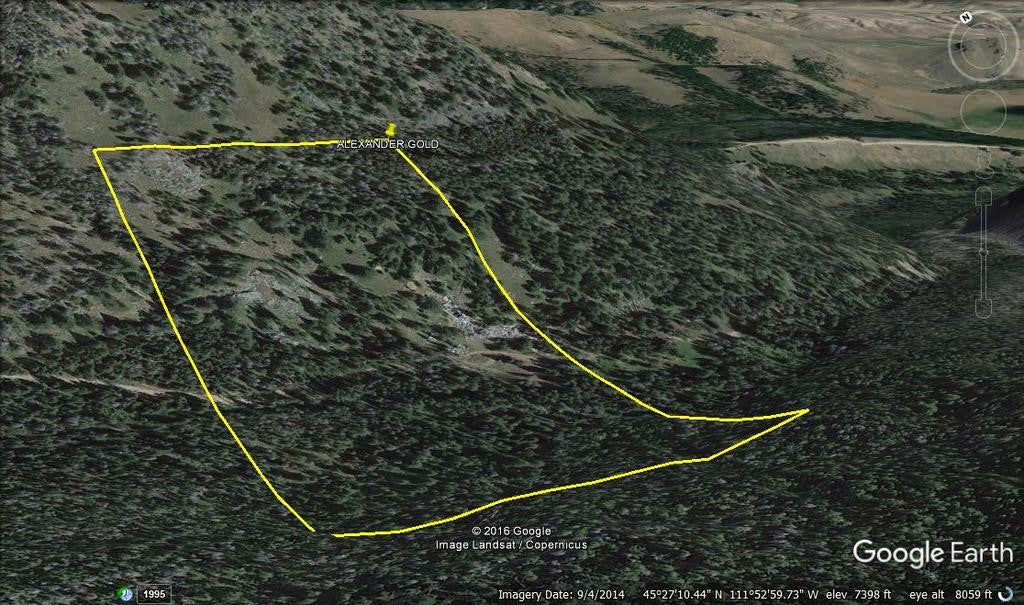
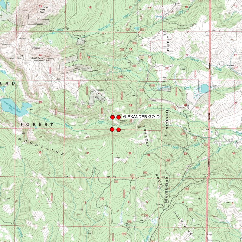
ALEXANDER GOLD
MMC233844

20 Acre Unpatented Placer Mining Claim on Federal Land Montana

South Meadow Creek is a stream in Madison County, MT with an elevation of 4,826 feet, or 1,471 meters above sea level. This place is also known as South Fork, Meadow Creek aka McAllister aka Bald Mountain (sub-district).
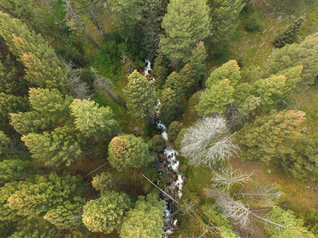
This placer gold Mine totals over 846 feet of creek. With this claim you will be getting the exclusive mineral rights to 20 acres on an excellent spot on the creek for you to work at your leisure.
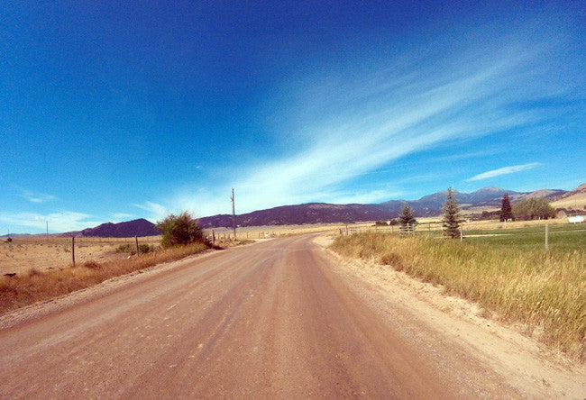
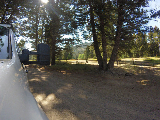
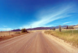
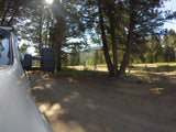
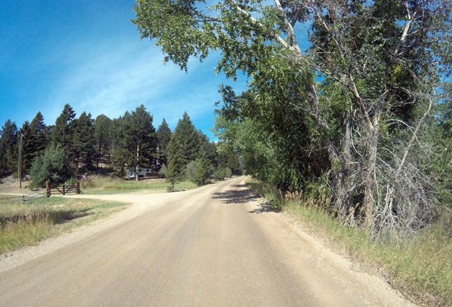
The access to the claim is fairly easy and 2WD will be sufficient to get you to the mine. The main road is located about 400-500 feet away from the claim. There is a dirt road/trail that comes off the main road, and leads you into the claim. There is room to park your vehicles, camp, and stage equipment. Due to the location of the claim, always check the road conditions and weather before heading out to the mine.
Commodities (Major) - Gold Deposit
Type: Placer
The Washington mining district is in the Tobacco Root Mountains and includes the head-waters of Washington, South Meadow and Leonard Creeks. The placers of Washington Bar, a gravel deposit at the mouth of Washington Creek, were discovered in 1864. Placering occurred on Washington Creek and Hogum Gulch, both later worked by hydraulic methods. By 1888 the two creeks had produced half a million dollars in gold from these placer operations. Around 1888, the immense gravel banks were in the hands of the Montana Hydraulic Mining Company which held patents on seven miles of gulches, some 4,500 acres. The gravel assayed at 50 cents per cubic yard and it was estimated that 50 million dollars of gold remained to be recovered. The company constructed a four foot flume and a 30 inch flume to provide water for three hydraulic giants (Cope 1888).
RECREATIONAL:
For Fishing License purchase, fishing rules, and fishing regulations please visit Montana Fish & Wildlife. Please remember to check with the local Fish and Wildlife department to ensure the stream is open to the public.

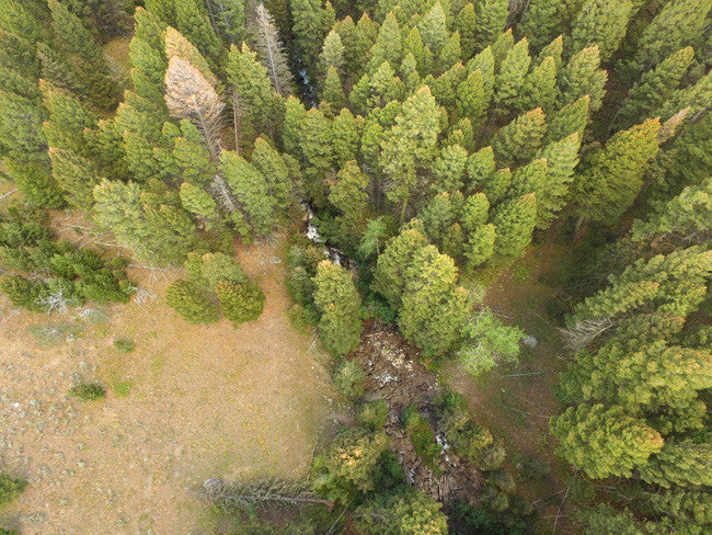
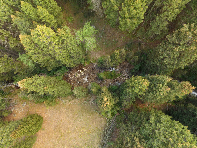
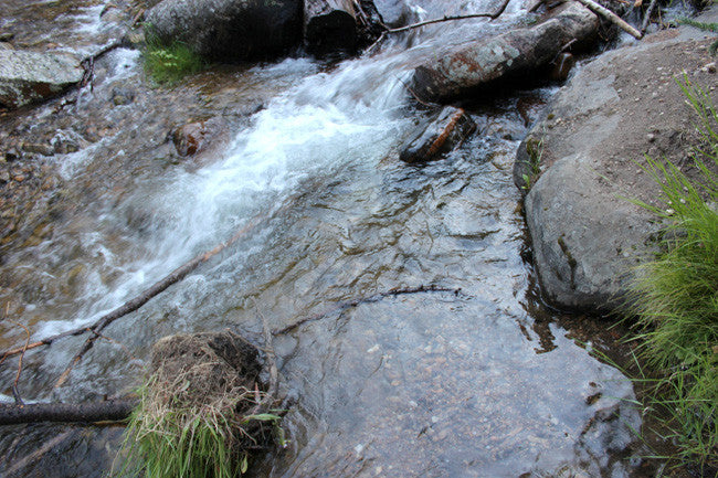
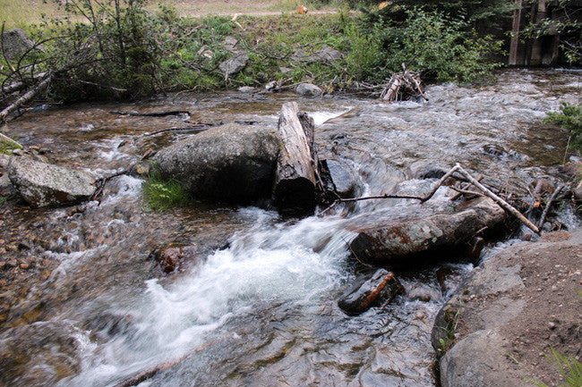
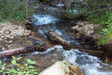
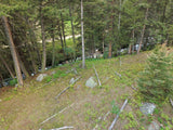
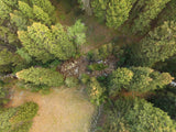
(over view of creek, and surrounding area)

Buyer will receive the following with their completed transaction:
- Quitclaim deed showing full ownership of the claim. This will be stamped, recorded and verified with the County and the BLM offices.
- Welcome packet with all of the rules and regulations as they relate to the State and BLM where the claim is located.
- Educational documents to annually renew your mining claim with the BLM.
- A CD of all of the documented images of the claim including maps of the site.
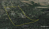
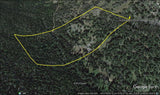
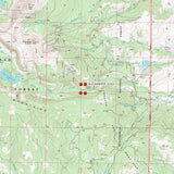
- Map of claim marked and GPS coordinates.
- Multiple maps showing claim location and surrounding areas for access.

(Fairly easy, 2WD to claim)
South Meadow Creek, like its northern counterpart, begins in the southern portion of the Tobacco Root Mountains. Located in the upper portion of this drainage is South Meadow Lake. This naturally occurring lake has now been modified to increase its water storage capacity. Like North Meadow Creek, this stream also originates in thick timber stands, and makes its way down into the valley. Once in the valley, it flows through lush hay meadows and pastureland before reaching its confluence with North Meadow Creek, just west of Ennis Lake.

There is lodging and camping facilities nearby)
The gold production of Madison County is exceeded in Montana only by that of Silver Bow and Lewis and Clark Counties. Most of its gold was produced before 1904 from the placer deposits of Alder Gulch, by far the richest placers in the State (Lyden, 1948, p. 80-95). After 1904, lodes became increasingly important gold sources.
Most of the gold lodes and other auriferous deposits are near the contacts of Precambrian metamorphic and Paleozoic sedimentary rocks with the Tobacco Root batholith and other smaller intrusives and satellite stocks that are probably related to the Boulder batholith (Hart, in Tansley and others, 1933, p. 23-55). Some deposits are in the igneous rocks.
The more productive lode areas are the Norris, Pony, Renova, Sheridan, Silver Star-Rochester, Tidal Wave, and Virginia City districts.
The total gold production of the county through 1959 was at least 3,746,000 ounces - 2,605,000 from placers and 1,141,000 from lodes. This must be considered a conservative figure, for as Lyden noted (1948, p. 80), estimates of the Alder Gulch placer production ranged from $50,612,000 to $125 million.

A recreational miner with a pick, shovel or gold pan does not need a special permit on BLM land in Montana. A person using a suction dredge in Montana should get a permit from the Water Protection Bureau, Department of Environmental Quality, 1520 East Sixth Ave. PO Box 200901, Helena, Montana 59620-0901, phone 406 444-3080. If the suction dredge intake is less than 4 inches in diameter, a general permit is required. If the dredge intake is larger than 4 inches, a more complicated permit is required for which there is a significant charge. The Montana Department of Natural Resources and Conservation and the US Army Corps of Engineers may also require permits for suction dredging.” http://nandugreen.typepad.com/chasing_the_wind/2009/08/recreational-gold-prospecting-on-public-land.html
Discharges Associated with Portable Suction Dredges
The purpose of the Portable Suction Dredge General Permit (General Permit) is to regulate wash water effluent from portable suction dredges, to state waters in accordance with effluent limitations, monitoring requirements and other conditions set forth in Parts I, II, III and IV of the General Permit. A written authorization letter from the Department is required before an applicant is authorized to discharge under the General Permit. http://deq.mt.gov/Water/WPB/mpdes/suctiondredge

ABOUT THE MINING DISTRICT
Upper North Meadow Creek--the northern part of this area is underlain by granite and the southern by Cherry Creek gneisses and schists, cut by a dike-like intrusion of hypersthene gabbro. Most of the ore deposits occur as veins in the gneiss, but those of the Frisbie mine are mostly in the gabbro near the gneiss. A few silver veins are known to cut the granite.
Lower Meadow Creek--the country rock is granite and gneiss. Ore deposits occur as low grade gold-quartz stringer veins in the altered contact gneiss zone. The ores are oxidized.
Upper South Meadow Creek--the ore shoots generally occur in synclines resulting from minor folding.
Alder gulch, just over the hill to the west of Meadow Creek fueled Montana’s most exciting placer gold rush, and the Revenue hill, with its rich gold mines bordering the Meadow Creek area to the north, were attractive destinations for migrating land and gold seekers. Meadow Creek, situated in between those two industrious areas, did not go unnoticed by the ambitious settlers.

One was a man named Tecumseh Smith, nicknamed 'Pony' because of his small stature.
Gold mining in Pony between 1870-1880 was profitable. Five million dollars in ore was taken out. An eastern syndicate believing a large deposit of ore was high grade, built a 100-stamp processing mill. The ore body turned out to be low grade and consequently the massive mill never turned a wheel. The historic 'brick office', assay office, is still standing and part of the town's character. The Tobacco Root Mountains and surrounding areas are familiar grounds for the elk, moose, deer, antelope, bear and mountain lion. And the bird hunting is great too: duck, geese, quail, turkey, pheasant, and more.


LEGAL NOTES
We offer a lifetime guarantee should the BLM take back the land.
As the largest company in the mining industry selling legitimate and valuable historic claims, you can rest assured that you are not only covered with our 100% lifetime money-back guarantee, but you can also rest easy that there is no fine print on any of our claim listings telling you will have to deal with any games like being charged phony fees or having to pay inflated “processing” or “transfer” fees. The final price for this mine is ALL you will pay.
Our in-house legal counsel will complete all of the paperwork and documentation for recording and transferring FULL ownership of this mine into your name if you win the auction, AND we will ship you everything in one to two business days of receipt of your payment in full (usually just one day!). So you can plan to visit (and start working) your claim the next day without the lengthy delay you will experience with other companies selling claims –and you will not have to pay any extra costs, fees or other poor excuses for extra profit that normally just go into a seller’s pocket.
-PLUS-
We'll take care of all the paperwork and arrangements so you can enjoy your claim immediately after payment and we keep you informed through the entire process with confirmations when payment is received, when your paperwork has been shipped.

While we cannot physically ship land to you as it doesn't quite fit into the mail box ;)
We will ship all paperwork/maps upon payment clearing we ship same business day (if payment is received by 1PM P.S.T.) We always provide tracking information so you are always informed.
