


Description
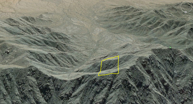
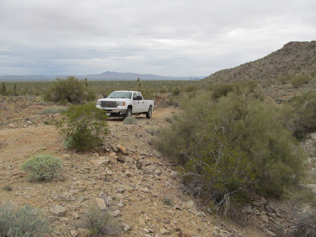
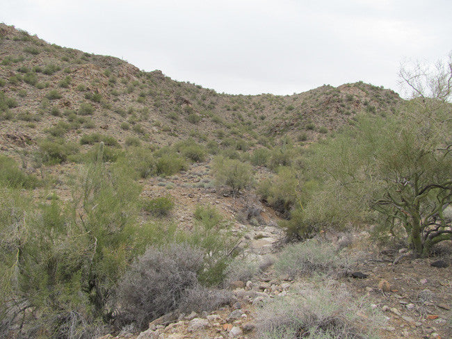
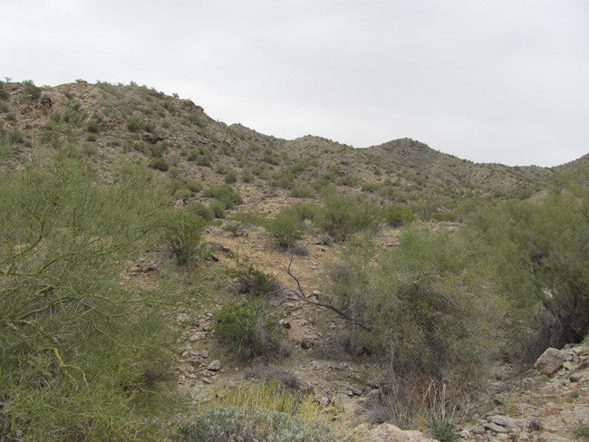
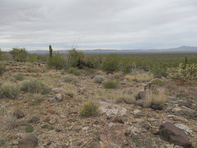
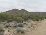
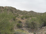
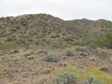
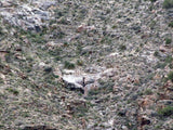
The Yellow River Placer Mining Claim is one of those rare hidden gems that you don’t find all that often (but can spend a lifetime looking for). About a 35 minute drive north of Wenden AZ, this area is well known for producing gold, but historically it is a hard-rock mining area that produces free milling gold. Nestled in a hidden valley that is surrounded on three sides by majestic hills, there are numerous gold mines up in the hills, all of which are claimed, but no one has spent much time in the valley itself.
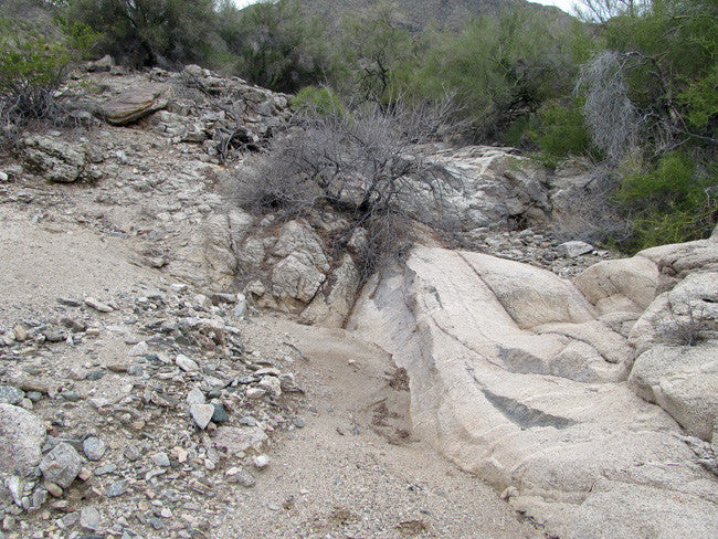
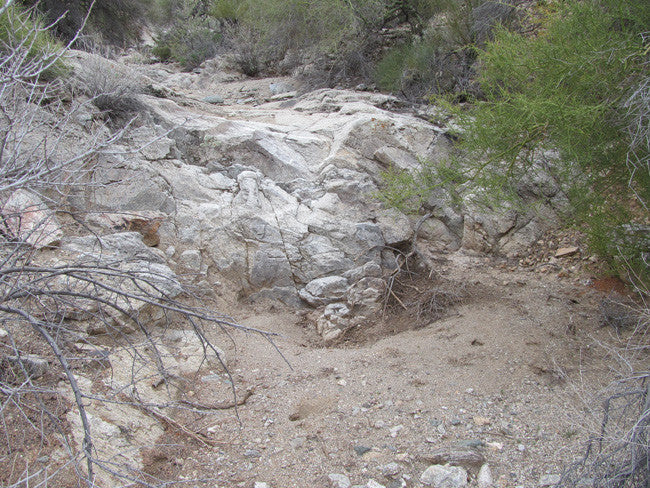
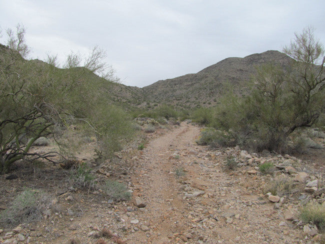
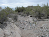
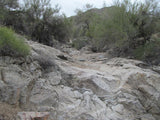
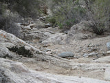
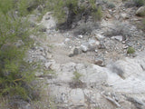
Normally we work with lode claims ourselves, as it is often better to go to the source when mining. However, given the topography here and the nature of the annual floods every monsoon season, this particular claim is perfectly situated to be a repository for all of the gold that washes down from the mines at the top of the hills. When it rains here, this wash turns into a torrent of water - and I mean a lot of water comes down.
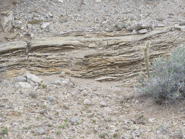
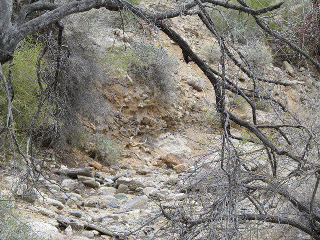
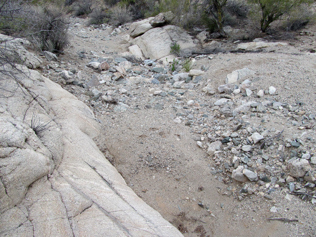
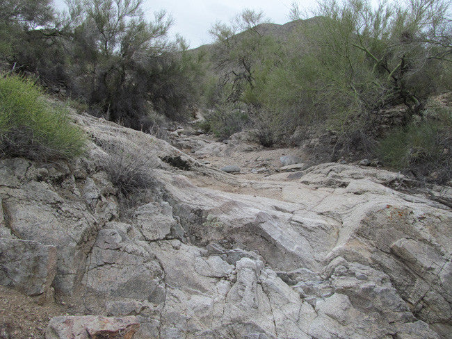
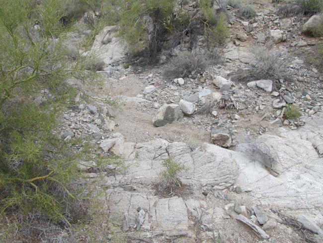
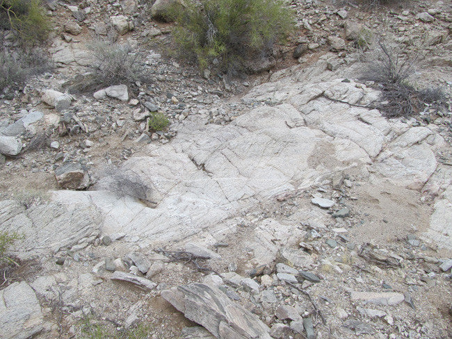
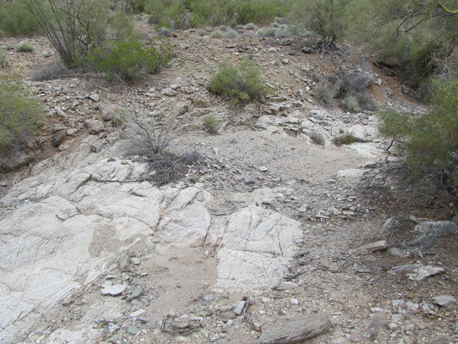
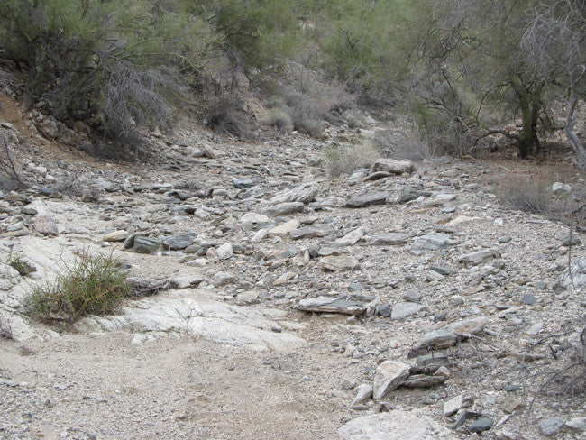
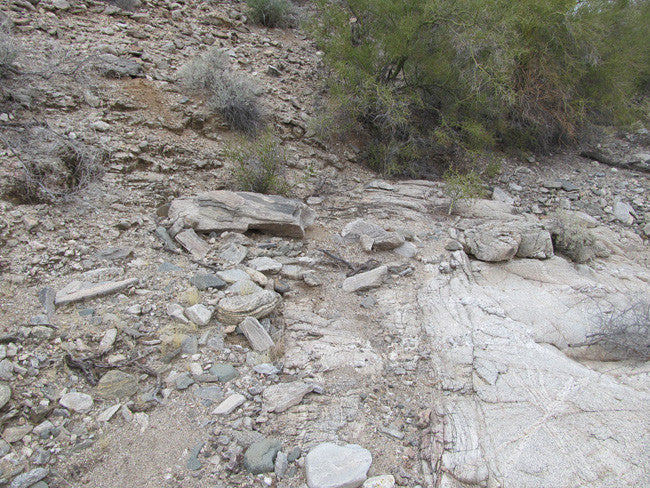
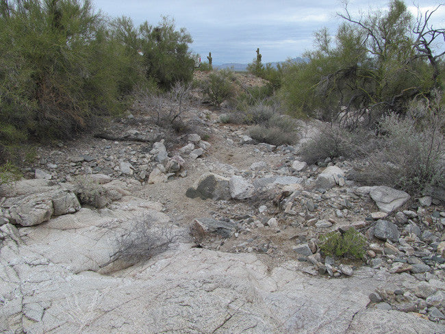
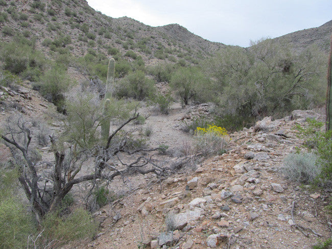
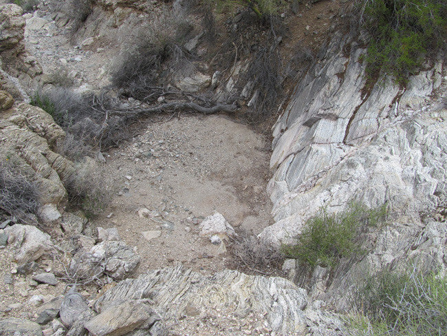
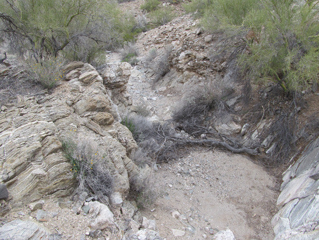
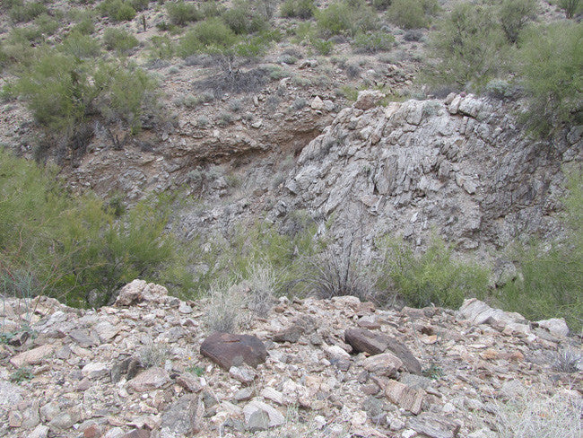
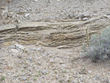
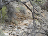
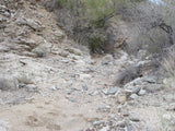
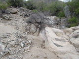
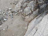
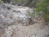
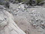
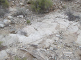
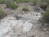
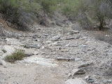
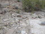
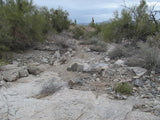
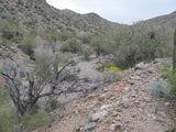
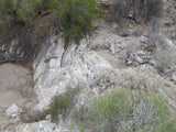
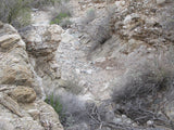
Over thousands of years, the water has carved this wash as deep as 30 feet into the surrounding terrain and 50 feet across - and because of the natural terrain conditions, you have more than a dozen waterfalls and plunge pools as well as all kinds of benches and gravel bars on this 20 acre claim. Like the riffles in a sluice box, the natural rock obstructions make them perfect for trapping gold when the water is running. Because gold is heavier than gravel, sand and rocks, it will naturally settle to the bottom when it encounters an obstruction and can no longer travel downstream. Less than a ½ mile from the base of the hills, you’re getting to the gold BEFORE it travels further down the wash onto someone else’s claim.
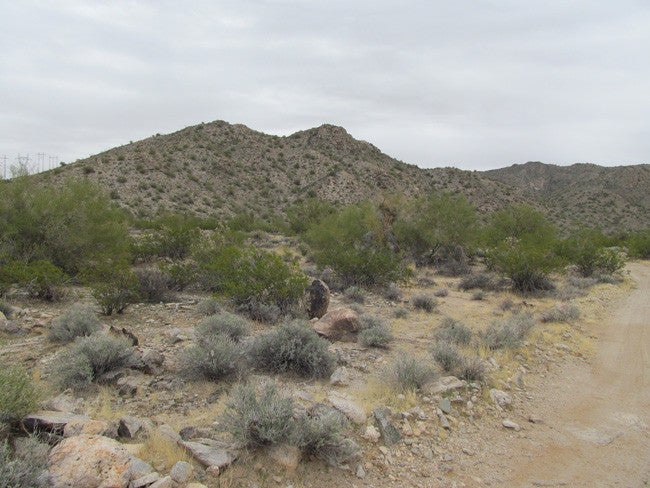
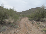
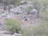
With relatively easy 2-wheel drive access on the old power line dirt road, you can park within 20 to 75 feet of the dry wash year round and walk your equipment in for ease of working this material. Ideally you’d want to process material onsite by bringing a recirculating sluice box and a water supply (10 gallons out to do it) right to the claim. Or, you could dry wash onsite or even bring home a few hundred pounds of material each time you visit and pan it out in the comfort of your backyard. A spiral wheel would work great for running your fines after classifying if you’re not big on panning, and you have enough material on this claim to keep you busy for literally a decade or more.
Work this claim in absolute peace and seclusion, as you will likely never see another person - yet you’re close enough to drive to a motel if you don’t want to camp. And if camping is your thing, there is plenty of flat ground/room to bring in a small to medium sized travel trailer and live where you work.
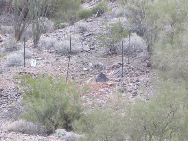
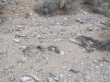
We’ve owned this claim for a little over a year, so rest assured that it has been fully vetted with the BLM. There is no record of a previous claim ever and no evidence that this wash has ever been worked - so this is the only promising virgin ground around for miles and miles. After extensive XRF sampling and running a few pans myself, I believe that you will be pleasantly surprised with what you find here. We’re so confident of this that we pulled a 6-gallon bucket of material out of one of the plunge pools that you can try working in the comfort of your backyard before you make a decision to purchase this claim. I documented the entire collection process for you on video so you can see that there was no games here - and the material you get will be security taped like you see on the video, so you are assured of getting what you see me pull out of the ground on the video.
(The test ore bucket is available for purchase)
ABOUT THE MINING DISTRICT
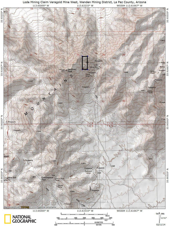
The Cunningham Pass Mining District is an active Cu-Au-Ag-Fe-Ba-Pb-U mining area in T6-7N, R12-13W, in the central Harcuvar Mountains in the vicinity of Cunningham Pass.
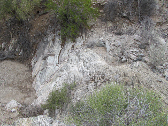
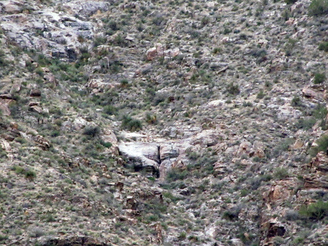
Mineralization is spotty, but often high grade, pockets and streaks of copper-gold-silver ores with quartz, iron oxides, siderite, calcite and barite in strong lensing, intersecting fissure veins and along contacts or in cross-cutting aplite, pegmatite, diabase, and granite porphyry dikes. Strong oxidation and secondary enrichment occur near the surface. Wall rocks are Precambrian metamorphics intruded by dikes and probably underlain by Laramide intrusive. Probable strong, wide fault zone strikes NW through Cunningham Pass. Workings include numerous scattered shafts, tunnels and open cuts. This district was opened in the early 1900's by companies and lessees. Total estimated and recorded production would be some 9,000 or more tons of ore containing about 773 tons of Cu, 4,436 oz. Au, 2,344 oz. Ag and some lead.
Geography
The Harcuvar Mountains/Cunningham Pass Mining District, which is about 40-50 mi west of Wickenburg and 8 miles north of Wenden, is about 12 mi long and from 3 to 5 mi wide. The District contains to the northeastern half of the mountain range, centered on the Cunningham Pass. Topography of this part of the range is characterized by a single, fairly level main ridge having a locally wide crest. Lower flanks of this main ridge are steeper and more rugged, particularly on the southeast flank, and contain canyons and spurs.
Smith Peak, the highest point in the range is 5,242 ft in elevation; elevations in the District range from 4,957 ft in the northeast to slightly higher than 2,400 ft in the southwest, near Cunningham Pass.
The District comprises an area of rugged mountains rising abruptly from the desert floor characteristic of Sonoran Desert basin/range topography. The rocky canyons, sculpted ridgelines, and challenging desert peaks offer an outstanding setting for primitive forms of recreation. The northern ridgeline of the Harcuvar Mountains is isolated and rarely visited, greatly enhancing opportunities for solitude. The high-ridgeline features a unique 3,500 acre island of chaparral habitat. Human-made developments include evidence of vehicle routes, mining and grazing activity. However, because these developments are widely dispersed and largely unnoticeable due to the topography, they do not detract from the area’s overall naturalness.
Vegetation is typical of the Sonoran Desert and is characterized by palo verde, saguaro and barrel cactus, ocotillo, and mesquite.
Climate
The region is characterized by low precipitation, high temperatures, and high evaporation. The only spring in the area is generally dry. The District is within the Tropical-Subtropical Desertland climatic zone (Brown 1994). Temperatures range from near 30 degrees F in the months of December/January to often exceeding 115 degrees F from July through August. Annual precipitation generally ranges from 4 inches in the lowlands to 12 inches in the uplands.
Geology
The Cunningham Pass mining district (Wilson and others, 1934; Keith, 1978) is centered about 3 mi west of the study area on a broad northwest-trending fault zone in Early Proterozoic crystalline rocks and Cretaceous granite (Keith, 1978, p. 29-33; Keith and others, 1983).
The geology of the western Harcuvar Mountains is dominated by crystalline rocks, including high-grade Proterozoic gneiss and schist, strongly deformed and metamorphosed metaplutonic rocks of Jurassic and/or Proterozoic age, and geometrically complex intrusions of variably deformed Cretaceous Tank Pass Granite.
Less abundant rock types include Paleozoic or Mesozoic quartzite and marble, Middle Tertiary mafic dikes and intrusions, and hydrothermal veins.
The structural-metamorphic history of the area is very complex, and most rock units have experienced multiple episodes of metamorphism and deformation. The area contains a number of previously unrecognized ductile and brittle-ductile shear zones with various geometries, ages, and kinematic histories.
Brief Mining History
Prospecting and mining in this district began in the middle 1880's when numerous shafts and open cuts were worked for copper, gold, and silver. Total estimated and recorded production from the Cunningham Pass district through 1974 is about 9,000 tons of ore containing 773 tons of copper, 4,436 oz gold, 2,344 oz silver, and minor amounts of lead (Keith, 1978, p. 32). At May 1988 market prices of $1.04/lb (pound) copper, $451.06/oz gold, and $6.54/oz silver (Engineering and Mining
Journal, 1988), these metals would have had a value of about $3.6 million.
Wildlife
Wildlife in the District is commonly associated with the Sonoran Desert Life Zone. Big game species include mule deer, javelina, bighorn sheep, and mountain lion. There are no federally listed threatened or endangered species known to occur within the District. The District contains suitable habitat for numerous smaller animals, as well as a wide variety of migratory birds. A partial list of XXXX includes: California leaf-nosed bat (Macrotus californicus), Southwestern cave myotis (Myotis velifer brevis), spotted bat (Euderma maculatum), Yavapai Arizona pocket mouse (Perognathus amplus amplus), chuckwalla (Sauromalus obesus), desert rosy boa (Lichanura trivirgata gracia), the Sonoran Desert tortoise (Gopherus agassizii), great horned owls (Bubo virginianus), and ringtailed cats (Bassariscus astutus)
