


Description
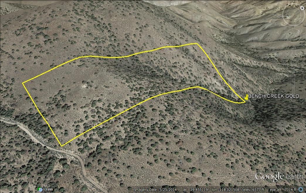
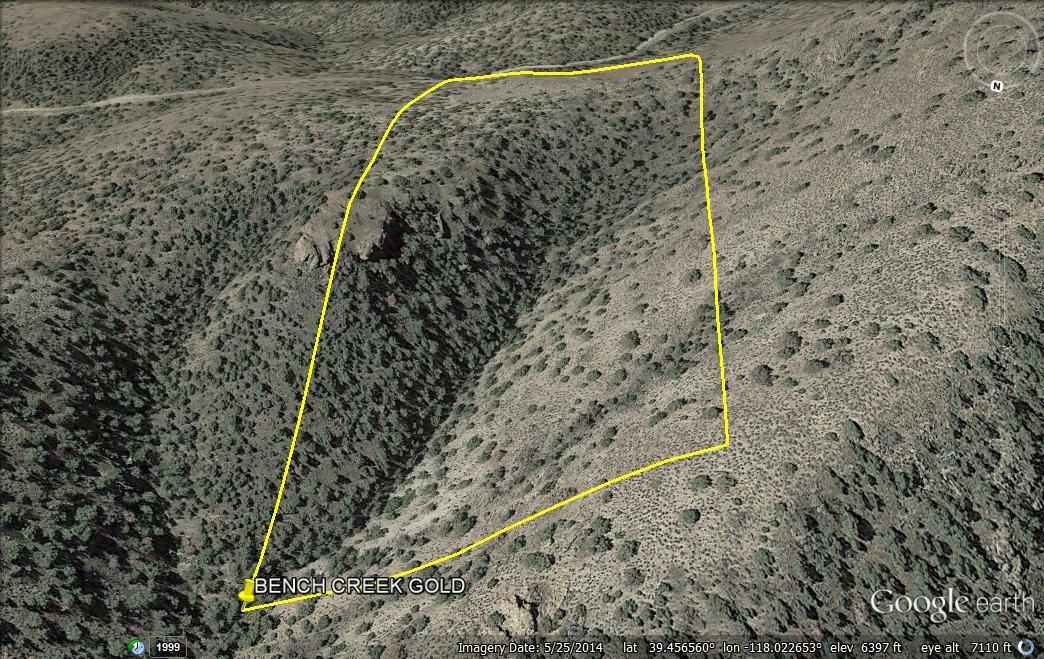
BENCH CREEK GOLD
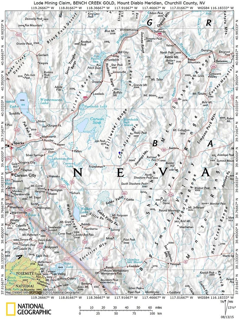
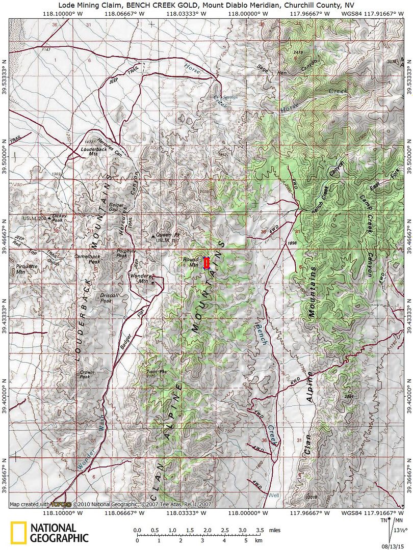
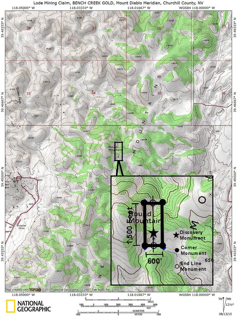
NMC111191120.66 Acre Unpatented Lode Mining Claim on Federal Land in the Historic Chalk Mountain Nevada Mining District / Churchill County Nevada
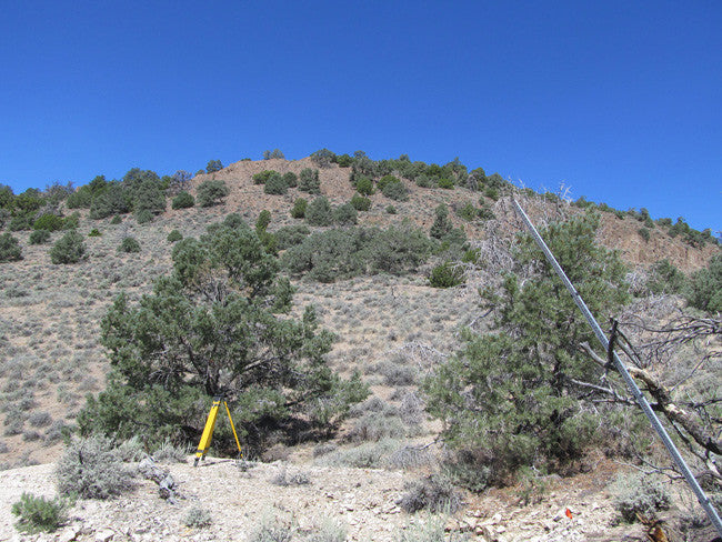
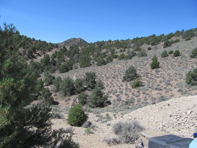
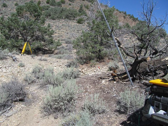
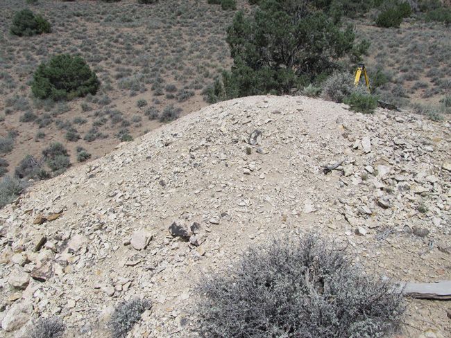
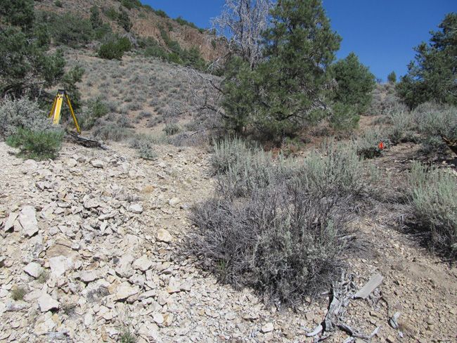
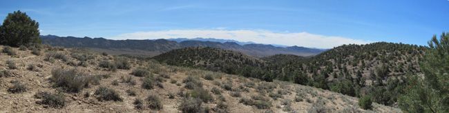
| The BENCH CREEK GOLD mine is tucked away in a hidden valley, secluded with a couple of peaks surrounding it.
|
|
|
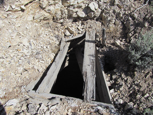
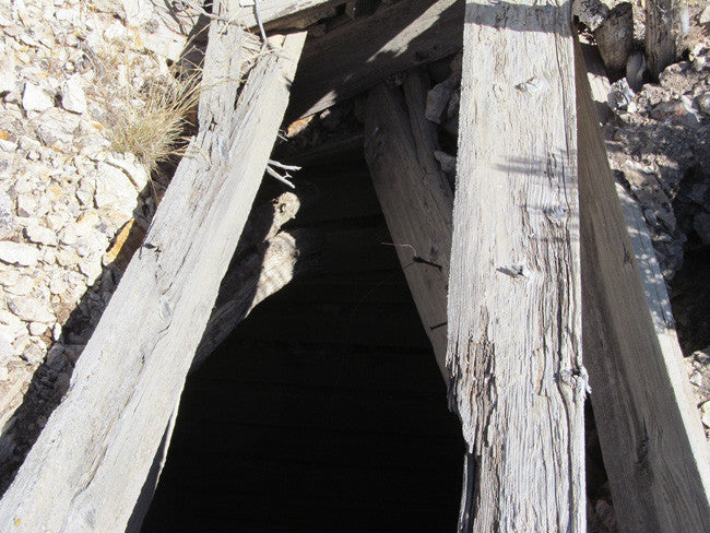
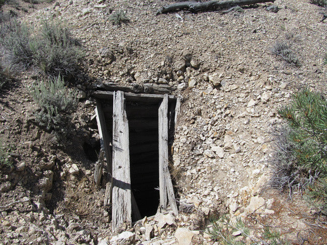
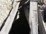
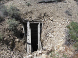
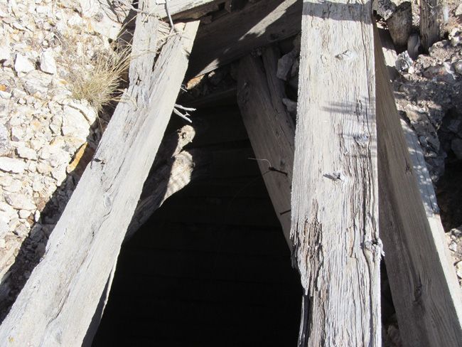
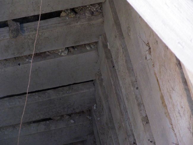
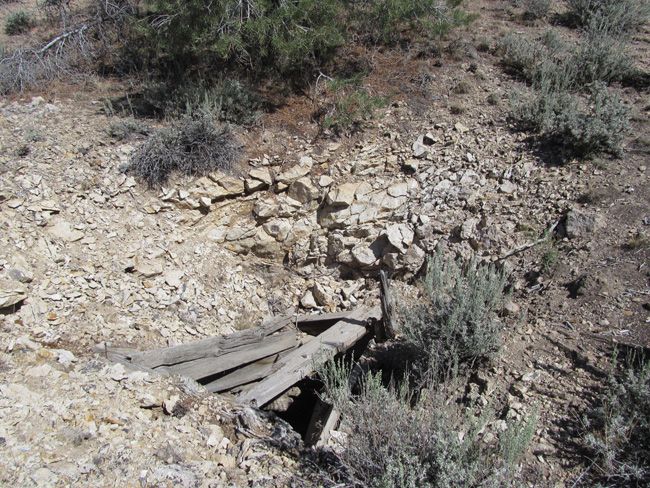
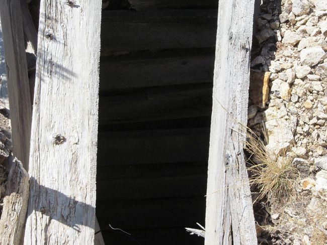
This is a very remote, and very promising mine shaft. The gold and silver readings are extremely good, and this mine is definitely well preserved. |
 |
|
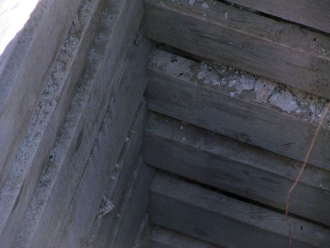
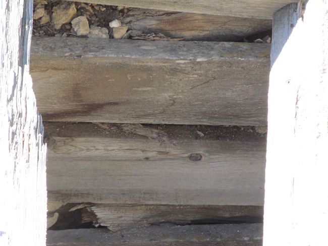
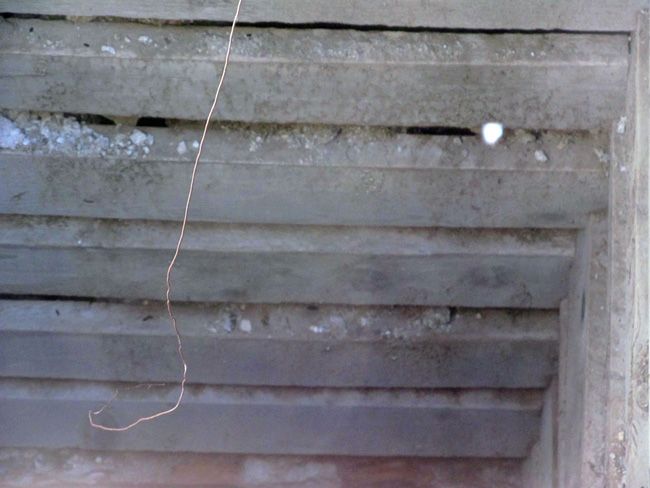
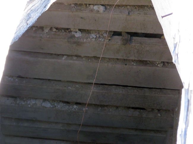
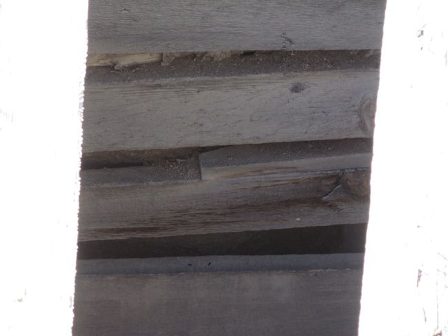
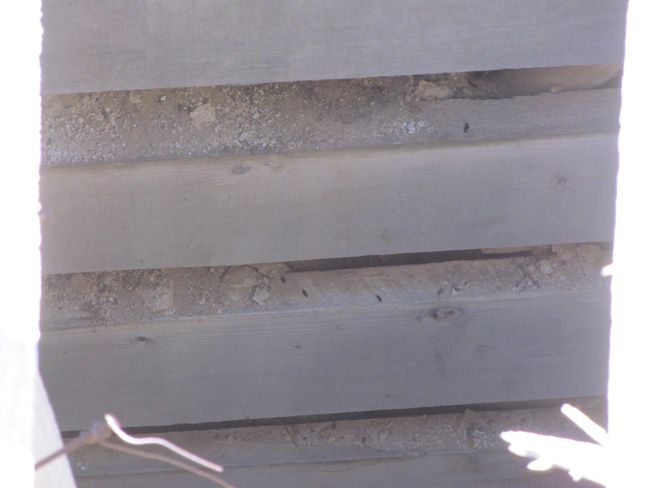
At 86 feet deep, the shaft is fully collared, and the wood is in great shape. There are a few pieces on the surface that might be a little worn, but it is solid all the way down. |
 |
(Scroll down to see all pictures)
As the largest company in the mining industry selling legitimate and valuable historic claims, you can rest assured that you are not only covered with our 100% lifetime money-back guarantee, but you can also rest easy that there is no fine print on any of our claim listings telling you will have to deal with any games like being charged phony fees or having to pay inflated “processing” or “transfer” fees. The final listing price for this mine is ALL you will pay.
Our in-house legal counsel will complete all of the paperwork and documentation for recording and transferring FULL ownership of this mine into your name if you purchase, AND we will overnight you everything in one to two business days of receipt of your payment in full (usually just one day!). So you can plan to visit (and start working) your claim the next day without the lengthy delay you will experience with other companies selling claims –and you will not have to pay any extra costs, fees or other poor excuses for extra profit that normally just go into a seller’s pocket.
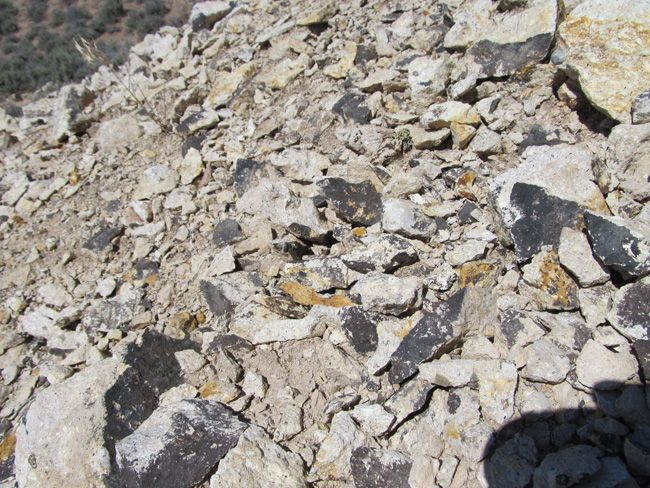
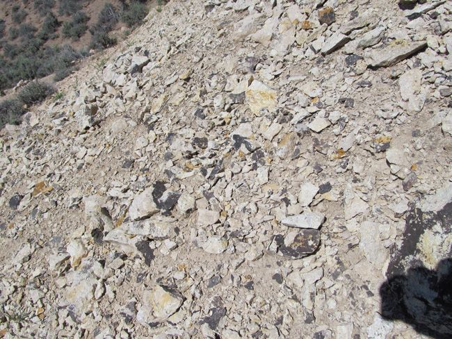
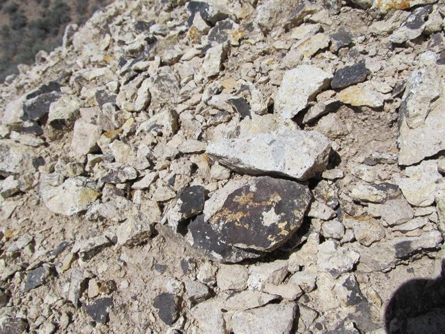
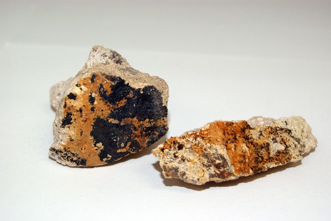
Nice tailings
(Scroll down to see all pictures)

Come to Hike, Camp, Ride and Shoot - or come to pull some shiny rock$ out of the ground;-)
Buyer will receive the following with their completed transaction:
- Quitclaim deed showing full ownership of the claim. This will be stamped, recorded and verified with the County and the BLM offices.
- Welcome packet with all of the rules and regulations as they relate to the State and BLM where the claim is located.
- Educational documents to annually renew your mining claim with the BLM.
- A CD of all of the documented images of the claim including maps of the site.
- Map of claim marked and GPS coordinates.
- Multiple maps showing claim location and surrounding areas for access.
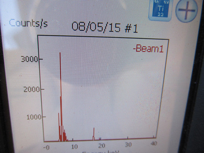
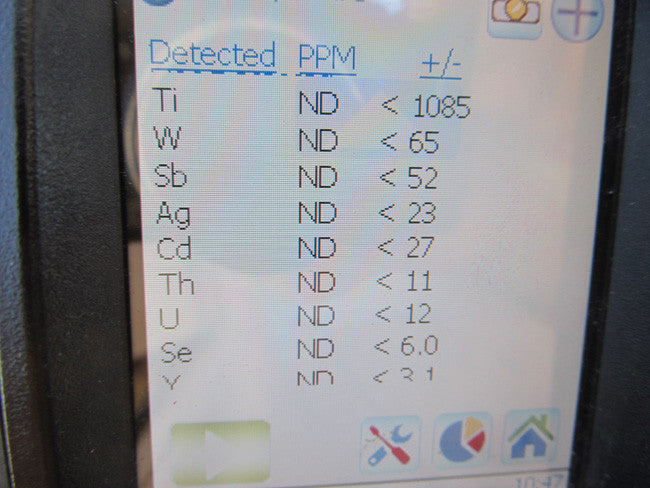
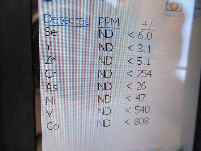
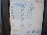
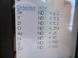
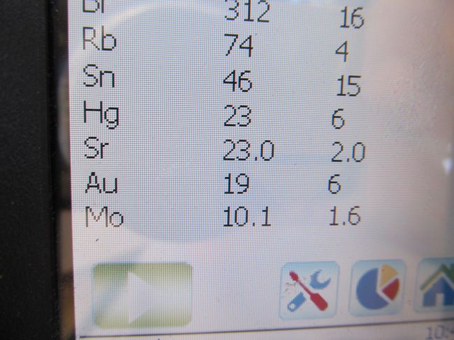
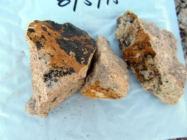
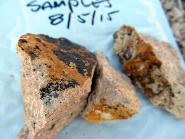
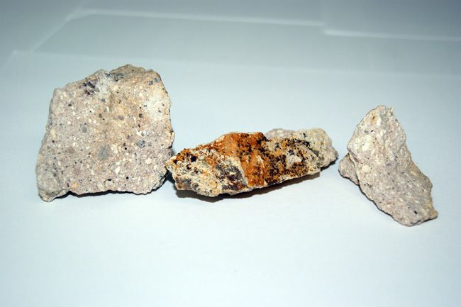
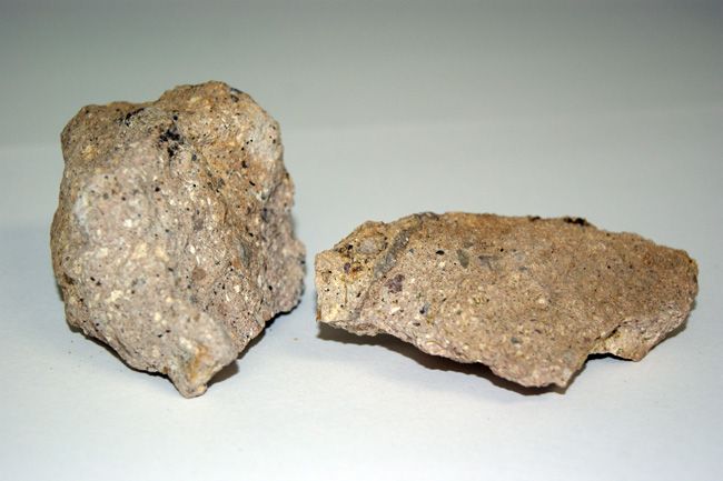
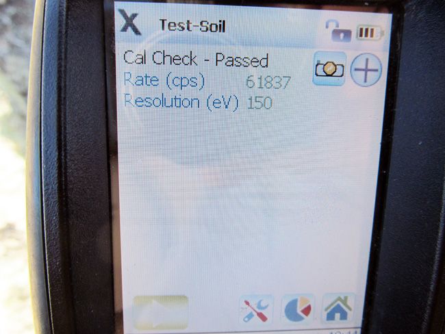
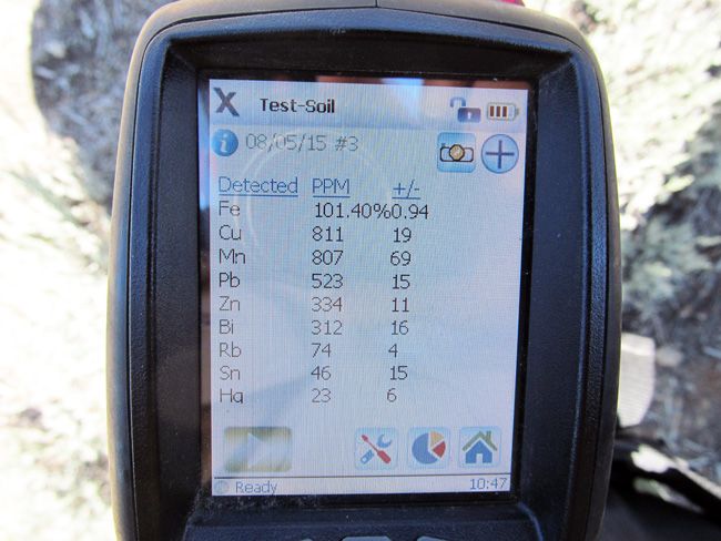
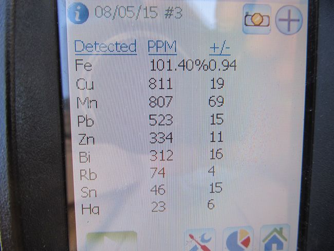
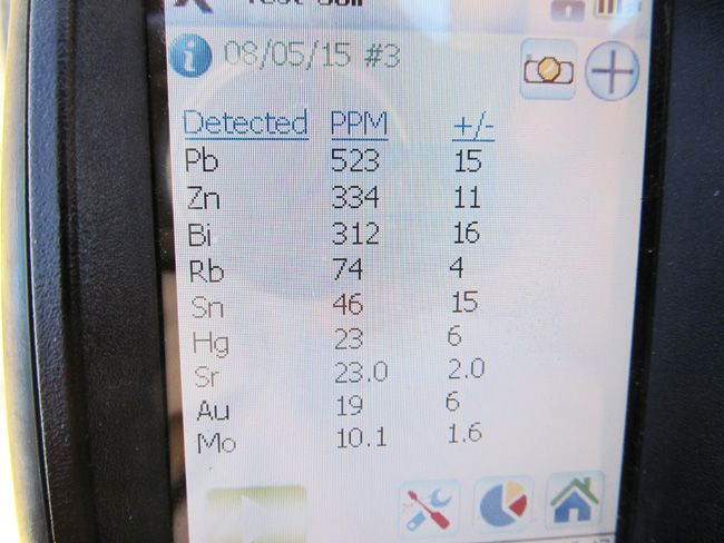
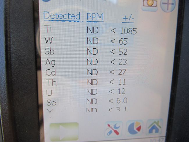
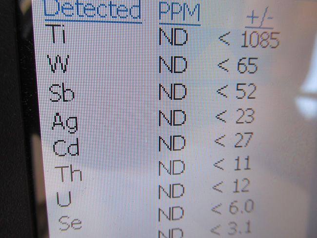
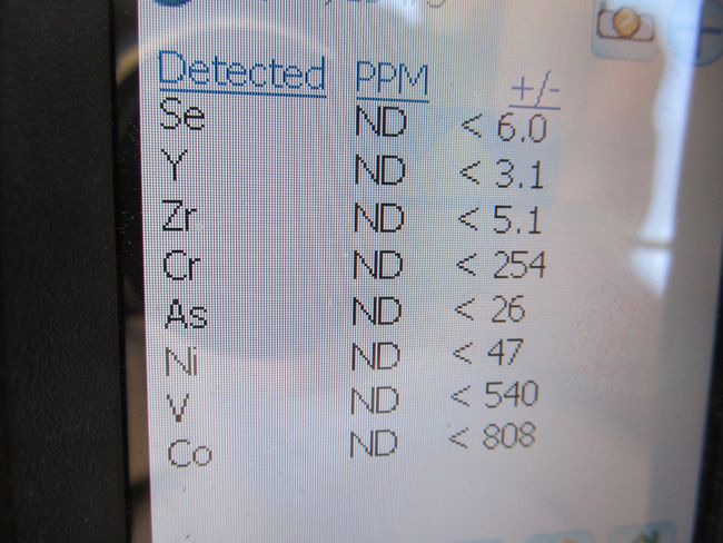
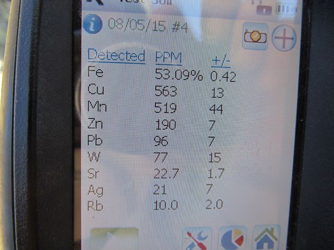
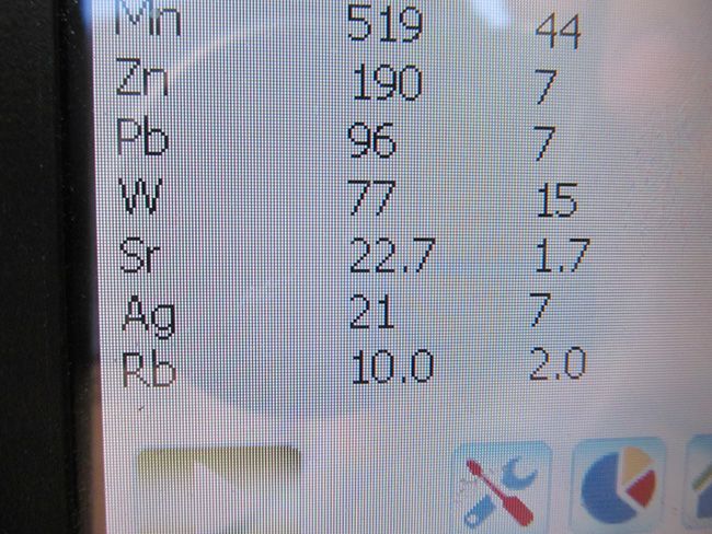
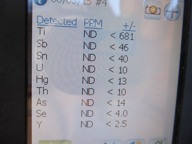
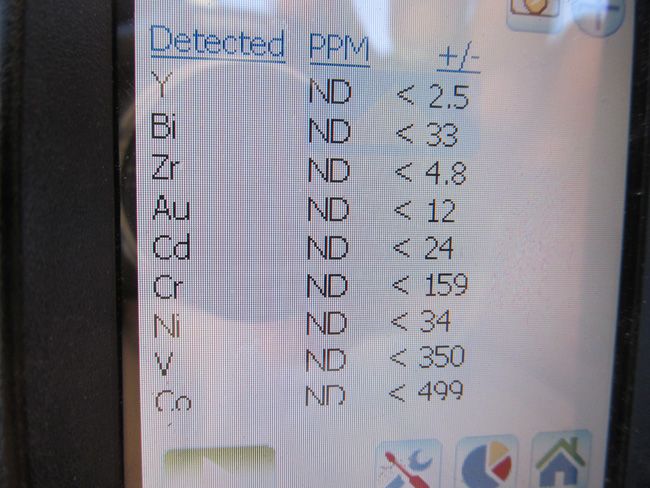
***Samples were pulled from our last visit. Below are the samples that you will receive along with everything else above. Also below are the samples and microscoped images :)
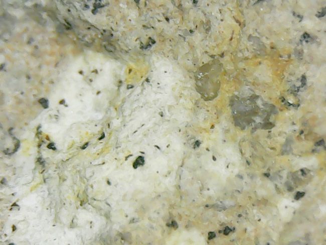
(Below are the microscoped pictures of samples)
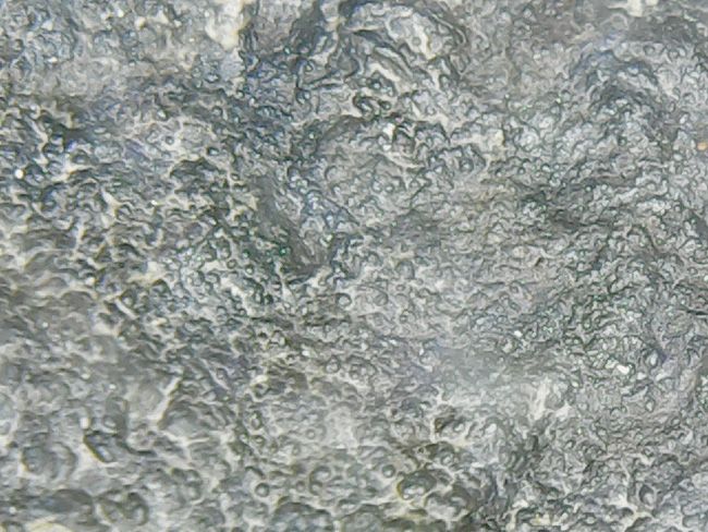
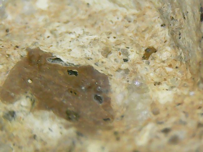
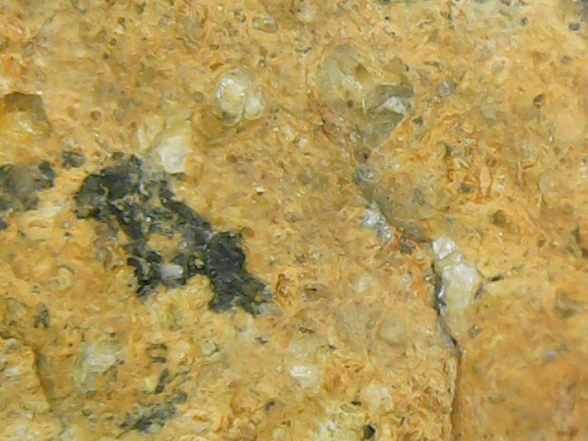
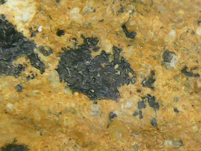
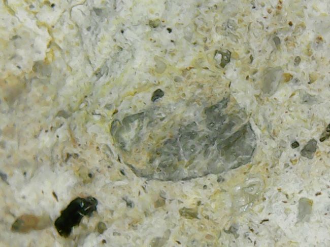
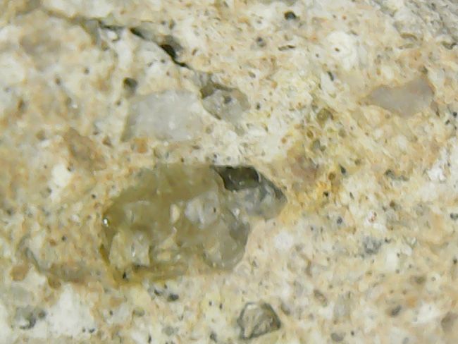
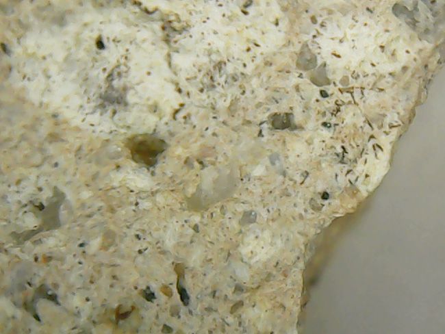
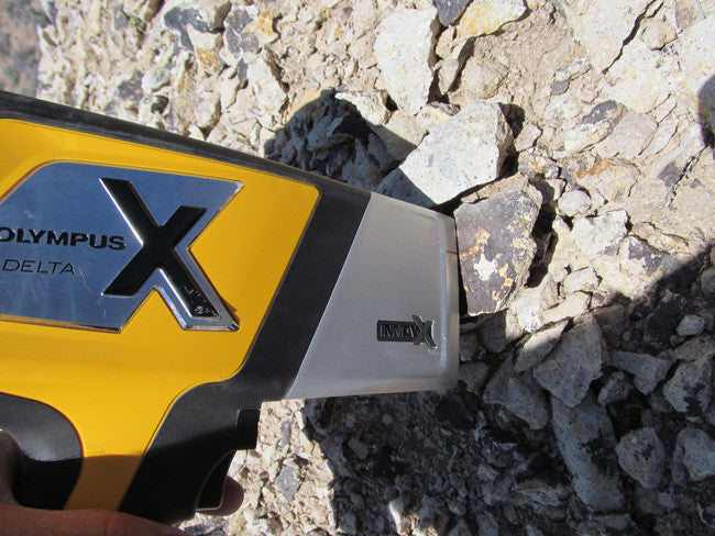
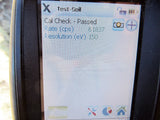
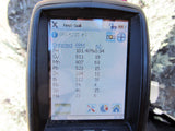
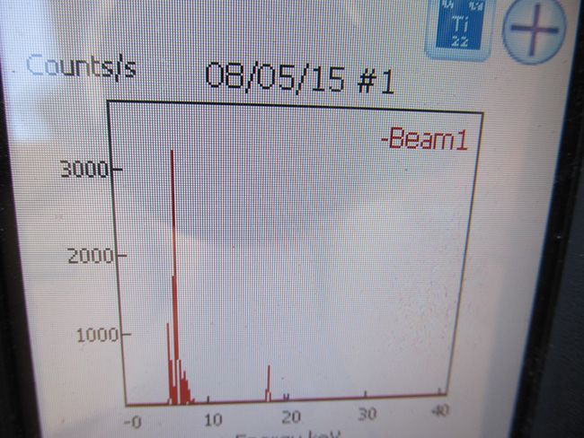
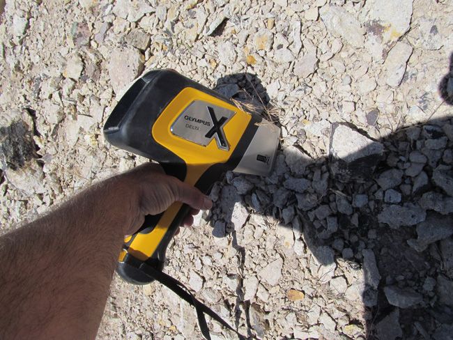
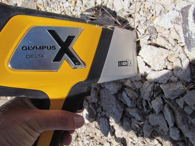
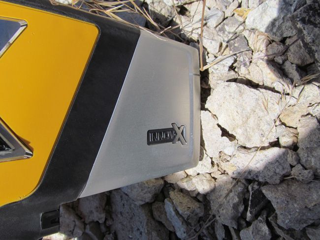
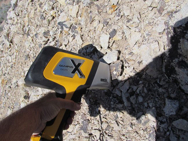
Portable X-Ray Fluorescence field units (also known as XRF guns) are commonly used by large commercial mining operations, well-equipped/funded private prospectors and even the Environmental Protection Agency (EPA) as well as many other government agencies for the most accurate field sampling in the quickest amount of time. In no way do we advise that you base all of your commercial mining valuations on just one or two samples (regardless of how accurate the method that you use to sample is), but this extremely precise and versatile $40,000 device is equipped with powerful X-ray tubes, specialized filters, highly advanced detectors, and multi-beam optimization that efficiently analyzes the chemistry of the rock, soil, and sediment that hosts metals, for a quick and extremely accurate analysis of even trace levels of metals like silver, lead, gold, platinum, copper and many other elements.
Today’s highly sensitive XRF Handhelds (we use the best unit available on the market – an Olympus Delta Premium with a full mining package) work by emitting an x-ray beam with enough energy to displace the electrons in the inner shells of the atoms that differ from the energy it gives off leading to a loss of energy in that atom. The specific loss of energy identifies the elements that are present in the sample. While fire assay is still the most widely used way to gauge how much or a particular metal (like gold and silver) is present in a sample since it can test the entire sample, it is an expensive process and takes many weeks to get an answer. XRF technology is the fastest and most accepted method in existence today for sampling a few millimeters (or deeper depending on the type of host rock sampled) into the surface of even the hardest rock, and the accuracy is measured in 1 to 2 parts per million (PPM).

ABOUT THE MINING DISTRICT
FALLON MOUNTAIN MINING DISTRICT, CHURCHILL COUNTY, NV
LOCATION
The Chalk Mountain district, Churchill County, encompasses Chalk Mountain, which is just north of U.S. Highway 50 at Drumm Summit, about 45 miles east of Fallon. The mountain, named for its conspicuous light color, is about 3 miles long by 2 miles wide and rises some 1,000 feet above the surrounding terrain. Chalk Mountain is on the east side of Dixie Valley, about midway between the old mining camps of Fairview and Wonder. Access is from the south via Highway 50 or from the west from the Dixie Valley road (State Route 121).
HISTORY
Miners from the early days of the Comstock were aware of the gold-lead-silver mineralization at Chalk Mountain, but ore was unable to be shipped economically until the district was fully developed (Schrader, 1947, p. 116). Prior to 1921, production was sporadic with occasional carload shipments running 4 ounces gold to the ton, 60 percent lead and 60 ounces silver to the ton. Major activity began in 1922 with the formation of the Chalk Mountain Lead-Silver Mining Co. to develop mines located about mid-way down the east-side of the mountain. By 1925, the company was reported to be shipping 12 tons daily of $100/ton ore (Schrader, 1947, p. 116). At least five other mining operations, mostly on the west side of the mountain, were active during the same 1920's period.
The most notable of these was the Nevada Chalk Mountain Mining co. which produced large quantities of ore for several years. The most productive years for the district were from 1923 to 1929, but the exact dollar amount produced is not known as part of the production was credited to the nearby Fairview district. The Chalk Mountain mine continued to operate sporadically until the 1950's (Willden and Speed, 1974, p. 64).
GEOLOGIC SETTING
Four major rock types crop out at Chalk Mountain; highly folded limestone and dolomite of possible Triassic age, volcanic and sedimentary rocks of Triassic or Jurassic age, massive quartz porphyry that intrudes the carbonate rocks, and a younger granodiorite (Willden and Speed, 1974, p. 64). The northern half of Chalk Mountain is made up of the quartz porphyry which is itself intruded by several smaller bodies of granodiorite. The quartz porphyry is bounded on the south by an irregular, approximately east-west striking contact with carbonate rocks that make up most of the southern half of the mountain. A large body of granodiorite intrudes the carbonate rocks and crops out along the southwestern flank of Chalk Mountain; the carbonate rocks are highly folded and narrow skarn zones occur along their contact with the granodiorite.
ACCESS
The access road to the BENCH CREEK GOLD mine is a little difficult. It is remote and has been no signs of recent traffic in at a least a couple of decades, so it is a little washed out. Most of the road is a two wheel drive, but once you reach the last 2,500 feet, the best way to go is 4 x 4 wheel drive.
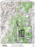
The area is full of dirt roads and old workings, so a good map and a good hiking/hand-held GPS unit is a must, but we'll show you exactly where it is on the map as well as provide you with the precise latitude and longitude of each corner marker, so finding it will not be a problem for you.
I advise caution whenever driving or hiking on this claim – the entire valley is dotted with abandoned mines, prospects and old workings – most of them are easy to see from a distance, but some of them are impossible to see until you are right on top of them. I would estimate that only 20% of them are roped or fenced off – the rest are wide open and you should be extremely careful if entering them.
A couple of spare tires or an air compressor and patch kit or at least a couple of cans of tire sealant is strongly recommended for obvious reasons! Also, be sure to bring in whatever water you may need, as there are almost no water sources in the area 8 months out of the year.
Note that all of the pictures of this claim were taken by my team and/or myself on a recent visit to this property.
All Pictures are of the actual property – no stock photographs were used

LEGAL NOTES
A mining claim gives the holder the right to mine on mineral-rich land that belongs to the federal government.
Mining claims are a tangible asset and show proof of all interests in minerals in the area. They can be bought, sold or used as collateral, just like any other piece of real estate. A mining claim can be sold, traded, leased, gifted, willed, used as collateral or transferred in part or in its entirety just like any other real property using a quitclaim deed which is a recordable conveyance.
We offer a lifetime guarantee should the BLM take back the land.
As the largest company in the mining industry selling legitimate and valuable historic claims, you can rest assured that you are not only covered with our 100% lifetime money-back guarantee, but you can also rest easy that there is no fine print on any of our claim listings telling you will have to deal with any games like being charged phony fees or having to pay inflated “processing” or“transfer” fees. The final listing price for this mine is ALL you will pay.
Our in-house legal counsel will complete all of the paperwork and documentation for recording and transferring FULL ownership of this mine into your name if you purchase, AND we will ship you everything in one to two business days of receipt of your payment in full (usually just one day!). So you can plan to visit (and start working) your claim the next day without the lengthy delay you will experience with other companies selling claims –and you will not have to pay any extra costs, fees or other poor excuses for extra profit that normally just go into a seller’s pocket.

While we cannot physically ship land to you as it doesn't quite fit into the mail box ;)
We will ship all paperwork/maps upon payment clearing we ship same business day (if payment is received by 1PM P.S.T.) We always provide tracking information so you are always informed.
