

Description
BETTY MINE
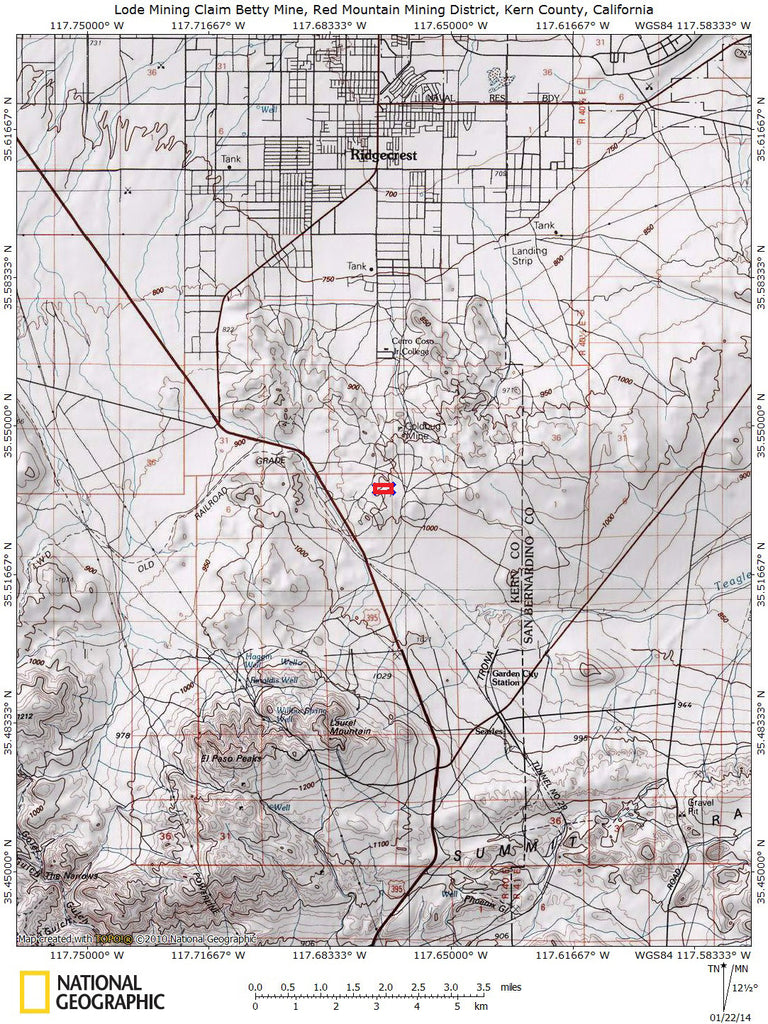
20.66 Acre Unpatented Lode Mining Claim on Federal Land in the Historic Red Mountain, CA Mining District


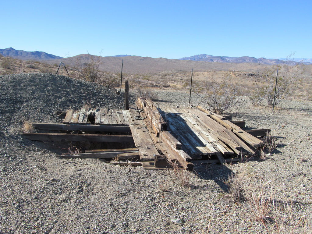
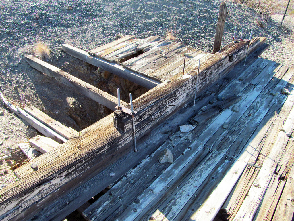
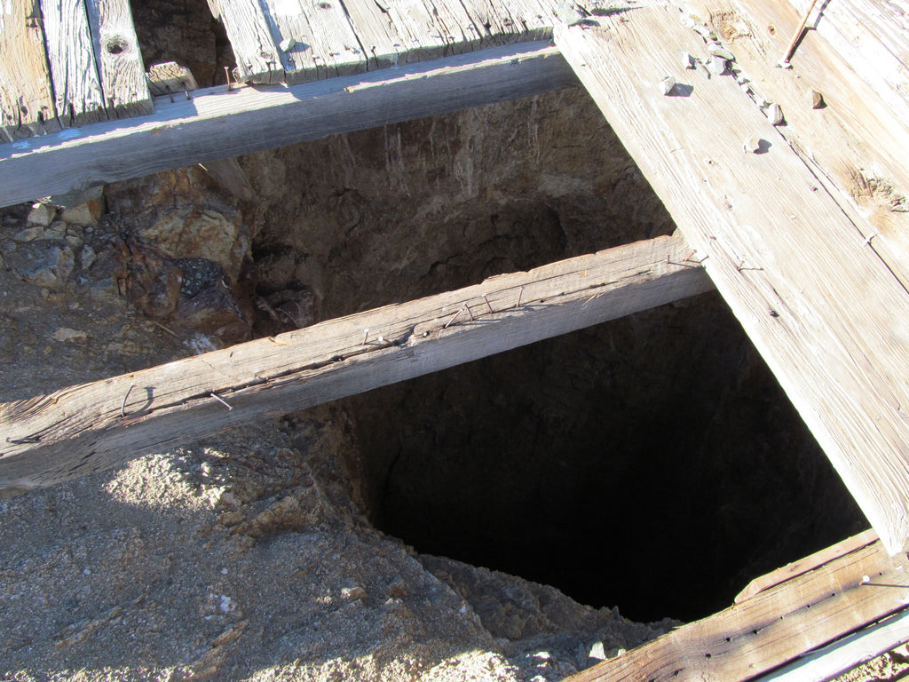
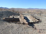
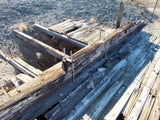
There is a fair amount of tailings that may be worth re-running with today’s more efficient processing methods, but I think for the serious miner, the value is going to be in the workings underground.
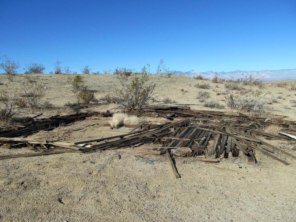
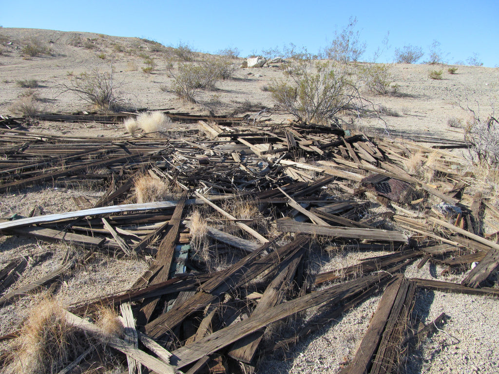
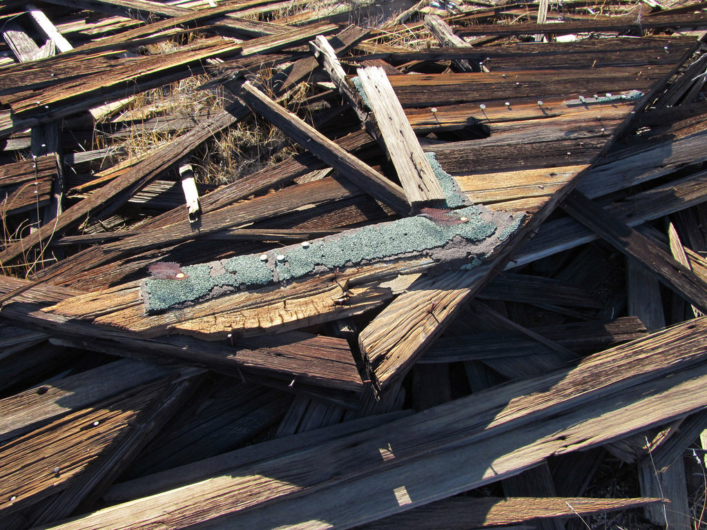
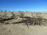
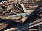
The ruins from the original cabin are only about 75 feet away from the mine (nice commute) and of course they are protected, so you’ll want to leave them alone. But fascinating to see that kind of history right in front of your eyes. Several working operations nearby.


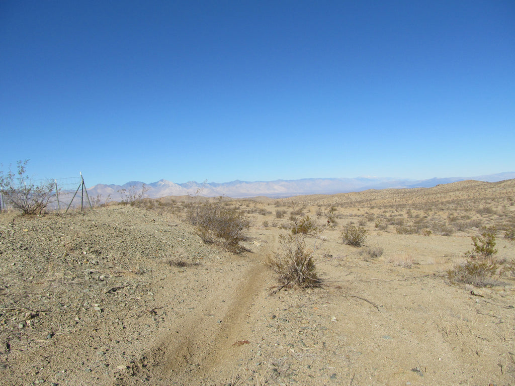
People are still pulling enough gold out of the ground in this area to justify the time and expense – which is a good thing and not something you see in every area. Good access and good roads right to the base of the mines on this claim. Two wheel drive is all you will need and only about a mile and a half off the paved road (Route 395), so easy to get in and out. The claim is about a 30 minutes outside of Ridgcrest, which is a fairly large high-desert community, so easy access to supplies and equipment (Walmart, numerous restaurants, fast food and gas stations) as well as a lot of options for lodging.


HISTORY ON THE MINE:
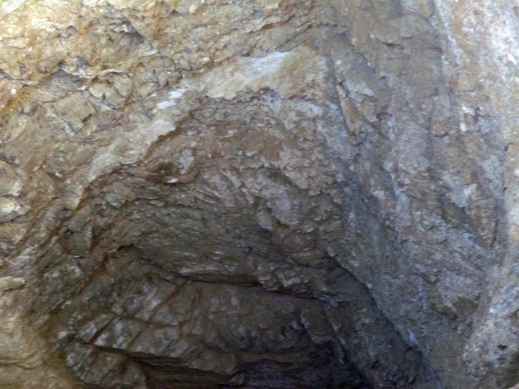
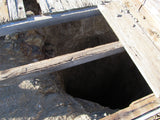
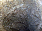
First claimed and worked by AJ Bannister from Philadelphia in 1868, the Betty Mine could very well be one of the original claims staked and actually worked in the Red Mountain area when the gold rush stampede began a year or two earlier. Records are difficult to obtain from this period, so we can’t see what type of money this mine made, but it does show that the mine was worked to a depth of 110 feet and had more than 650 feet of horizontal cuts, drifts and adits. I got a reading of 94’ with a laser range finder, so there may be some debris or rock at the bottom.


Come to Hike, Camp, Ride and Shoot - or come to pull some shiny rock$ out of the ground;-)

ABOUT THE MINING DISTRICT
RED MOUNTAIN MINING DISTRICT
District History
The Red Mountain district has long been of interest to large and small-scale prospectors using both dry washers and in more recent times, metal detectors. The district lies near the Kern-San Bernardino County border in the vicinity of the town of Red Mountain, about 40 miles northeast of Mojave and 30 miles north of Kramer.
The Red Mountain district, which is mainly in Kern County, has been chiefly a source of hard rock gold, but has also been noted for significant silver recovery. Although this region was prospected as early as the 1860s, no significant finds were made at that time. It was not until placer gold was discovered in 1893 in Goler Wash, in the El Paso Mountains 15 miles to the northwest, that there was any mineral production.
Numerous short-lived dry-washing camps soon sprang up in various locations along the El Paso range. As a result of this activity, the Yellow Aster mine, the most important hard rock mine at nearby Randsburg, was discovered in 1895. Other discoveries were made, and the rich ore recovered in these early operations led to a gold rush.
The district was once called Osdick, was named after one of the origianl miners. In early years the ore was shipped out of the area for treatment, but a 100-stamp mill was erected at the Yellow Aster mine in 1901 and other mills were built soon afterwards. During the early days some difficulty was encountered in concentrating the placer gold found near Randsburg because of the presence of large chunks of "heavy spar" or scheelite (an Tungsten ore mineral). The Atolia area was an important source of tungsten metal for the US, especially during the times of the two World Wars.
Large-scale gold mining continued until 1918, but small-scale placer operations continued through the 1930s, and to a lesser extent even into the present. The famous and highly productive Kelly or California Rand silver mine was discovered in 1919 and was operated on a major scale through the 1930s. Gold production from the district was substantial in the 1930s and continued into the early 1940s.
In the early 1990s, a large open pit mine was developed on low grade ores occurring in brecciated zones found in the Baltic and the nearby Yellow Aster mine areas. The production of this large operation has only been curtailed in recent years as the low grade ores are now mined out. The mine may be reopened because of the current high gold prices. The total gold output of the district is estimated at more than $20 million through 1960 or roughly one million ounces. A similar amount of gold is thought to have been mined from the low grade ores in recent years.


Geology
The principal rocks underlying the district are the Precambrian Rand Schist and the Atolia Quartz Monzonite of Mesozoic age. The Rand Schist is chiefly biotite schist with smaller amounts of amphibolite and quartzite. To the east are poorly consolidated clays, sandstones, and conglomerates of continental origin, which are overlain by andesite at Red Mountain.
Rhyolite and latite intrusives are in the east-central part of the district. To the north and west in the El Paso range, much of the area is covered by the Ricardo formation and overlying younger basalt rocks. Granitic rocks and older schists underlie the sediments in the El Paso range.
Ore Deposit
Most of the lode-gold deposits are in veins that occur along faults, except at the nearby Yellow Aster mine in Randsburg, where the gold is in a series of closely spaced veinlets in small fractures. The majority of the gold deposits are in the schist, which is more widespread than the quartz monzonite, and nearly all are in an area where the rocks have been colored a pale red by iron oxides. The veins are unoriented but usually have a well-defined hanging wall.
The ore bodies most commonly occur in the vein footwalls, usually at or near vein intersections or in sheared and brecciated zones. The ore consists of iron oxide-stained brecciated and silicified rock containing native gold in fine grains and varying amounts of sulfides. The sulfides increase at depth, but the gold values decrease.
Most mining has stopped where unoxidized sulfides were found in the veins, and the maximum depth of development is 600 feet. Milling ore contains from 1/7 to 2 ounces of gold per ton. The high-grade ore nearly always occurs in pockets near the surface. Most of the placer gold has been recovered from dry placers at Stringer or in the Rand Mountains north of Randsburg.


ACCESS
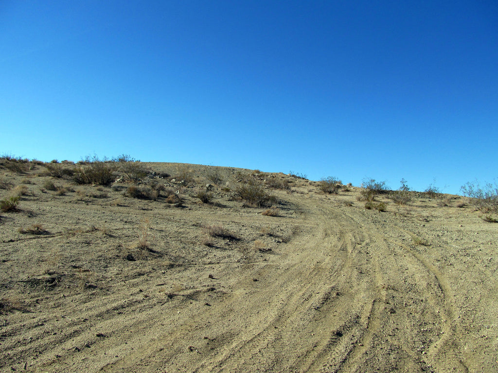
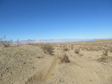
This entire area is relatively easily accessible by dirt roads which are well marked and well maintained. A 2-wheel drive car can get to this claim off of Route 395 via Boundry Rd (dirt), but I would recommend a good 4-wheel drive or even ATV’s to be able to access the entire claim that is not on the road.
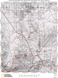
The area is full of dirt roads, so a good map and a good GPS unit is a must, but we'll show you exactly where it is on the map as well as provide you with the precise latitude and longitude of each corner marker, so finding it will not be a problem for you.

I advise caution whenever driving or hiking on this claim – the entire valley is dotted with abandoned mines – most of them are easy to see from a distance, but some of them are impossible to see until you are right on top of them. I would estimate that only 20% of them are roped or fenced off – the rest are wide open and you should be extremely careful if entering them.

A couple of spare tires or an air compressor and patch kit or at least a couple of cans of tire sealant is strongly recommended for obvious reasons! Also, be sure to bring in whatever water you may need, as there are almost no water sources in the area 10 months out of the year.


LEGAL NOTES
A mining claim gives the holder the right to mine on mineral-rich land that belongs to the federal government.
Mining claims are a tangible asset and show proof of all interests in minerals in the area. They can be bought, sold or used as collateral, just like any other piece of real estate. A mining claim can be sold, traded, leased, gifted, willed, used as collateral or transferred in part or in its entirety just like any other real property using a quitclaim deed which is a recordable conveyance.
We offer a lifetime guarantee should the BLM take back the land.
As the largest company in the mining industry selling legitimate and valuable historic claims, you can rest assured that you are not only covered with our 100% lifetime money-back guarantee, but you can also rest easy that there is no fine print on any of our claim listings telling you will have to deal with any games like being charged phony fees or having to pay inflated “processing” or“transfer” fees. The final price for this mine is ALL you will pay.
-PLUS-
We'll take care of all the paperwork and arrangements so you can enjoy your claim immediately after payment and we keep you informed through the entire process with confirmations when payment is received, when your paperwork has been shipped.
SHIPPING
While we cannot physically ship land to you as it doesn't quite fit into the mail box ;)
We will ship all paperwork/maps upon payment clearing we ship same business day (if payment is received by 1PM P.S.T.) We always provide tracking information so you are always informed.
